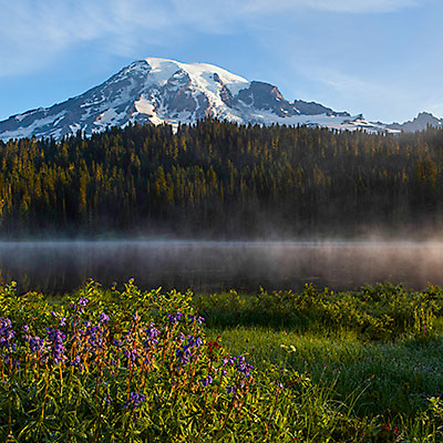
2013.8.35am at morning, I didn’t gave up the hope that the sky might be cleared. Looking out through the window, I could see surrounding mountains clearly. Magic! I grabbed my gears and run out of the hotel, together with several fellow photographers.
When we got to the reflection lake, thick fog still dominated the lake. Another two photographers told me, they came last year and it was a day like this. Although the paradise area was clear, the sun hadn’t shown up until too late around the reflection lake. Pondered for a while, we decided to go some other places. 2 miles back toward the paradise area on the left-hand side, there is a vista point that is facing the mountain and overlooks the valley. No cloud, the light was warm.
Sunrise in Mt. Rainier
The reflection lake must be good now. We all drove back. Less than 10 minutes after we left, the sun has dispersed the cloud, only light fog remained above the surface of the lake. A short trail led me to the lake shore. It was perfect, I couldn’t ask for better conditions. I spent about half an hour around at the lake side.
Sunrise over Reflection Lakes, Mt. Rainier
Sunrise over Reflection Lakes, Mt. Rainier
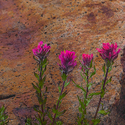
I went back to the lodge to meet my wife and we decided to do some hiking in this beautiful morning. Nisqually Vista Trail is at the west side of paradise area. The trail is a loop and easy to walk, unfortunately it’s not as exciting as the Skyline Trail. The glacier retreats fast, there was not much too see indeed; and the flowers were not abundant.
Nisqually Vista Trail, Paradise, Mt. Rainier
Panorama view from Nisquallly parking lot. Clouds were still in the valley. Mt. Rainier
We decided to have a walk again between the lodge and the Myrtle Falls, the same section of Skyline Trail we hiked the previous day. It’s around 8am. The view was fascinating, but as the sun rose higher, the light quickly became too harsh for photographing.
Skyline Trail, Paradise, Mt. Rainier
Myrtle Falls, a signature view of the nation park. The light was too strong already. Skyline Trail, Paradise, Mt. Rainier
We returned the lodge in time to catch up their serving of breakfast. We checked out the lodge at 9am. Our destination was Portland, Oregon, so we would leaving from the Nisqually Entrance. Not far from paradise area, we stopped by at Nevada Falls, and walked down to the view point. It’s a popular site and maybe the first attraction for tourists coming from this direction. On our way leaving the park, I noticed the clouds started returning to the park. We were really lucky to have a chance to see Mt. Rainier’s different faces. The final highlight was short but priceless.
2013.8.2I got up at 5am. My plan was to drive to the Tipsoo Lake to take pictures of Mt. Rainier’s reflection at sunrise. I sticked to my plan although there was no sign that the clouds would go away. Certainly, they didn’t and they were thicker than the previous day. I still drove to WA-410 and WA-123 fork, very close to the Tipsoo Lake. I really couldn’t see anything. I had to give up. At Lower elevation, it’s just a cloudy day. I returned to Ohanapecosh campground and took some pictures of the river under the bridge.
Ohanapecosh River, Mt. Rainier
Ohanapecosh River, Mt. Rainier
We checked out of our lodge at 9:30. We drove to the Paradise area through Stevens Canyon Rd. About half way between WA-123 fork and Paradise, there is stone bridge right in front of a tunnel. We made a stop there. The area is called Box Canyon. Under the bridge, the gorge is like a narrow and deep slice, the raging water is far below the bridge. The Box Canyon Loop a short hike that take no more than 15 minutes. The air was so humid (we were in the cloud) that it seemed one can squeeze water out of it. The fog gave the view a touch of desolation.
Box Canyon, Mt. Rainier
Box Canyon Loop, Mt. Rainier
Box Canyon Loop, Mt. Rainier
Box Canyon Loop, Mt. Rainier
It’s still too early to get a room when we reached Paradise Inn. We knew the lodge has almost 100 years of history, but what we saw still impressed us very much. The lobby (The Great Hall) is huge and inviting. There are two fireplace and a lot of chairs for guests to enjoy this wonderful construction. We had a lunch at the restaurants and set off to explore the hiking trails of Paradise area. We walked Skyline Trail toward Myrtle Falls. Crossed the bridge, we kept on Golden Gate Trail for another half a mile.
The creek above Myrtle Falls, Skyline Trail, Paradise, Mt. Rainier
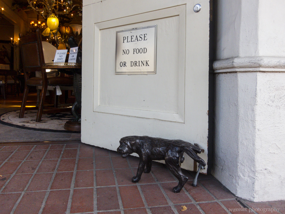
Paradise Inn front door in a foggy day, Mt. Rainier
We returned to Paradise Inn and checked into our room. My wife decided to stay in the room and I’d have a hike by myself. I took the opposite direction of Skyline Trail, detoured on Alta Vista Trail and turned back through Deadhorse Creek Trail. It’s a nice day for hiking but difficult for photography. Dewdrops hung on every petal, but I could hardly take pictures on any flower 20 feet away.
Avalanche Lily, Deadhorse Creek Trail, Paradise, Mt. Rainier
I walked for one and a half hour and retired to our hotel. Nothing beat the feeling of sitting in the cozy and warm lodge, watching the gloomy weather outside and having a cold beer after a long walk.
2013.8.1I still clearly remember the view when last time we drove from Seattle city to Sea-Tac Airport 8 years ago – a huge mountain, standing by itself, dominated the horizon, bold and respectful. That’s Mt. Rainier, whose prominence (4,027 m) ranks #21 in the world. Mt. Rainier is also renowned for blooming wildflowers during the summer months. This year, we finally got a chance to visit Mt. Rainier in the peak blooming season at the end of July.
Our flight arrived at Seattle at 9am. We took WA-410 to go to the park. It’s as cloudy as Seattle’s sky normally is, but after 2 hours, when we entered the park, it’s getting clear. At one point as we passed Sunrise Park Rd. fork, we could see Mt. Rainier.
White River, Mt. Rainier
We turned right at WA-410 and WA-123 fork to Tipsoo Lake before going to the lodge. We stopped at one vista point to overlook the valley. Clouds were moving fast up against the valley toward us. We were not aware that the clouds would stay in the park for the rest of two days.
Tipsoo Lake is a lovely lake with tranquil water. The whole area was covered by wildflowers. A lot of Lupine, dotted with Pasque Flower seed head in white and Arnica in yellow. A hiking trail surrounds the lake. From the far side of the lake, one can photograph Mt. Rainier’s reflections, but as I was taking pictures on this side, clouds started moving into the lake and soon swallowed everything within. I didn’t have a chance to see the reflection, but the cloud also made this flower-surrounded small lake like a fairy place.
Lupine and Pasqueflower Seedhaed, Tipsoo Lake, Mt. Rainier
Clouds approaching the Tipsoo Lake, Mt. Rainier
As we reached the other side, the lake had been immersed in the cloud. Lupine and Cow Parsnip, Tipsoo Lake, Mt. Rainier
Tipsoo Lake, Mt. Rainier
As we left the Tipsoo lake, we couldn’t even see the road at some section because the cloud was too thick. We literally walking in the cloud, until we reached lower elevation, the cloud really became the cloud. We booked the lodge of our first-day stay at Parkwood area. Along Hwy. 12, Parkwood is not even a town. It only has a couple of stores, restaurants, and hotels, but the lodge we booked, Timberline Village, is 4 miles outside the area towards the park. We totally missed it at first. A local man asked us to follow his car and helped us find the lodge.
Although the facility is basic, the room is spacious with a very good shower. We had lunch at Cruiser’s Pizza because of the coupon that the lodge left on our room table. It’s maybe the only normal dining place in the area. The food is fresh. My wife said the burger was the best she had in years.
Street of Parkwood, Washington
We returned to the park after some rest. The whole park was still in the cloud. We wanted to try our luck at Sunrise area.
Ohanapecosh Entrance, Mt. Rainier
Hexagonal lava columns, Sunrise Park Road, Mt. Rainier
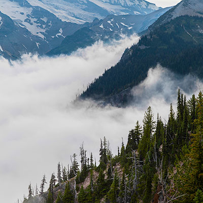
Two miles from Sunrise Visitor Center at Sunrise Lake Point, the cloud was so thick and we could barely see anything 30 feet away. We had little hope to see the mountain at all. There were only a handful cars in Sunrise Visitor Center parking lot. The rangers were about to leave and the only thing they could tell us about the weather was that it’s unpredictable. As we were walking toward Frozen Lake, I felt the cloud lifted up a little bit. We decided to change the route to go to Emmons Vista. Gradually, the sun dispersed the clouds and the majestic Mt. Rainier revealed itself in front of us. For 20 minutes, we were walking above clouds.
2012.12.27Leaving Kirurumu Manyara Lodge at 10am, we continued driving to the south on B144. After half an hour, we reached a town. This is Karatu district, one of the six districts in Arusha region. This is Justin’s home town. We stopped by a store and he left something for his friend.
Karatu, Arusha Region of Tanzania.
Passing the town, drove for another 3 miles, we turned left on a dirt road towards Lake Eyasi.
T K Eyasi Rd., near Oldeani, Karatu District
Two Southern Ground Hornbills by the dirt road after we turned from Rd. B144 to T K Eyasi Rd.
The road was a little bumpy. It’s getting hotter as we went further south. There were no high vegetation, but only bushes here and there.
Barren land near Lake Eyasi
Massai Cottage near Lake Eyasi
After about an hour, we saw a hut at the roadside. This is the reception office of Lake Eyasi area. A man working in the office joined us in the jeep. He would be our guide to visit Hadzabe bushmen and Datoga tribe living in this area.
The reception office as we entered the Lake Eyasi area.
Keep driving for another 5 minutes, we turned off the road and drove into the bush. All Hadzabe bushmen live around Lake Eyasi. Their total population is under 1000. They are the only hunter-gatherers in Africa. There were several attempts to bring in other cultures or even administration to the group, but all failed. They still live today as they have lived for thousands of years. The current approach is to keep them informed about political events and make sure they receive fair treatment in this fast-changing world. Inevitably, the intrusion of tourism affects their traditional way of life, but on the positive side, more income offers more opportunities for their kids to get some education.
Women of Hadzabe Bushmen Tribe, near Lake Eyasi
A smoking men of Hadzabe Bushmen Tribe, near Lake Eyasi
Hadzabe Bushmen Tribe, near Lake Eyasi
Hadzabe Bushmen Tribe, near Lake Eyasi
It’s at noon of the day. Most men and women in the tribe just sitting in the shade. Some of them were smoking or making tools for hunting. They demonstrated some of their skills, such as making fire with hand drilling and bow shooting. The guide also showed us the rock that the bushmen use to shelter from rain and the tree that they use to display skulls of animals they hunted. At last, several young men and kids gathered in a circle, sung and danced together. The other thing that visitors can do is to hunt with them in the early morning. Most of time, they shoot down birds with their bows; very occasionally, they might be able to catch Baboons.
Making arrows, Hadzabe Bushmen Tribe, near Lake Eyasi
The hunter, Hadzabe Bushmen Tribe, near Lake Eyasi
Left where Hadza people live, our next stop is to visit a family of Datoga Tribe. Their house was next to the main road, so I am not sure if they are real indigenous people or staged for tourists. Datoga men practice polygamy. All wives in the family came out to welcome us. We enter their cottage with very low roof and watched them grinding corn. At another side of the yard, we watched them melting bronze metal and making arrows. They also make bracelets for sale. The guide told us that they got their raw materials from nearby village. We saw them using bronze pipes. They already have access to these modern industrial objects, but they make them into arrows for primitive people. The fact itself is quite surreal to me.
Wives of a family of Datoga Tribe, near Lake Eyasi
We checked into Tindiga Tented Camp at around 2pm. Compared to the first two lodges, this camp is much more basic. The front desk was located in a small dining room. We were the only guests on that day.
After having some rest, Justin took us to drive around the area. The jeep climbed to a nearby hill. At its east side, there were crop fields of the nearby villages; at the west, we could see Lake Eyasi about 1 mile away. Justin said the lake shore were all mud because of the rain and difficult to access,
Agriculture area near Lake Eyasi
Overlook Lake Eyasi
Kids from the village followed us to the hill top, near Lake Eyasi
Justin wanted to show us how ordinary Tanzanians live, so we went to the Qaund’ded Village at the foot of the hill. We first stopped by a small pond – this is the water source of the village. Young men and women carry water from here for their daily usage. Most people didn’t mind me taking pictures, but one girl was unhappy about that, so I stopped.
Villagers carrying water from the pond, near Lake Eyasi
The pond is the only water source of the village, near Lake Eyasi
The girl didn’t like us taking pictures on them, near Lake Eyasi
We drove through the village. Justin said the climate of this area is good for growing crops and villagers work hard, but by looking at their shelters, these villagers must still live in deep poverty.
Qaund’ded village near Lake Eyasi
Qaund’ded village near Lake Eyasi
We had dinner together with Justin. We talked about various subjects, such as the interesting brotherhood relationship between China and Tanzania in the past; but mostly we talked about our everyday lives, the marriage tradition, education and so on. Justin was quite unhappy about western influence on Tanzania’s school system. He felt that kids now a day were so spoiled. He said if he had choice, he’d send her daughter to the school that allow corporal punishment!
I was woken up by chirping birds the next morning. I had a walk around the camp. The morning sun was warm, not harsh yet. I got some good shoots on those birds.
2012.12.26We left Tarangire National Park at 10am. Driving 3 miles on dirt road and a couple of miles on paved road to Arusha direction, then we turn left on B144. This is a section of straight high way. The landscape is open and dry, covered with sparsed low bush. The distance between Tarangire and Lake Manyara is not far. From here, we could already see the south part of Lake Manyara.
From Tarangire to Lake Manyara.
After about an hour, we entered a populated area, Mto wa Mbu, which borders Lake Manyara National Park to the southeastern side. Justin took us to a nearby village. Crossing a banana field, we saw several farmhouses and thatched shacks. A shack was used to display handcraft and woodwork. Some locals were working on the new items, carving and polishing the wood sculptures.
A banana field near Mto wa Mbu.
Farmhouses in a village near Mto wa Mbu.
Tanzania is renowned for original and fanciful woodcarvings. They are also popular tourist souvenirs. One of men first gave us a short talk, telling the story about why their tribe moved from Mozambique and how they created these woodwork based on their dreams and their everyday lives. We were much more impressed by the way he talked than the story he was telling. He spoke slowly and calmly, with clear logic and great confidence – it’s a very persuasive sales pitch. He claimed the carvings were made by Ebony wood, but Achmed told us before we left Arusha, “whoever said it’s Ebony, it’s not”. We bought some paintings made by banana leaves.
Locals working on woodcrafts.
We decided to check into the lodge before going to the Lake Manyara National Park. It’s hot at noon and animals are not active anyway. We passed by the park’s entrance and started climbing a steep hill –
we were actually escalading the western wall of the East African Rift Valley. Unlike the river valley or glacier valley, the rift valley is not created by erosion but by tectonic plates pulling apart from each other. Horsts and Grabens are often produced along the parallel faults. In the section of Rift Valley, the geological structure appears to be a half-graben, where the valley’s western wall rises 2000 feet high on one side and a flat lowland on the other side extended to as far as eye can see. Lake Manyara lies right at the foot of the wall.
There are several souvenir stores along the road. Tingatinga style paintings were displayed outside the store; inside, thousands woodcraft items, from two-inch-long statues to full-sized monkeys and buffaloes, were packed on the shelves. We picked three foot-long figures and bargained for about 40% discount of what they originally asked for. Even at this price, the store could easily worth hundred thousand dollars.
Woodcarvings displayed in a souvenir store near Lake Manyara.
After lunch, we checked into our hotel, Kirurumu Manyara Lodge. The lodge sits on the rim of the Rift Valley. From its entrance, the paved alleys split into branches. Each branch leads to a tent cabin surrounded by woods, yet every tent has a view of Lake Manyara.
Our room in Kirurumu Manyara Lodge
Overlook Lake Manyara from the patio of our cabin. There was a thunderstorm over the lake.
At 4pm, we climbed down the Rift Valley to the park. Once we entered the park, the dry and hot air was suddenly behind us. The temperature seemed to drop several degree at least.
There was a huge thunderstorm at the direction of Mto wa Mbu. Lucky we were not caught by it. Lake Manyara.
Because of abundant water source, unlike Tanragire National Park, most of Lake Manyara National Park is covered by lush forest. The game drive road winds through the jungle. Not far from the entrance, at the northeast end of the park, there is a small pool called “Hippo Pool”. We could only see one hippo from far away, but Justin assured us that we would see plenty of them in Serengeti. Along the road, baboon troops haunt the dense woods or lounge on the open ground. The park is also a good place to view birds and eagles.
Game drive road in Lake Manyara National Park is a loop. Contrasting to the forest in the north, the southeast of the park is the grassy floodplain. More animals were visible.
Zebras in Lake Manyara National Park with the Rift Valley escarpment as the backdrop.
A giraffe wandered in the low bush, Lake Manyara National Park.
Lowland in the south end of Lake Manyara National Park.
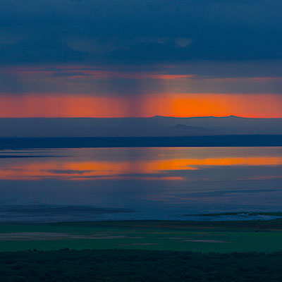
We retired to our lodge after spending about two hours in the park. On our way back, I took several pictures of sunset at a vista point by the rim of the Rift Valley.
Sunset over Lake Manyara.
The Rift Valley.
Serengeti Beer, dinner at Kirurumu Manyara Lodge.
The next morning, I got up at 6am. Next to the dinner area, the platform in front of the lodge’s bar has a great view of Lake Manyara. Just like the previous day, the sky was covered by the heavy cloud; also like the previous day, the cloud opened a long and narrow gap at the horizon. If the sunrise at Tarangire was splendid, the sunrise over Lake Manyara had a sense of mystery.
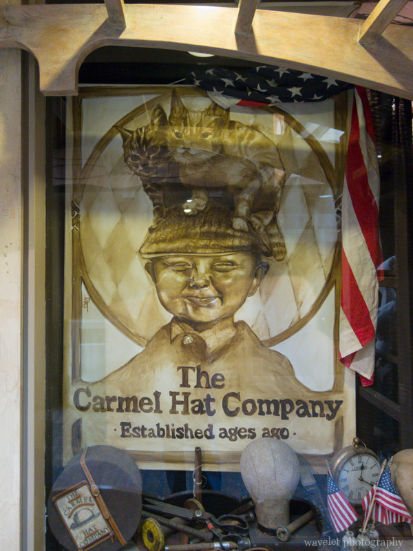
2013.7.5I drove California Highway 1 many times in the past, but I never stopped at Big Sur. During our stay in Carmel, we had a half-day trip to Big Sur and stopped by several most famous landmarks.
Garrapata Beach, Big Sur, CA
Bixby Bridge, Big Sur, CA
Bixby Bridge, Big Sur, CA
Pfeiffer Beach blowhole, Big Sur, CA. The beach has a hint of purple color, but what makes the place famous is, only a couple of days in winter at sunset, the sun light can just reach the beach through the blowhole, which creates very dramatic images.
Julia Pfeiffer Burns State Park, Big Sur, CA.
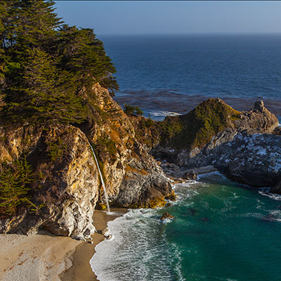
A signature view of Big Sur – McWay Falls, Big Sur, CA
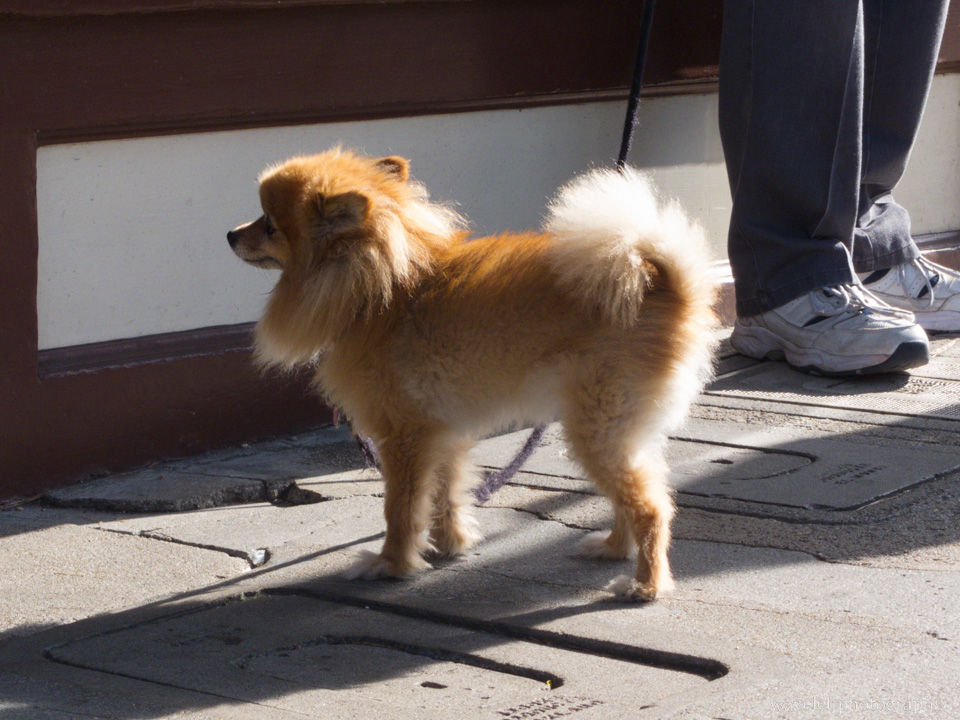
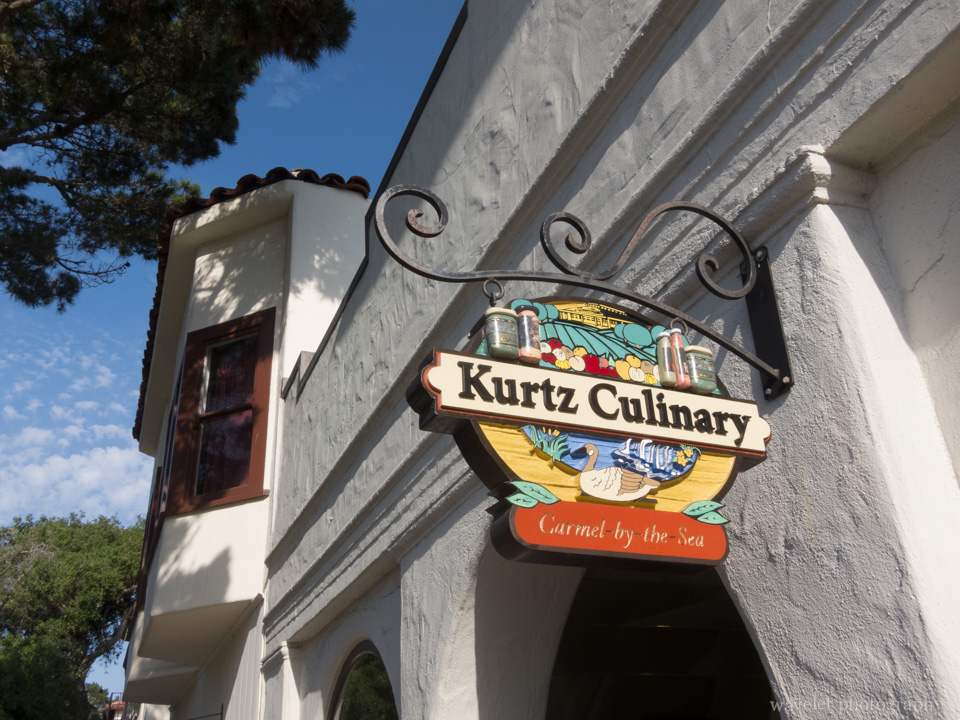
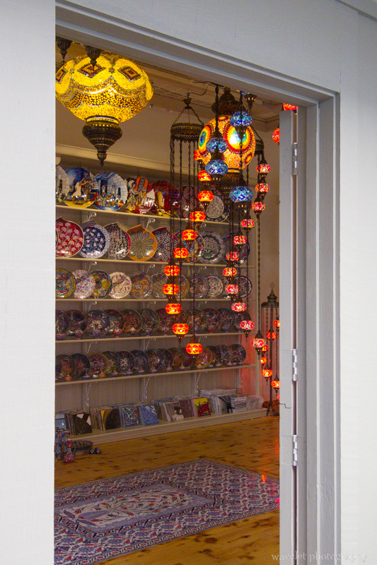
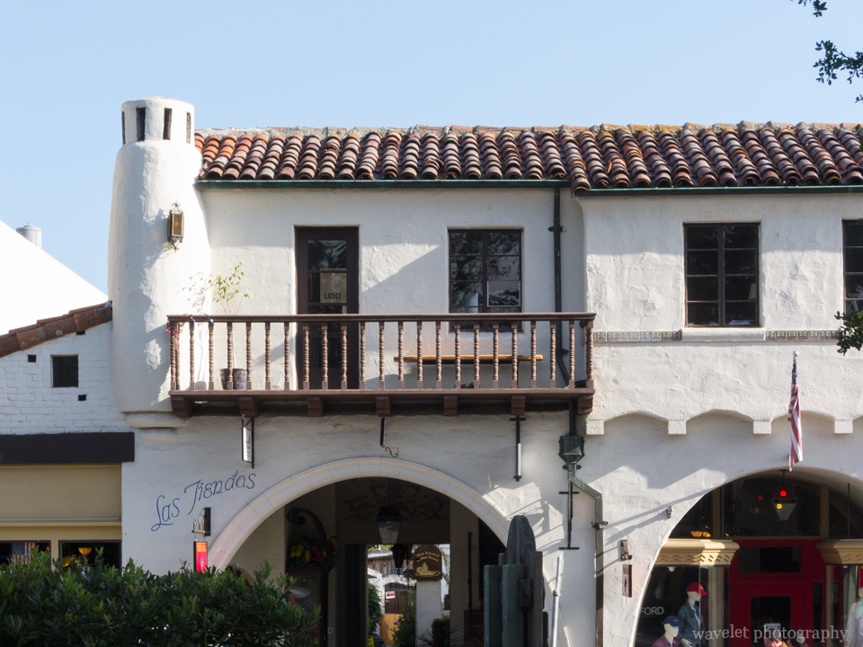
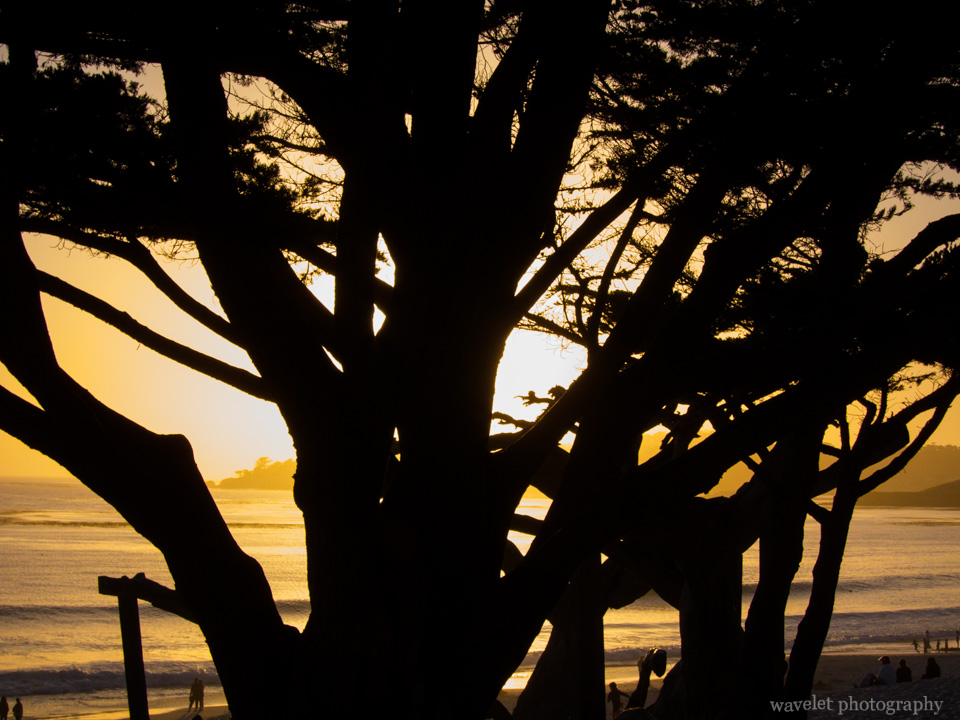
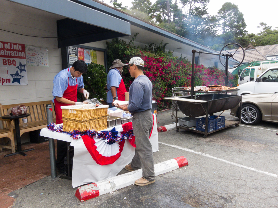
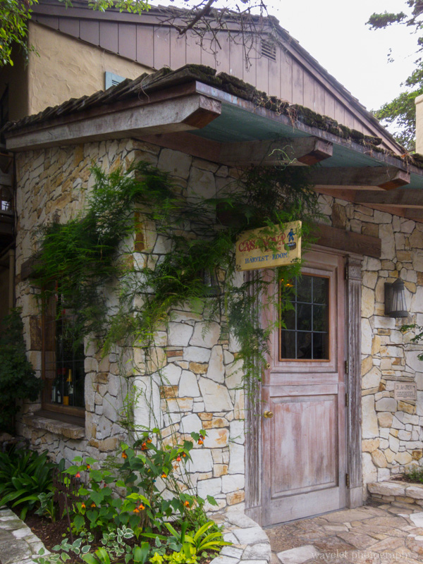
2013.7.4~6Feeling nowhere to go, we spent two nights in Carmel during the Independence Day weekend. It’s certainly not as exotic as our other trips, but it’s also much easier and cozier. I only wish they could have more better restaurants. We stayed in Carriage House Inn. We love their afternoon wine and cheese tasting very much.
2012.12.25~26We checked out from our lodge in the morning at 8:00am. After exchanged some cash at Arusha’s city center, we headed west to Tarangire National Park.
Half an hour later, we already left the majestic Mt. Meru behind, now we were surrounded by the open plain dotted with Maasai villages. The village normally consists of several thatched huts with low roof and a cattle or sheep pen. As Justin and us got more familiar, our topics of discussion started touching things of his life, such as his family and what he did for living. He became very angry when he told us about the government corruption and unfairness in the society. He is quite a passionate person.
A Maasai village by the lake, on the way to Tarangire from Arusha.
It has been very cloudy since we left Arusha. Rain started about 1 hour after we were on our way and soon became a downpour. There are two rainy seasons in Eastern Africa. November and December is supposed to be a minor one. However, according to Justin, there was a drought in November this year and it only started raining in late December, so we saw higher than normal precipitation at this time of the year. The rain was so heavy so that many ponds and creeks came to live along the road. The good thing is that this kind of rain normally doesn’t last long, and most part of the road were well paved, we didn’t have any trouble to get to the park at 10:30am.
Maasai herders, on the way to Tarangire from Arusha.
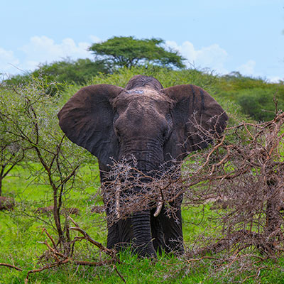
The area is scorching hot in the dry season. Animals migrate into the park along the Tarangire River, which is the only permanent source of water year around. It’s the greatest concentration of wildlife outside the Serengeti ecosystem. During the rainy season, most animals scatter over the region but elephants stay. Elephants and Baobab Trees are two huge creatures that can be commonly seen in the park.
The most spectacular feature of Tarangire is its largest population of elephants.
An Abdim’s stork near the entrance of Tarangire National Park.
We were surprised to see ostriches in the park. In fact, ostriches are native to Africa and only farmed in Australia. Here, they are doing “pair dancing”.
Visitors in the Safari tour, Tarangire.
Our plan was to have a short game drive, and then have our lunch before checking into the campsite. The landscape was getting more beautiful as we approached the Tarangire River. Wide panoramas of open Acacia woodland, rolling savanna studded with Baobab Trees, our jeep drove right into it. I was so excited and almost wanted to shout it out. This is exactly what I imagine Eastern Africa to look like!
Landscape of Tarangire National Park.
Game drive in Tarangire.
Tarangire River flooded over the bridge because of the early rain.
The picnic area sits on top of a hill overlooking the Tarangire River. We had the same lunch box as the earlier day. We saw people from different countries, China, India and Arabic regions. Some of them were on the day-tour from Arusha. Human’s activities also attracted a group of black-faced vervet monkeys. They were just as aggressive as those in Mount Emei.
A group of black-faced vervet monkeys at the picnic area, Tarangire.
A huge centipede on the ground of the picnic area, Tarangire.
Tarangire Safari Lodge is one of tens of “luxury camps” established in Eastern Africa national parks. These camps run just like hotels, except the visitors live in tents instead of rooms. The tent is spacious and it has private bath and toilet attached to it. The quality of these luxury camps varies widely. Tarangire Safari Lodge is by far the best one we lived in.
The lodge is situated on a panoramic bluff. We were impressed once we step into the the lounge, which is also served as the lodge’s lobby. The open design offers 180 degree unobstructed view of the Tarangire River valley. All tents are build along the cliff so you can just sit in front of your tent and watch elephants, giraffes and impalas coming to the river or playing over the wide plain.
The open lounge of Tarangire Safari Lodge.
Overlook Tarangire river from Tarangire Safari Lodge.
Our tent in Tarangire Safari Lodge.
It’s hot and the sun is harsh at noon. We rested in the tent and went out again for game drive at 4pm. As we crossed the same bridge over the Tarangire River again, we found that the flooded river a couple of hours earlier now almost dried out.
Palm trees by the Tarangire River.
Termite mounds, Tarangire.
Whenever you see several jeeps stopping by the road, it never hurts to stop and check too. This time was different – there were more than 20 vehicles lining together but we couldn’t see a thing. After asking other drivers, Justin told us that there were two African hunting dogs lying under the tree at distance. This is an endangered specie. There are only two groups of them in activity in northern parks of Tanzania. We were very lucky.
A pair of very rare African Hunting Dogs, Tarangire.
Another interesting scene we encountered later was a group of elephants drinking water and having fun around a pond. Sometimes they enjoyed the water maybe too much, they, especially the young ones, need some extra help to get out of the pond.
Because of the vast open space and the dramatic change of temperature in a day, the weather varies from time to time and from place to place in the park. While driving in the park, we often saw dark cloud gathered at somewhere far and the rain blurred the line between the cloud and the ground. After the thunderstorm, there was a rainbow. I asked Justin to stop the car and took these pictures. We were in awe of nature’s beauty!
The dramatic shape of cloud and the open wildness in Tarangire National Park.
Elephants walking under the rainbow, Tarangire.
A large group of elephants moved in the dusk of Tarangire National Park.
None of the campsites has wall or fence. It can be visited by wild animals. After dark, the camp has its personnel to escort visitors between the dining area and their tents. Living in the tent is comfortable. Secure the zippers of the tent and apply the repellents, we were not bothered by mosquitoes at all.
We planned to leave early the second day for game drive, but the sunrise was just too spectacular to miss. The thick and dark cloud covered the whole sky, except a narrow gap at the eastern horizon. The sky was burning red as the sun rose. It’s violent yet brilliant.
Sunrise in Tarangire National Park.
Tarangire Safari Lodge was bathed in the warm light of sunrise.
We left the campsite at 6:30am. Only 200 yard out, we saw 9 lions in the bush. They seemed alert and gazing out over the open field outside the bush. One after another, quietly and in an organized manner, they walk out of the bush. Justin jumped on to the jeep, trying to see what their target is, he said their move normally meant they were ready to attack, but he couldn’t see anything. A couple of minutes later, these lions seemed to lose their interest. They sit down and eventually all lied down on the ground. What a group of lazy cats!
A group of lions hidden in the bush not far from the lodge, Tarangire National Park.
Once they moved out of the bush, they seemed to lose their target, Tarangire National Park.
Every move that lions made can be found in cats, Tarangire National Park.
We drove to the picnic area again. It’s early, there were nobody but us, and some groups of impalas and Thomson’s gazelles running around, enjoyed the morning. As we were about to leave, Justin spotted something unusual far across the river – there was a lion on the tree. Trees are normally leopard‘s territory in Eastern Africa, not lions’, but this lion looked quite conformable on the tree.
A lion lying on the tree near the picnic area, Tarangire National Park.
What dominates the park is still elephants. They can get very close to the vehicle, within 20 feet. Although most of time peaceful, they can become aggressive if irritated, especially when they are with their calves. If you are faced with adult elephants, you’d better give them the right of the way, even you are in a car.
A baby elephant with the family, Tarangire National Park.
Baobab Trees are regarded as tree of life, because they are capable of providing shelter, food and water for animals and humans. Mature Baobabs are often hollow, their trunk skin from the ground up to 10 feet high are mostly gone. This is because Baobab Trees keep water in the trunk during the wet season for themselves to get through the dry season, but elephants know this trick and they peel off Baobab’s skin to get water. In the dry season, Baobab Trees lose all their leaves to preserve moisture. The tree is like it is planted upside down with its roots sticking up in the air.
A Baobab Tree with hollow trunk in Tarangire National Park.
Baobab Trees in Tarangire National Park.
The map of Tarangire National Park.
We returned to our lodge after 3 hours game drive and checked out at 10am. We were heading to our next destination, Lake Manyara National Park.
2012.12.24Justin picked us up at the lodge at 8:30am in the second morning. Our safari tour officially started from Arusha National Park.
Jeeps for the safari tour waiting for the guests at Ilboru Safari Lodge. The leftmost one is ours. The plate number cannot be better.
The perimeter of Arusha National Park is only several miles to Arusha, but its main gate is about 40 miles away from the city. Although the size is small, the park has diversified geographical features, including Mt. Meru, Merella lake, forest and grassland over the Ngurdoto Crater. About an hour later, we parked our car at the entrance. While Justin was checking in at the office, we saw several giraffes walking in a bush about 200 feet from us. It’s our first wildlife encounter in Africa, understandably we were quite excited.
We stopped at a ranger station near Tululusia Hill. One good thing about Arusha National Park is that, while visitors are not allow to leave their cars in other national parks, they can hike in Arusha National Park, accompanied by rangers with shotguns. Justin introduced us to one ranger, bigger group will have more rangers to walk with them. The rangers are guides at the same time. They are quite knowledgeable about plants and animals in the park.
The Whistling Thorn tree. This is giraffes’ favorite food. Although the thorns are long and sharp, giraffes prefer the leaves over grass, partly because they have to put their heads way down to get to the grass, which makes them more vulnerable to attacks.
We walked along a dried creek into the Buffalo Glade, an open area surrounded by forest. A group of buffaloes were at the edge of the woods. As we walk towards them, the ranger kept reminding us not to get too close, not to stare at them for too long. He said there were two times in the past that he had to warn then fire at buffalo when the visitors entered the flight zone and the buffalo started charging.
Buffaloes at Arusha National Park. It seemed we already got their attentions.
Leaving buffaloes behind, we kept walking across the glade. At the other end of the grass, we met three persons just climbing down from the mountain. One visitor had only a pro-camera in his hand and the other two locals carried other equipment and camping stuff for him. This is a typical format of hiking tours in Tanzania and Kenya. In some programs, such as climbing Kilimanjaro, the tourists are accompanied by even more locals.
Buffalo Glade, Arusha National Park.
A zebra skeleton at Buffalo Glade, Arusha National Park.
We entered the shade area of Tululusia Hill. A walk on the rocky trail rewarded us with something quite unexpected, a 28-meter water fall.
Rangers at Momella-Tululusia Waterfall, Arusha National Park, Tanzania.
Momella-Tululusia Waterfall and roots of a fig tree, Arusha National Park, Tanzania.
We turned back and walked along the foot of the hill. In the middle of the woods, we saw a giraffe under the Acacia Tree eating leaves, calm and elegant. My wife happily had some pictures with the giraffe.
A Giraffe under the Acacia Tree, Arusha National Park, Tanzania.
Bushpigs at Buffalo Glade, Arusha National Park, Tanzania.
We walked for about 2 hours and returned to the ranger station at 1:30pm. Justin and us sit down in an open hut to have our lunch. What’s in the lunch box are almost same every day and same for all different tour groups. It normally contains a fried chicken leg, a piece of bread, an apple, a bottled drink and some bagged peanuts. Every morning, the camping sites prepare the lunch box and give them to the guide. They are not very fresh, but the chicken was always tasty.
It started raining as we were having the lunch. Lucky that we didn’t try to climb the hill, which is normally part of the program. We resumed our game drive to the east in the rain after lunch. Some animals were using bushes to shelter from the rain.
A male waterbuck standing in the rain, Arusha National Park, Tanzania
A bushbuck found shelter under the Whistling Thorn tree, Arusha National Park.
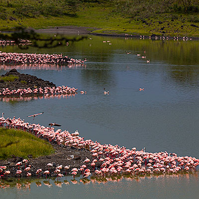
The rain stopped as we were approaching Momella Lakes. This is a group of lakes that are fed by underground water. Different mineral not only give lakes different colors but also support many types of waterfowls. The most attractive ones among them are certainly flamingos. They gathered along the lake as if to embroider the lake with the pink border.
Greater flamingos. The clear distinction to lesser flamingo is that the greater flamingo’s bill is mostly pink. Arusha National Park.
Flamingos at Small Momella Lake, Arusha National Park.
We circled around the Big Momella Lakes. At its north side, hundreds of lesser flamingo standing in the still water. I reduced the exposure time to darken the water in the hope of creating an abstract theme. To me, the image of Africa safari has always been endless savanna, vast, wild and sometimes brutal. These tranquil lakes with flamingos revealed a peaceful and soft side that we didn’t expect.
Big Momella Lake, Arusha National Park.
Lesser flamingo – their bills are in dark color. Arusha National Park.
Arusha National Park is located in between Mt. Meru and Mt. Kilimanjaro. On our way back, we first stopped at a vista point that can view both of these two mountains. Only 40 miles from Mt. Kilimanjaro (19,341 ft), Mt. Meru (4,977 ft) is the second highest mountain in Tanzania, and a dormant volcano dominating the park and the city. In the eruption about 8000 years ago, Mt. Meru lost much of its bulk on the east side and created the dramatic terrain of Arusha National Park. The hollow center couldn’t support the huge body, several collapse ensued. In a clear day, one can see Mt. Kilimanjaro from Mt. Meru. Unlucky to us, the Kibo Summit of Kilimanjaro was blocked by the cloud.
Mt. Meru, Arusha National Park.
Panorama of Arusha National Park. Mt. Meru is on the left. On the right, we could only see the northwest slope of Mt. Kilimanjaro.
We made a brief stop at an one-room museum near the park’s gate. Moving further, we encountered a troop of baboon walking directly towards us. They are large size old world monkeys that can be commonly found in Africa. At one point, we also saw a colobus monkey on the tree, but I didn’t have a good shot of it.
Baboons at Arusha National Park
The map of Arusha National Park
We left the park at about 3:30pm. We saw several coffee plantations on our way back to the city. Coffee is Tanzania’s largest export crop. These plantations still employ the traditional shade-grown cultivation, in contrast to sun cultivation, which yield more coffee. Shade-grown coffee is considered superior in quality and causes less environmental issues, thus, more “organic”.


")