Paris – Latin Quarter
2014.10.30OpenStack summit in Paris was held in early November, that’s why we went to Paris at this time of the year. We were worried about the weather because supposedly it’s the time that cold weather starts moving in and it sees more rain. However, it turned out to quite extraordinary – there were much less tourists in early November, leaves started turning yellow, and we were so lucky to have some abnormal warm days. The best of all, we didn’t miss the rain, but only once. Who said that Paris is most beautiful in the rain?
We planed 9 days in Paris, including the conference days. We thought it would be more than enough, but in end we didn’t have to time to go to places, such as Versailles or Monet’s Garden, let alone countless museums in the city.
The plane landed at Charles de Gaulle Airport at 9:30am. We called a taxi to go into the city. The road was crowded, it’s about 11 o’clock when we got to the hotel. We’d stay at Citadines Saint-Germain-des-Prés Paris for 3 nights. The hotel is located at the 6th arrondissement, right next to the Seine and across the street from the Pont Neuf. Within the walking distance to many attraction, the hotel is a perfect starting point to explore the Left Bank of Paris.
As usual, after we settled down, my wife stayed in the hotel to have some rest and I had a walk to know the neighborhood. Along the Seine and towards the direction of Notre Dame, after passing Fontaine Saint-Michel, I walked until I got to the Petit Pont. It’s 5th arrondissement here. On my left, it’s the Parvis Notre-Dame; on my right, it’s the center of Latin Quarter.
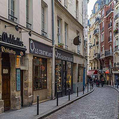
Turned right on Rue Saint-Jacques, there is a small street on the left hand side, named Rue Galande. It’s short and narrow, but some well preserved medieval houses and cellars can be found on this street. The street appears both in “Midnight in Paris” and “Before Sunset”.


On the left of the street, there is a small and humble church, Église Saint-Julien-le-Pauvre. In fact, it is one of the oldest churches in the city. It’s history can be traced to as early as the 13th century. It looks plain and even dilapidated, a stark contrast to Notre-Dame across the river.

The garden north to the church is called Square René-Viviani. It’s just an ordinary garden except there is a 400-year-old locust tree in the garden. It’s said that that’s oldest planted tree in Paris. People enjoyed their lunch sitting on the lawn. There is a quite strange-looking fountain, called Saint Julien fountain, in the center of the square. which is built in 1995. This is a good place to overlook Notre-Dame across the river.

Next to the garden is the famous Shakespeare & Company Bookstore. Located at the French cultural center, the bookstore’s focus is selling English-language literature. This is in fact not the old bookstore that Hemingway and Joyce spent a lot of time with. The current bookstore on the Left Bank was build in 1951, and inherited the original bookstore’s style and name. When I got there, Jimmy Page was there to meet his followers and signed his biography for them. At the end of moive “Midnight in Paris”, there are several shots of the bookstore.


Returned to the street directly facing the Petit Pont. This is a busy street with many visitors and locals. Rue Saint-Séverin is on the right side, but you won’t be able to find a hint of quietness and arty style in Rue Galande. There are a lot of souvenirs and restaurants. You are also taste Korean, Mediterranean or many other regions food here as well.


I came back to the hotel. My wife and I had a lunch in a Cafe by the river. It’s 3pm now. We first walked around following my earlier route. When we returned to Shakespeare & Company Bookstore, Jimmy Page and many book shoppers had left. We had a chance to enter the bookstore. It’s dark and crowded, stacks and books were all over the place. It’s said that you can dig out some books that cannot be found elsewhere.

Latin Quarter is an area between the 5th and the 6th arrondissements. Compared to the area around Place de la Concorde where we lived later, the later one is high-grade and luxury, but Latin Quarter is active and lively, bookstores, cafes and restaurants are everywhere. Locals are having coffee by the busy road, watching people coming by, totally ignore the dust and loudness on the street. The cost of living is lower because a lot of low to mid-end shops are packed here. With Paris’ oldest university, Sorbonne, and a number of other higher education institutes in the district, Latin Quarte has always been the place where students and intellectuals want to hang out. Even today, when many quirky bookshops have given way to the chain clothing stores, the name alone evokes images of romantic and unconventional old Paris.
Île de la Cité divides the Seine into two at this area. Passed the Pont Neuf, it’s Notre-Dame. At 4pm, visitors waiting for entering the cathedral were still winding through the entire square. We walked along the river to the back of Notre-Dame. Square Jean XXIII is a quiet and peaceful park. From here, one can see the spire of Notre-Dame and the flying buttresses in long and beautiful shapes. One of major scenes in “Midnight in Paris” was shot here.


Pont de l’Archevêché at the east of Notre-Dame is the narrowest bridge on the Seine. Every bridge on the Seine has love locks, but Pont de l’Archevêché and Pont des Arts are two bridges that have enormous amount of them. So many love locks with so much weight are put on the bridge so that it creates a danger to crumble the bridge. Paris government had to remove them all together to save the bridge, but soon they came back again.


It passed 5pm when we returned to the hotel. One good thing in practical sense about our hotel is that free hot water is provided at the lobby. You cannot always drink coffee by the road. It’s still the golden hour even in the city. I grabbed my cameras and tripod and headed out again.
The dome of Institut de France is not the grandest compared to other great domes in Paris, but I found that some best pictures of mine were taken here. The following photo is selected because it has all the elements, the sunset, the Eiffel Tower, Institut de France, Pont des Arts and the western end of Île de la Cité.


Pont Neuf in fact is not “new”. On the contrary, it’s the oldest bridge on the Seine. The bridge has to sections that connect the Left Bank, Île de la Cité and the Right Bank. The body of the bridge was lighten up during the night and reflected in the river – a beautiful scene for photography.

After dark fell, I took some random shots in the streets of Île de la Cité.


We had our lunch at Chez Fernand, 5 minutes walk from our hotel. It serves French cuisine. Tasted good.


, Plaza Sotomayor, Valparaiso")


, Papa Vaka, Easter Island")


, at Puna Pau, Easter Island")


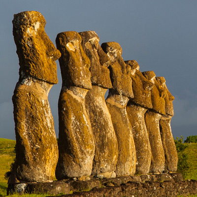
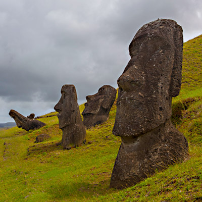
 from Ahu Tongariki, Easter Island")


, Easter Island")


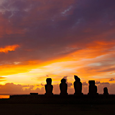
 and Tahai at sunset, Easter Island")