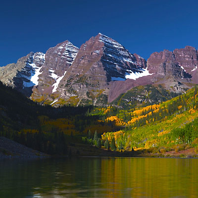
The Last Place on Earth – Patagonia

2011.12.27Patagonia is a region located in the southern end of South America. The Argentina side is characterized by semi-arid plateaus, embellished with ponds and lakes; the Chilean side, also called Austral, stretches from south Andes to Tierra del Fuego island and Cape Horn, features the landscape of volcanoes, lakes and snow peaks with unsuspected natural beauty. The single mention of the name evokes the fascination of remote and pristine. (To fully appreciate the wildness of Patagonia, I recommend a documentary film – The Last Wild Race.) Our trip stayed within the Chilean side of Patagonia. It would take 3-hour drive from Punta Arenas to Puerto Natales, and another two and half hours to reach Torres del Paine National Park.

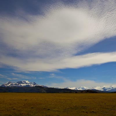
Leaving the Strait of Magellan behind, mountains were still far away, the only thing we could enjoy was the openness and nothingness of Patagonian plateau.

Nothingness of Patagonia
The south of Chilean Patagonia is semi-barren.

Driving for about an hour, a herd of thousands of sheep blocked the highway. Sheep farming is another main economic activity of Patagonia besides tourism. The shoulder of the highway was narrow here so the herd had to take over the highway. The shepherds drove them back and forth across the road, sheepdogs followed behind and kept all the sheep together. We fully enjoyed the scene and stopped to take pictures, but other cars didn’t have the patience as we had. Eventually, sheep were gathered at one side of the road when the space was wider so we were able to pass.

A Herd of Sheep
Sheep took over the highway.

The roadside scenery became more lively as we drove further to the north. Land were all covered by grass and various of flowers. Snow mountains at afar started revealing themselves.

Roadside Flowers, Patagonia
A common flower of Punta Arenas and Patagonia.
Overlook Mountains of the southern Andes.
Overlook mountains of the southern Andes.

Puerto Natales is small town by the bay that connects to the Pacific Ocean through winding Señoret Channel. It is a gateway to TDP nation park and not much else. Buses run every hour from here to the park. Because accommodations within the national park are usually expensive, many visitors stay here over night and go to the park as day trips. As the result, there are good choices of restaurants and hotels in the city. Our plan was to take a rest and maybe have a lunch here.

There will be no gas station beyond this point. It’s important to fill the tank at Puerto Natales. When we stopped at a gas station, the worker pointed to the left back tire of our car. The tire was not just flat, there was a large gap. When we opened the trunk, we found the spare tire was flat too. People working at the gas station were very helpful. They inflate the spare tire and installed it to the car without asking us any money. They tried to speak to us about something but we couldn’t understand a word. Luckily, we found another traveler who was washing his car at the gas station knew both English and Spanish so he could translate for us. They suggested us to get the flat tire repaired so we would have a backup and they told us the shop that could do that.

Not very clear with the direction they gave, we ended up having a short city tour. Eventually, we found a small shop that had a pile of tires outside their door. The old tire was not repairable. They asked us to pay 20 bucks for a used tire in stock. We called the local Hertz office, but as expected no one answered the phone. It’s not a time to bargain. We bought the tire, put it into the trunk and hit the road again. It’s about 2pm.

Puerto Natales
Overlook the Cerro Benitez peaks of the Cerro Toro mountain range at Puerto Natales.

The road split after 10 miles out of Puerto Natales. On the left, the road was unpaved. It’s supposed to be the newer road and can take you to the park faster. Although it is more tempting to stay on the paved road, it is said the pavement won’t last very far ahead. We turned left. After a couple of miles, there was a tourist attraction, Cueva de Milodon, a cave where the remnants of a prehistory giant sloth were found. We didn’t pay to enter the cave, but stopped to check the tire – it ‘s going flat again. For next 1 hour or so, on the unpaved road, others drove 30 miles per hour while I only drove 15 mph. At last, I couldn’t stand it anymore. I stopped at the roadside of Lago Porteño and replaced the tire with the one we just bought. It’s only 15-minute of work, but finally I felt more comfortable and confident driving on the rough road.

Strange Halo
Halo in the strange shape.

We drove along Lago del Toro and scenery was getting better and better . When we reached the southwest entrance of the park, it’s almost 5pm already. We paid the entrance fee, as usual in South America, foreigners sometimes have to pay 10 times as much as local people, and I decided to take some photos of the surrounding mountains. Right after I made the following shot, my wife run to me and asked, “Do you have the car key with you?” I instantly knew that the last thing I wanted to happen had happened. I left the car key in the car but didn’t tell my wife clearly. When she closed the door, the car automatically locked itself, with the key inside.

Southwest Entrance, Torres del Paine National Park
Mountain range at southwest entrance of Torres del Paine National Park.

The entrance didn’t even have a phone. We found a couple who also traveled with their car and spoke some English. They took us to the police station 10 miles down the road. We were so lucky to have them help us communicate with the officers, because no one working in the park spoke English. We called Hertz, but again no one answered, plus I didn’t expect they could drive two hours to come to us. The police paged a patrol officer. When I saw him come with a iron wire I felt so relieved and though we could be on our way soon. However, when he took us to our car, we found he didn’t really know how to use the tool. Before long, another officer came. He had no idea either. Maybe the car was different in Chile, we removed the rim at the bottom the window but couldn’t found any hook inside the door. In the next two hours, three of us tried everything, using the wire to reach the key, to push the door control. The frame of the door was deformed, but nothing worked.

The breakthrough came when one officer made a circle with a thin wire and connected it to the thick wire. He managed to reach the hook that controls the trunk door and got trunk opened. Unfortunately, there was no way to get into the car from the trunk and the officer even got his finger cut. As they were working at the back of the car, I decided to try my luck. This time I tried to reach the door handle. I got it hooked at the first attempt, pull the wire, Voila! the door was opened.

We couldn’t thank for these two officers more. They never gave up on us in that two hours, even with all the efforts turned to disappointments. We tried to pay them but they refused firmly, instead, each of them took out a record book and asked us to write down our acknowledgment. One of officers proudly showed us his Chilean Police badge. What a lovely and honorable police force! No wonder Chile is the safest country of South America.

From Puerto Natales to Hosteria Pehoé in TDP

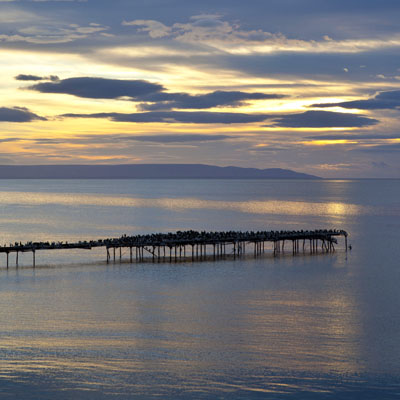
The rest of the journey was smooth. We arrived at our hotel, Hosteria Pehoé, at 8:00pm. It took us 10 hours on the road. Hosteria Pehoé is located in the middle of Logo Pehoé, the very heart of TDP. It was the most eventful day of all our travel trips, but there is nothing more rewarding than sitting in the restaurant having dinner while watching the unbeatable sunset view over the signature landscape of Torres del Paine National Park.

Logo Pehoé, Torres del Paine National Park
Sunset over Logo Pehoé.
Hosteria Pehoé
Hosteria Pehoé and Cuerno Principal.
0 Comments

The Last Place on Earth – Punta Arenas

2011.12.26After two connection flights at Dallas and Santiago, we arrived in Punta Arenas airport at 5pm. Our journey started at the southernmost city of Chile.

Dallas/Fort Worth Airport
Dallas/Fort Worth Airport.
Aeropuerto de Santiago de Chile
Aeropuerto de Santiago de Chile – Santiago Airport is plain and simple. We didn’t go out to see the Chile’s capital city.

We got a Corolla from Hertz at the airport. While checking the car, I noticed the tires were not very good, but I didn’t pay much attention to it. I couldn’t imagine the trouble it would bring to us.

Driving out of the airport, the view of the open blue sea confirmed that we were indeed at the end of the world. In fact, it’s not an open sea, it’s the Strait of Magellan. We made a right turn and drove along the strait. After half an hour, we arrived at Punta Arenas. Although exposed to storms, compared to even more furious Drake Passage, Strait of Magellan is still a better choice of sailing ships. Before the Panama Canal was constructed, the Strait of Magellan was an important route that connected the Atlantic and Pacific Oceans. Because of that, Punta Arenas also became a booming town in mid-19th century. Today’s Punta Arenas is a tourist hub, visitors use it as a jumping point to explore Patagonia or cruise to Antarctica. However, the flourish and roaring past is history now, what remains is a quiet and small town by the sea.

Punta Arenas
Punta Arenas.

Our plan in Chilean Patagonia region was to stay in Hotel Dreams del Estrecho at Punta Arenas for one night, visit Torres del Paine National Park and come back to the same hotel for another night before we headed to Antarctica. The newly renovated hotel earned very high ratings on the travel sites. Built right next to the strait, it’s one of the tallest building in the city. The first floor is a casino that attracts many visitors. After some negotiation, we got a room with a view of the sea.

the Strait of Magellan
The Strait of Magellan.

It’s the Christmas day so most of stores and museums were closed. There were not many people on the streets. The good thing was, at the latitude of 53 degrees south, in the summer time, the sun won’t set until 10pm – we had a lot of time to walk around.

Punta Arenas
Av. Colón – one of the major roads of Punta Arenas, 8pm.
Punta Arenas
Bean Flowers – this flower in bright yellow color can be found everywhere in Patagonia region, 8:10pm.
Punta Arenas
A street painting at Punta Arenas.

Several blocks away from the hotel, we found a couple of restaurants open. We stepped into Brocolino because they had a chalk board in the window with their menu listed. The exterior was not attractive, the price was not cheap and the first thing the waitress told us was, “there is a problem, we only accept cash.” We sat down with a lot of doubts, but when the food came out, it was divine! The seafood were fresh; the fish was tasty and grilled perfectly. The best of all – there were no fancy plating but a lot of crab and fish meat. We couldn’t finish our dishes.

Brocolino Restaurant
Grilled Fish – Brocolino restaurant
Brocolino Restaurant
Outside of Brocolino restaurant, 9:25pm.

I got up at 5am the next morning and got some very good pictures of Strait of Magellan. After the breakfast, we checked out and were on our way to Torres del Paine National Park.

the Strait of Magellan
Sunrise over the Strait of Magellan.
Punta Arenas
Overlook Punta Arenas from Hotel Dreams del Estrecho.
1 Comment

The Last Place on Earth – Preparation

In this post, I will cover our preparation on clothing and cameras equipment.

Clothing

We were blessed with good weather in Antarctica. The temperature stayed above the freezing point most of time. However, “volatile” is often used to describe the weather in the continent. You’d better prepare for the worst.

Gears needed for the Antarctica trip are very similar to those used in Ski. Once our trip was booked, we found ourselves shopping at REI on every weekend. Several articles warned us not to wear cotton because they don’t wick the moisture away quickly enough. Instead, silk or polyester is recommended. Another key thing is to dress in layers, 3 to 5 in total. It allows you to adjust your clothing more easily when weather changes. Because you are going to wear parka and life vest while going ashore, dressing in layers keeps you warm and, at the same time, less bulky getting in and out of zodiacs.

Visitors Wearing Parka and Life Vest on a Zodiac
You will be looking like this on the zodiac.

Here is a list of things you might need in Antarctica,

  • Waterproof pants: This is a must, because most of landings are wet landing, means you will step into the water and walk to the land.
  • Long, thermal underwear:
  • Fleece pants and jackets: The thermal underwear and fleece are the most useful clothes we brought. I have been wearing the same one fleece in our entire Antarctica trip.
  • Gloves: A pair that is warm and a thin pair used when taking pictures.
  • Socks: A thin pair under a thick pair.
  • Hat, scarf or neck warmer: They keep you warm when it’s windy.
  • Sunglasses: To make you look cool in photos. 🙂
  • Goggle: Goggle is not absolutely necessary but it helps in wind or snow. The problem is that it tends to get foggy if you wear scarf at the same time, unless it has anti-fog coating. Pick the OTG (over the glasses) version if you wear glasses.
  • Windproof jacket: You will need a windproof jacket while walking on the deck outside. Waterproof is not really necessary because the parka provided by the ship is already thick and warm enough.
  • Boots: Boots are also provided on the ship so you don’t have to bring your own, unless yours is really good-looking. Keep in mind though, not only will you walk in the water but also over penguins’ poops.
  • Waterproof shoes: Not necessary. We wore boots all the time while ashore.

With all these stuff, we still managed to travel without any luggage. Packing less is one of our travel secrets. This is all we have.

All Our Baggage
All our baggage for the trip. Unbelievably compact for most our fellow passengers, but it’s a record high for us.

Cameras and Electronics

It is said that a photo is only as good as the photographer not the camera, but Antarctica is the place that you should take your best cameras to.

Big lens

Here is a list of photography related gears I brought with me,

  • Canon 5D Mark II
  • Canon EF 24-70mm f/2.8L USM
  • Canon EF 70-200mm f/2.8L IS USM
  • Canon 2x EF Extender II
  • Canon PowerShot S95
  • Slik Sprint Pro II GM Tripod
  • Filters: GND, ND, Polarizer. They were used in TDP and TDF, but not in Antarctica.
  • Compact Flash: About 120GB. I copied all RAW files to the netbook and never deleted one from the flash cards. I ended up using around 70GB with 3000 pictures.
  • Asus Eee Netbook: I always brought it to our trips to backup photos and checking emails. It’s too slow for reviewing photos though.
  • Lowepro Flipside 400 Camera Backpack
  • Kindle: I found myself very effective in reading on the cruise. I finished the book that usually takes 3 months in 4 days.
  • Canon ERC-E4S Rain Cover
  • Gregory Accessories Rain Cover
  • Lens Pen, Air Blaster

It’s very important to protect your camera gears from salt water. At first, I ordered a SealLine Boundary Pack (70L) but it looked like an overkill to me so I changed it to Gregory Rain Cover. I didn’t use it eventually but at one time I did pull out the built-in cover of the Lowepro bag on the zodiac. I also used the camera rain cover once while ashore; other time, I just used my body as the shield and wipe the snow with my gloves after each shot. It could be a totally different story if the weather was bad or the sea was choppy. Keep the bag inside the zodiac and be very careful with your cameras and lens.

Canon S95 is a very good lightweight camera for taking snapshots and recording videos. It’s also the only flash light I brought to the trip. When I take photos of people, I have a habit to turn on the flash when the background is too bright, so the human face can be illustrated. However, this is not always the right choice in the place like Antarctica. The snow on the ground already reflects enough light. Using flash is not necessary. Plus, when you are very close to the wildlife, flash light should not be used.

What would I do differently next time? I will definitely bring another camera so I won’t have to change lens back and forth in the field.

l will use tripod more as well. I took the Silk tripod with me every time I traveled abroad because of its compact size and light weight. It worked well in most circumstances but I had difficulties using it for long-exposure shooting, such as star trails, or with telephoto lens. I didn’t use the tripod in Antarctica. The high ISO performance of Canon camera and IS feature of Canon lens usually produce very sharp pictures. In a few cases, when 2x extension was added or shooting videos with 5D MKII, I wished I had the tripod with me.

Another reason to bring a tripod
Another reason why a tripod is needed.

Do I want bigger lens? I wish I could afford them. You can get reasonably close to wildlife in Antarctica, with a steady hand, 200mm lens with 2x extension is enough for amateur photographers like myself.

Two Chinstraps
Two chinstrap penguins
0 Comments

The Last Place on Earth – Planning

To most people visiting Antarctica, the journey is not only a once in a life time experience, but also an expensive one. The cost of the tour, cloths and cameras to bring and the time spent on planning are all much higher than normal travel trips. Here are some tips that are useful in our planning.

Time to visit

Ships and airplanes bring about 30,000 people to Antarctica every year. Most tour groups only operate between mid-November and mid-February, the summer of the southern hemisphere. The advantage of going earlier, for example, at the end of November, is that the price is cheaper and most lands are still covered by fresh snow. However, it’s going to be cold and storms are more common compared to later in the season. In later summer after January, the temperature drops again, but the area further south is more accessible because ice has been melting for the whole summer.

Brown Bluff
The worst weather we had – a little windy with light snow. Brown Bluff

To us, as first time visitors, the best time to visit Antarctica is from late December through January. When we were there, the temperatures rarely dropped below the freezing point and we didn’t encounter any storm. More wildlife can be observed, especially, this is the time to see penguin chicks. Of course, it is the most popular season. The price is higher and the vessels are normally fully booked several months in advance.

Choose the Ship

Cruising in Antarctica is not your typical Caribbean vacation. Choosing the vessel that is designed to sail in the icy water over large and luxury cruise ships is recommended. Small ships offer much better opportunities of shore landings, which is the heart of Antarctica expedition. Many channels and bays are simply inaccessible for large ships. Carrying large number of passengers also means each one has less time on the shore. I heard some large ships only take visitors to see the continent; others can only bring their passengers to land in a batched manner. The downside of smaller ships is that you will feel the wave harder in the tough sea.

Antarctic Dream and Ocean Nova
Antarctic Dream and Ocean Nova. King George Island.

Here are the tour companies we considered before we booked the trip,

Most these companies’ ships are refurbished from the boats that were originally used for research and explorations in the polar regions. The ship we traveled on was M/V Antarctic Dream. It has a capacity of 80 passengers and 40 crews. It served in Chilean navy under the name “Piloto Pardo”, which was to remember the captain that rescued Ernest Shackleton‘s crew after their failed expedition to be the first to cross Antarctica continent in 1916.

Itinerary

The duration of Antarctica cruise varies from 4 days to 20 days. Typical programs focus on the Antarctic peninsular, where the best combination of wildlife and landscape are presented. Ships normally spend 4 to 5 days in the region and do two landings each day depending on weather conditions. Itineraries and landing sites offered by these programs are very similar, but small differences do exist. For example, our program gets into Weddell Sea through the Antarctic Sound, which most tours don’t go. If you want to see more kinds of penguins, such as King penguin and Macaroni penguin, you should look for programs that can take you to Falkland and South Georgia islands. Some programs sail further south into the Antarctic Circle if weather agrees. It probably won’t offer anything distinguish besides the feeling of achievement.

Another thing you should consider is how to get to and leave Antarctica. “Classic” peninsular cruise spends two days each way on Drake Passage. If you are sensitive to the wave or have a tight schedule, recently, companies started offering fly-in/fly-out options. The airplane takes only two hours to cross Drake Passage. However, I think an Antarctic experience without Drake is incomplete. It’s one of the reasons that we chose Antarctic Dream because it has the programs to fly on one leg and sail the other. More specifically, I prefer sail-in/fly-out option, (but we had to choose the other direction to fit into our schedules), because you will have two days to get familiar with the ship and the weather, learn more about the continent through lectures and build up your expectation. Antarctica will live up to it!

Antarctic Dream Itinerary
Antarctic Dream Fly & Sail Itinerary

Overall, we are very satisfied with our itinerary. Eight landings were planned, six were taken. In every landing, we stayed ashore for one hour to two and half hours. We saw penguins, seals, whales and many sea birds. We sailed through the most beautiful channels, such as Lemaire Channel and Antarctic Sound. They were really breathtaking.

Price

The price of Antarctica cruise varies greatly for different programs, seasons and the vessels and cabins you choose. The base price for the “classic” programs, 10-day peninsular cruise starting and ending in Ushuaia, is around $5000 as of now (2012). With the fly option, no matter for one leg or both legs, the price is almost doubled. For the cabins of lower price, you should check if the cabin has private facilities and windows. Normally, no extra is charged if you want to share the cabin with other individuals.

One thing different from booking a flight is that, you pay the premium to reserve the room in advance, but the best price appears at the very last days before the ship leaves, if cabins are still available. In Ushuaia, I saw some last-minute deals at $3600. If you are a backpacker travelling around Patagonia, this can save you a lot of money. Our ship cut the base-rate cabin’s price in half three weeks before the travelling day. In case you have already made the reservation, you could negotiate with the company for an upgrade or adding more persons without extra charge.

0 Comments

The Last Place on Earth – Antarctica

Lemaire Channel

 
Returned from Peru, we had a decision to make about our next trip. Tanzania and Antarctica were soon shortlisted. At last, we decided to go to Antarctica because after that we would have officially been to all the continents in the world.

Antarctica, often called the bottom of the world, the last place on earth, is the coldest, driest, windiest and highest place on our planet. A trip to Antarctica is often considered to be a once in a lifetime journey. The trip has to be carefully planned. Luckily, we soon found several reviews that cover not only tour companies and itineraries, but also clothing and camera gears. Since we would have to travel this far, we also included several attractions in Chile and Argentina in our trip.

In this 16-day journey, we traveled from the frozen continent to Buenos Aires in the height of summer; we experienced the places that only existed as geography terms previously, such as Drake Passage and Strait of Magellen; we were in awe observing thousands of penguins and breathtaking landscapes; and we were inspired again by Amundsen, Scott, Shackleton and their heroic expeditions. I hope I can record our excitements in the following posts.

0 Comments

Colorado Fall Color – Maroon Bells

2011.9.26Maroon Bells is one of the most photographed places in the world. It is the very reason that we came to Colorado at this time.

It took about half an hour to drive from Aspen to Maroon Lake. It’s 6:30am when I parked the car. There were already 40 to 50 photographers at the lake side. It was a clear day, a day to produce good pictures but hardly extraordinary. There was no cloud at all to make the sky more interesting; and the wind made it very difficult to get a perfect reflection. I probably should have come much earlier, when the sun just reached the tip of the mountain, the color would have been a little warmer. One big challenge to shoot Maroon Bells is how to handle the dark shadow at the left side, which won’t disappear until noon. At the beginning, the shadow covered quite a large area. After 8am, I moved to the left side of the lake so the shadow area in the frame could be minimized.

Maroon Bells
Maroon Bells
Maroon Bells
Reflection of the Fall Color, Maroon Lake

In the summer, you can only drive your car to Maroon Lake before 9:00am. The same rule applied to weekends after September, but on weekday, there is no such control. I finished shooting on 9:30am, went back to hotel and took my wife to Maroon Bells. It is a place where the real thing is more beautiful than in the pictures.

Maroon Bells
Maroon Bells
Photographers at Maroon Bells
Most photographers were done with shooting after 9am. This might be a photo tour group.

We had lunch at Hickory House Ribs Restaurant in down. It is a popular place. Its BBQ won many national awards.

Hickory House Ribs Restaurant

We took a different way coming back to Denver. We continued on Hwy. 82 and turned to Interstate Hwy. 70 at Glenwood Springs. The highway cut through the Rocky Mountains and run along the Colorado River. Before reaching the Great Plains, there are several high passed and tunnels, including the famous Eisenhower Tunnel. The construction of Highway 70 in West Colorado is considered to be one of engineering marvels. It was a thrilling driving experience we didn’t expect that an Interstate Highway can offer. Especially at the Glenwood canyon section, the view was breathtaking.

The highway also passes several ski resorts with beautify green valleys and European style hotels. 70 miles west of Denver at Silverthorne, there is an outlet. We had some spare time to do some shopping.

Silverthorne outlets
Silverthorne Outlet

The evening flight took us home. The 3-day trip is only a short excursion to us. We were prepared for the big trip to come.

0 Comments

Colorado Fall Color – to Aspen

2011.9.2510-minute drive to the west of Colorado Spring, Garden of the Gods Park is the most popular public park in the region. It is worth spending half a day walking the trails and admire the nature’s magic creation. I had a early morning walk right after sunrise, but for only an hour. There was not enough time to cover the park and capture the dramatic rock formations with my camera.

Garden of the Gods Park, Entrance
Entrance of Garden of the Gods Park
Garden of the Gods Park

We had several choices going from Colorado Spring to Aspen. We could take Hwy. 24 to Buena Vista, go north on Hwy. 24 then turn west on Hwy. 82. This is the shortest path that takes only 4 hours. Another option was to take Hwy. 50 to Gunnison, then turn to Hwy. 135 through Crested Butte. It’s one of the most scenic drives in Colorado but will take at least 7 hours to get to Aspen. To keep the option open, we took Hwy. 50 first because we could still go back to Hwy. 24 at Salida.

Two hours later, we sit in a McDonald restaurant at Salida. It’s almost noon time, we decided to take the shorter route. It was a good decision, we stopped countless times for photos on Hwy. 24 and 82. If we had gone to Crested Butte, I am not sure if we could reach Aspen by night.

Salida

As we turned north on Hwy 285, the sunshine was very bright, but when we got closer to Hwy. 82, the sky turned cloudy and it’s almost like raining.

A Road-Side Ranch close to Buena Vista
A road-side ranch 10 minutes after we passed Buena Vista.
Clear Creek Reservoir
Clear Creek Reservoir before we turned to Hwy. 82. It looked like raining over the maintains.
Twin Lakes
Mountain fall colors over Twin Lakes on Hwy. 82.

Hwy. 82 is narrow and winding but the photo opportunities were abundant.

A Creek along Hwy. 82
It was raining a bit when we were at this creek along Hwy. 82
A Farm on Hwy.82
A farm at road-side of Hwy. 82

At 12,095 ft (3,687 m), Independence Pass is the highest place we have been visited, surpassing Cusco in the Andes Mountains. It is also a continental divide. In September, vegetation has all lost its green color.

The Road Leading to the Independence Pass
The road that leads to the Independence Pass
Independence Pass
Independence Pass

Driving for another half an hour, we finally reached Aspen. It’s already 5pm. Aspen is named because of the abundance of aspen trees in the area. These trees decorate the surrounding mountains with bright yellow color in the fall and make them dream settings for landscape photographers. Aspen itself is a lovely small town with exquisite shops and upscale restaurants.

Aspen
0 Comments

Colorado Fall Color – Rocky Mtn. NP

2011.9.24We didn’t plan to go to Rocky Mountain National Park because we knew we wouldn’t have time to reach the west side of the park with more majestic views, but after spending the morning at Denver, we found that we still had several hours left for the day. Boulder is only 30 miles north to Denver. Except its main street, which is a typical suburban shopping area, there was not much to see, so we didn’t make any stop. After another 50 miles, we were at Estes Park, a small town next to the park.

Estes Park is crowded place because a lot of people stay there for the night while visiting the park. Entering the national park, we stopped at Beaver Meadows Visitor Center. It’s almost 3pm. The ranger told us we’d have enough time to see the park’s east side and walk several trails. We first took Bear Lake Rd. to its end. It’s very cloudy at the time. The sky was featureless. We turned back almost right away and only took a couple of pictures along the way.

Bear Lake Rd., Rocky Mountain National Park
Bank of Glacie Creek, near Bear Lake Trailhead
Bear Lake Rd., Rocky Mountain National Park
Same location towards Bear Lake Trailhead direction
Moose Family, Bear Lake Rd., Rocky Mountain National Park
A moose family attracted many spectators …
Long Lens on Moose, Bear Lake Rd., Rocky Mountain National Park
… and professional photographers.

The road was winding up after we tuned to Fall River Road. We stopped at one place that overlooks Moraine Park mountain range. There was a very professional-looking photographer who had taken the best spot and was patiently waiting for the sunset. We didn’t have that luxury so I took several shots and kept on driving.

Moraine Park Mountain Range, Rocky Mountain National Park
Moraine Park mountain range before sunset.

We left the loop and turned to the Old Fall River Road. After about 1 mile, a short walk on Alluvial Fan trail led us to a waterfall. The waterfall was not very impressive, but on the trail, we saw several tiny chipmunks standing on tree twigs and eating fruits from the tree. They were the cutest animals we’ve ever seen.

Water Fall at Alluvial Fan, Rocky Mountain National Park
Water fall at Alluvial Fan trail end
The Cutest Chipmunk, Rocky Mountain National Park
The cutest chipmunk standing on the tree branches at Alluvial Fan trail

We returned to the loop but soon found the road was jammed. The park had an event at that night called “Elk bugling”. We felt that we had seen enough Elks in Banff, so we turned back and left the park through the way we came.

Just after we passed Estes Park, when the sun dropped below the horizon, the sky suddenly turned clear and the color became very sublet. I believe that photographer could make some good pictures. It’s something we as tourists cannot afford, waiting on the best location for the best moment. We booked the hotel at Colorado Spring, which was still 3 hours away.

1 Comment

Colorado Fall Color – Denver

2011.9.24We arrived at Denver in a late flight the day earlier. The next morning, our trip started with a city tour of Denver downtown. 16th street mall was still quiet at 10am in the morning. We went to see the State Capitol first.

View from Colorado State Capitol
View Denver Treasury Division from the State Capitol.
Colorado State Capitol

The 16th Street Mall is an 1.5-mile long shopping area opened in 1982. Besides all kinds of restaurants and shops, the tree-lined street also hosts various live performance and exquisite squares.

Double Daughter's Salotto, 16th Street Mall
Double Daughter’s Salotto on Market Street close to the 16th Street Mall
Writer's Square, 16th Street Mall
Writer’s Square on the 16th Street Mall
Tree-Lined Street, 16th Street Mall
Tree-lined 16th Street Mall
Overlook the State Capitor from the 16th Street Mall
At one end of the 16th Street Mall, you can see the State Capitol. We should have gone to the mall first and walked to the State Capitol from here.

After walking 2 hours, it’s nice to take the free MallRide bus back to where we started. We then went to Larimer Square. This short street is a historical downtown district. While the 16th Street Mall has mostly chain stores and restaurants, Larimer Square offers some authenticity of city’s past.

Larimer Square
Larimer Square
0 Comments