Faroe Islands – Lighthouse on the Cliff

2019.7.5
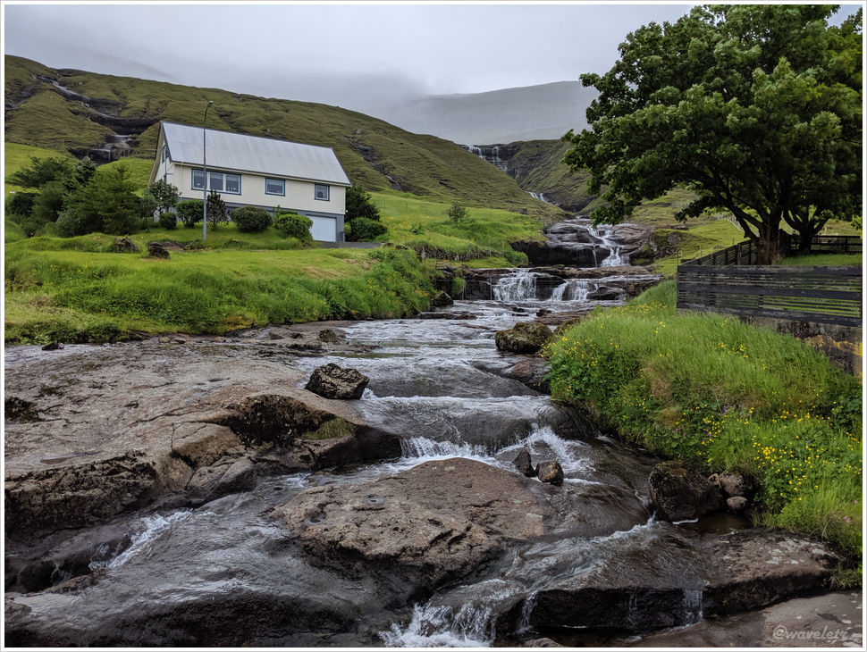
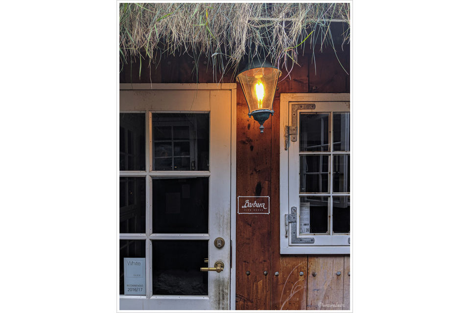
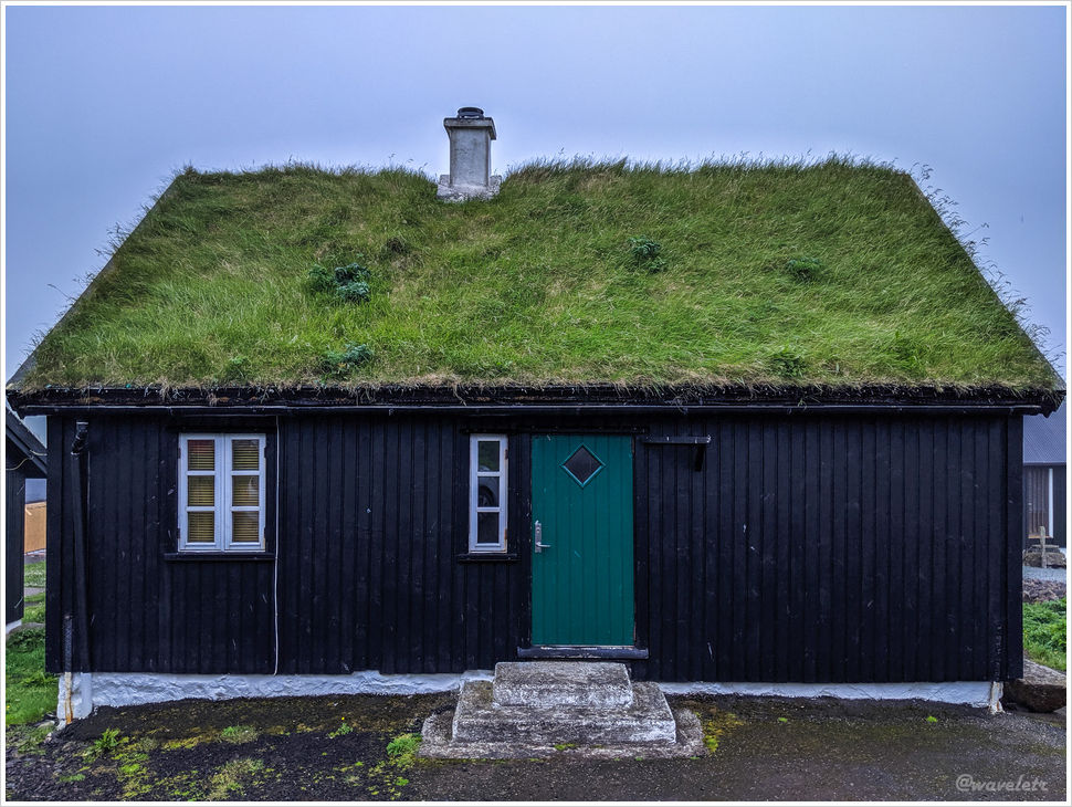
We couldn’t find a good hotel in Klaksvík, so we booked a one-night stay at a guesthouse in Leirvík on the other side of the tunnel. The guesthouse was a privately run two-story house with several rooms, operated by the owner. (That was back in 2019, though, it may have since been renovated or acquired by a rental company.)

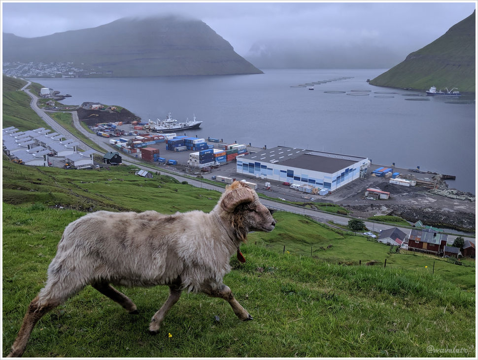
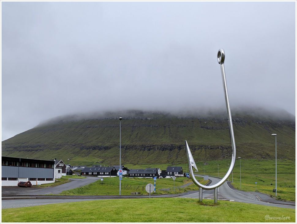
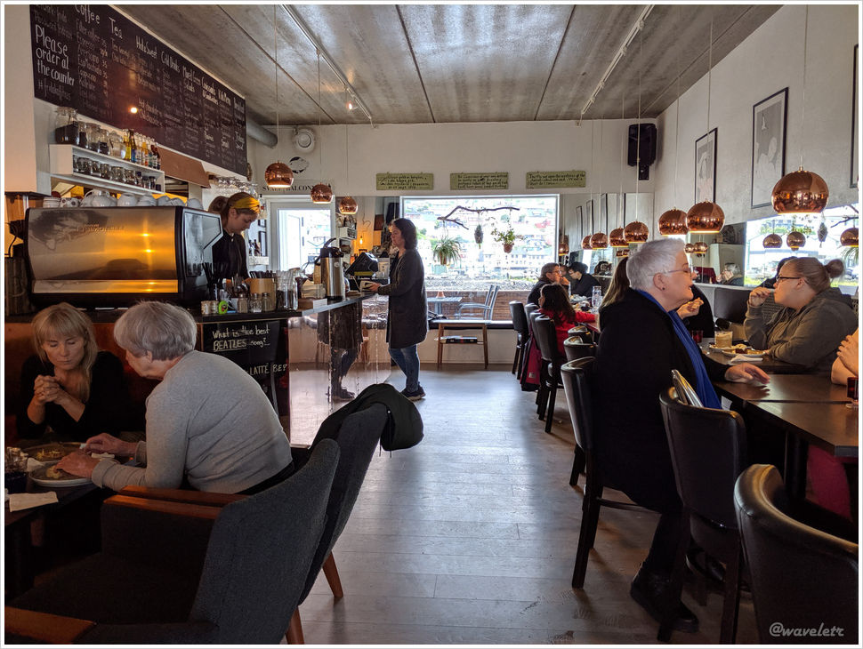
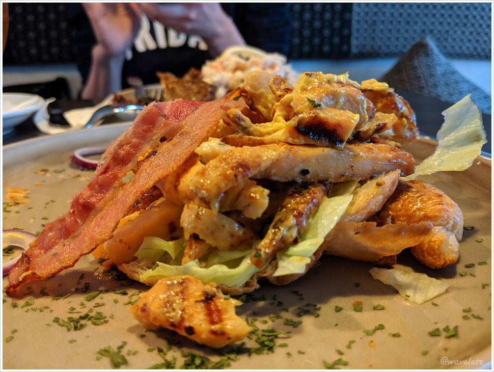
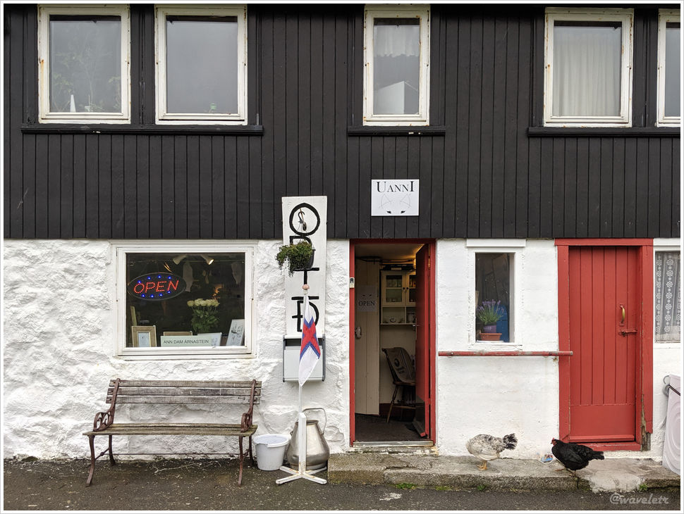
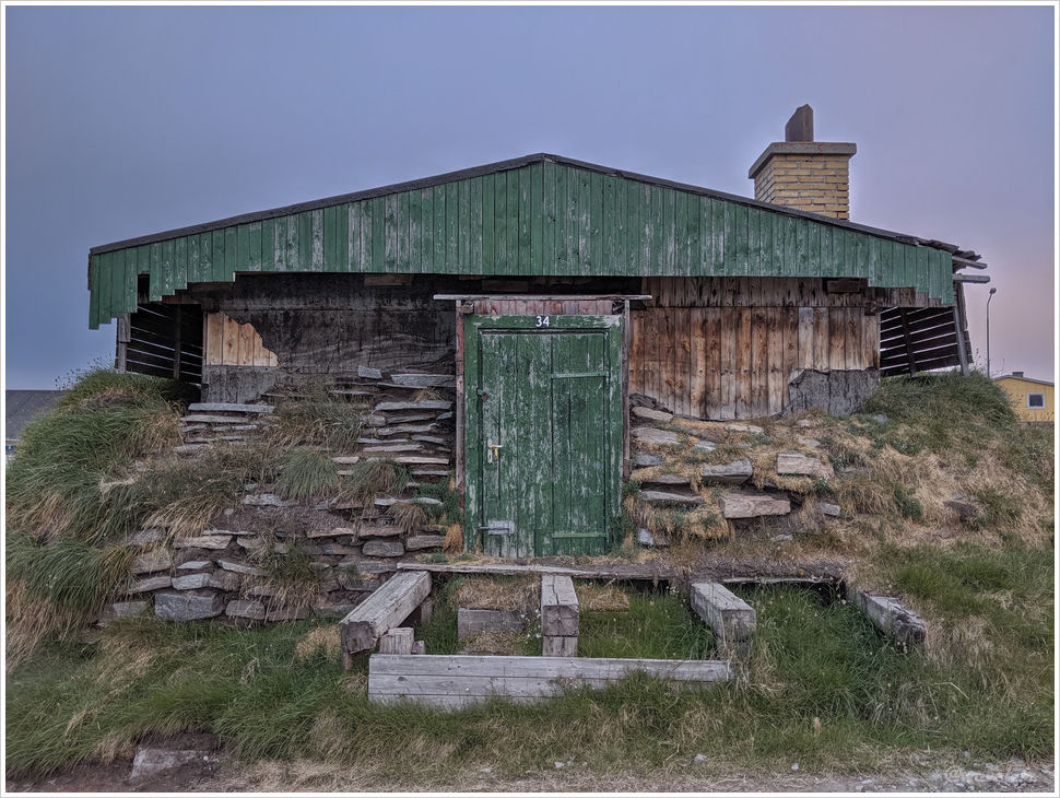
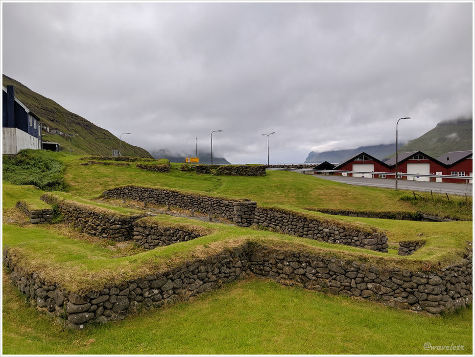
Klaksvík is a very small town, with only about three or four streets. By the roadside, there’s a site with remnants from the Viking era, dating back to around the 9th to 11th centuries when they first settled in the Faroe Islands. The town mostly consists of residential houses, with only a few shops, but there is a nice bowling alley. We sat down to watch people play, and although we had already eaten something earlier in the afternoon, we couldn’t resist ordering a few pieces of fried chicken for dinner.

Leirvík
Toftanes Viking farm, Leirvík

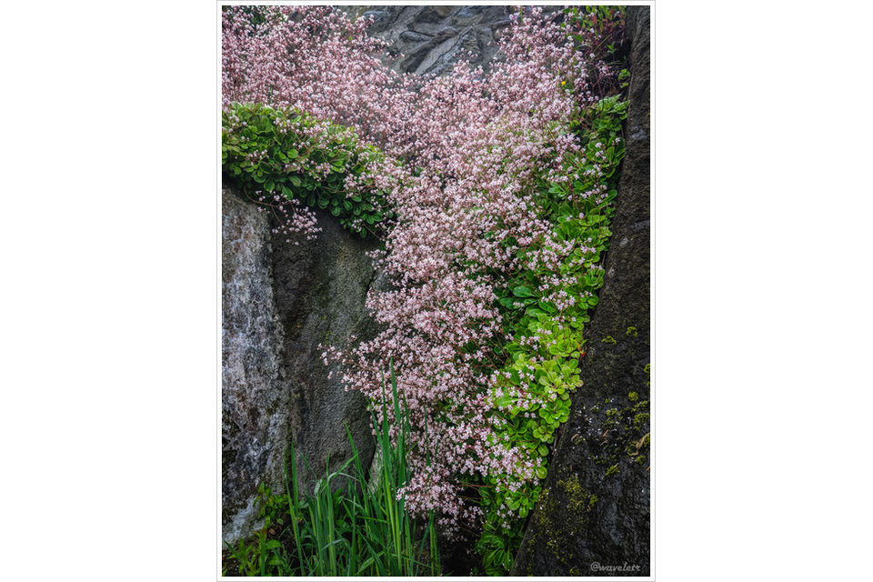
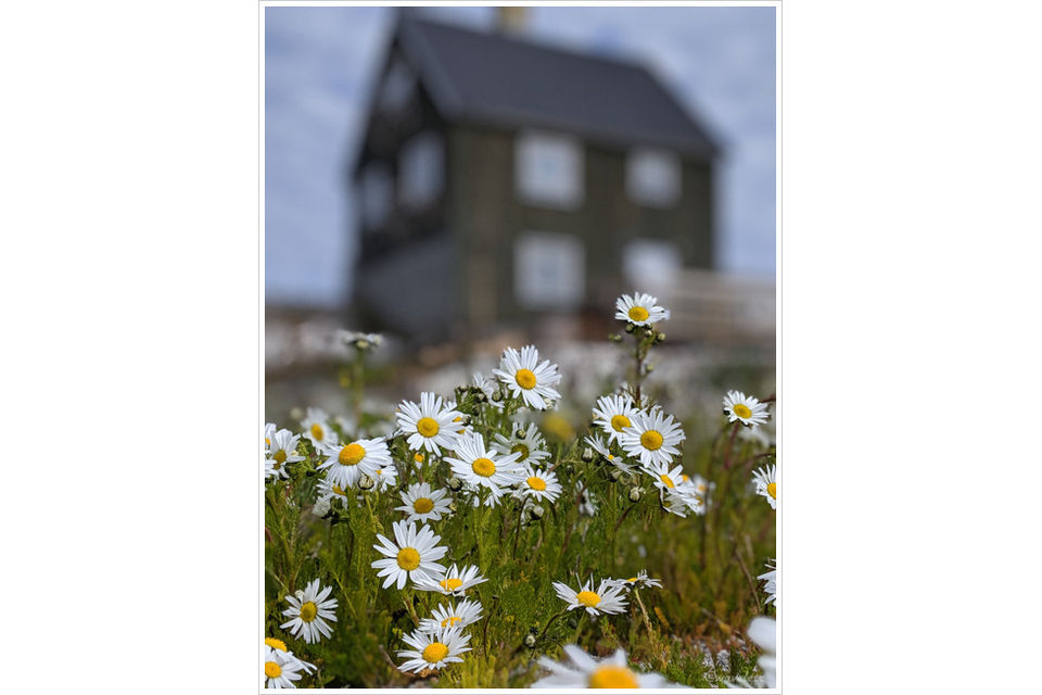
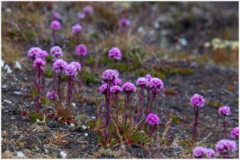
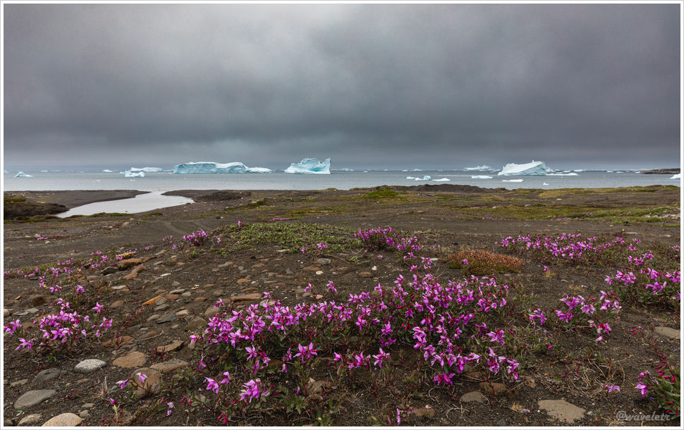
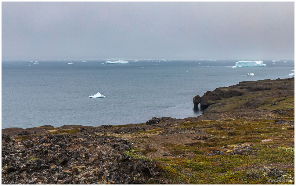
Our ferry was scheduled to depart at 10 o’clock. Early the next morning, I got up to take a few sunrise photos near Leirvík. By the roadside near the fjord, there was a patch of wildflowers, their colors vibrant in the soft morning glow.

Leirvík

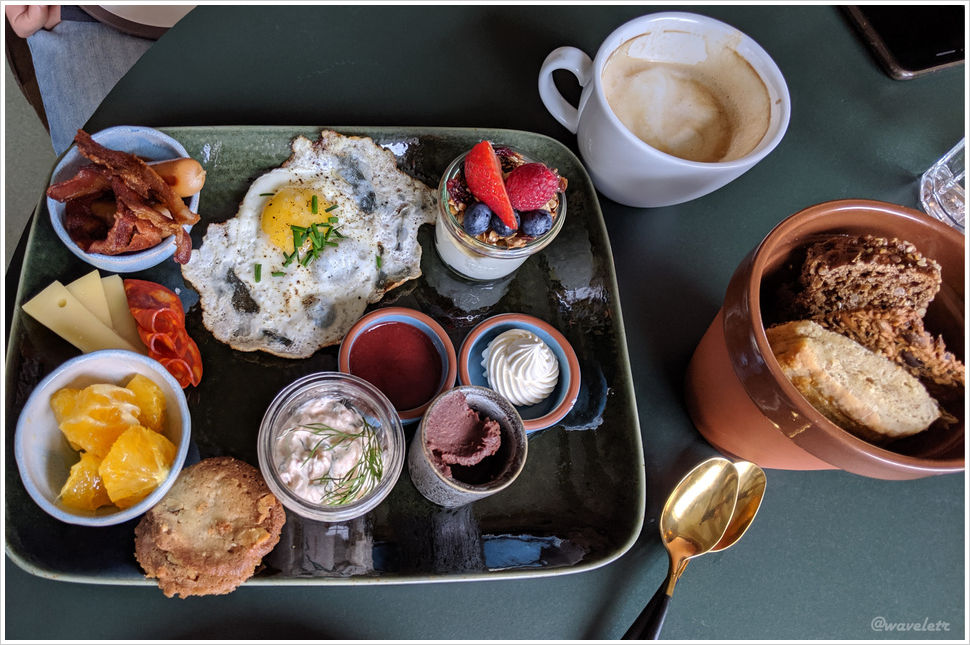
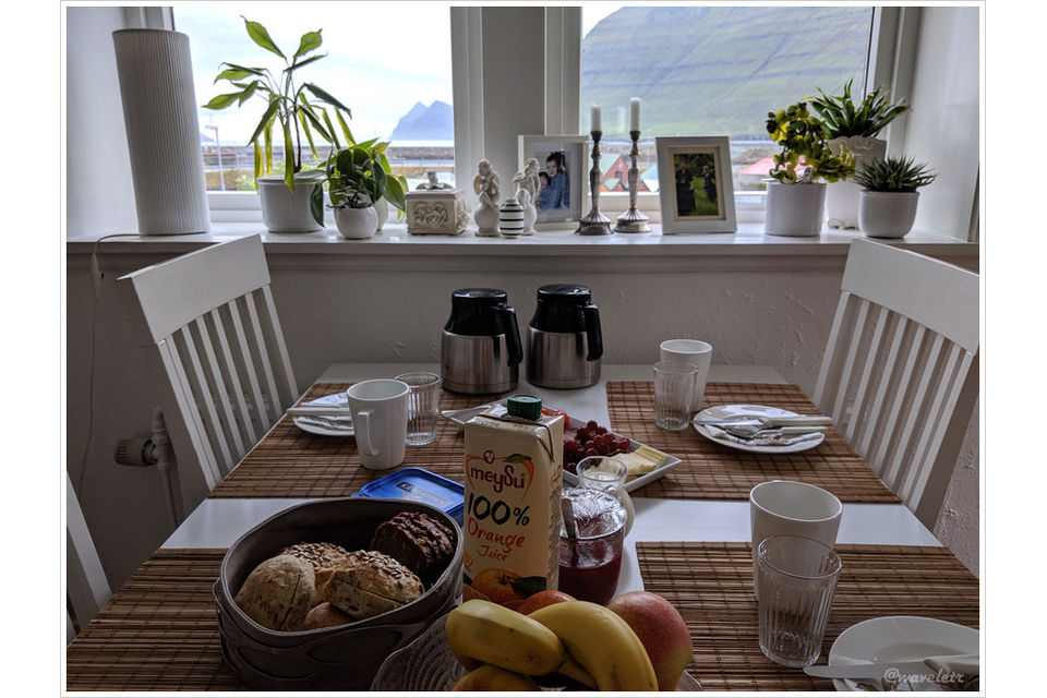
The owner of the guesthouse prepared nice The breakfast for us. When we mentioned the ferry to Kalsoy, the host didn’t seem concerned at all, “Arriving ten minutes early is more than enough,” she said.

Kalsoy Furry, Klaksvík

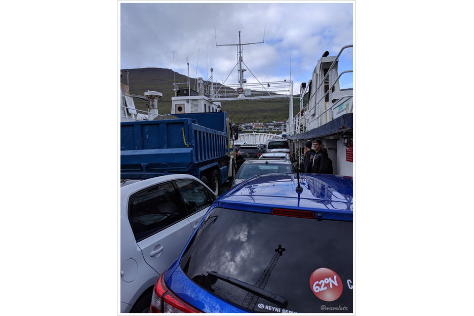
Fortunately, to be on the safe side, we arrived at the Klaksvík ferry terminal 50 minutes early, only to find more than a dozen cars already lined up. The ferry wasn’t a large, multi-deck vessel; it looked more like a tugboat and could hold at most 20 cars. As departure time approached, the cars boarded one by one. In the end, we barely made it. Our car was the last one to squeeze on, brushing left and right as it inched aboard. The vehicles behind us had no choice but to wait for the next ferry, an hour later.

Kalsoy Furry, Klaksvík

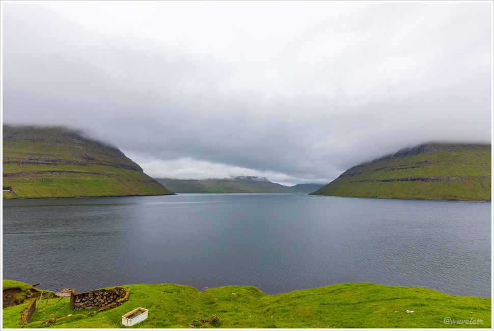
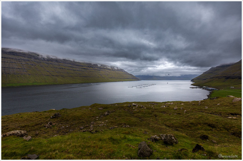
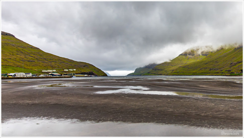
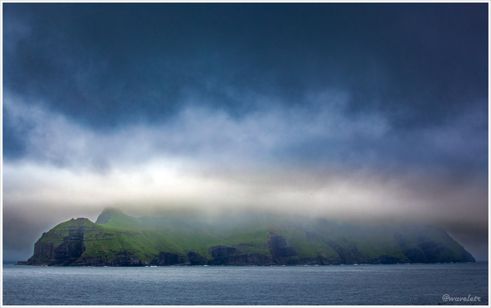
After leaving the narrow harbor of Klaksvík and crossing the fjord, we soon arrived at the port of Kalsoy Island. In the local language, Kalsoy means “man island,” while the neighboring island, Kunoy, means “woman island.”

Kalsoy

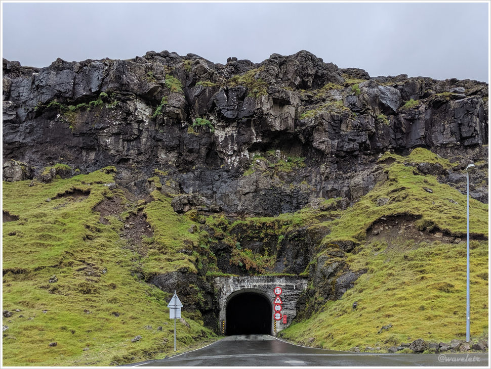
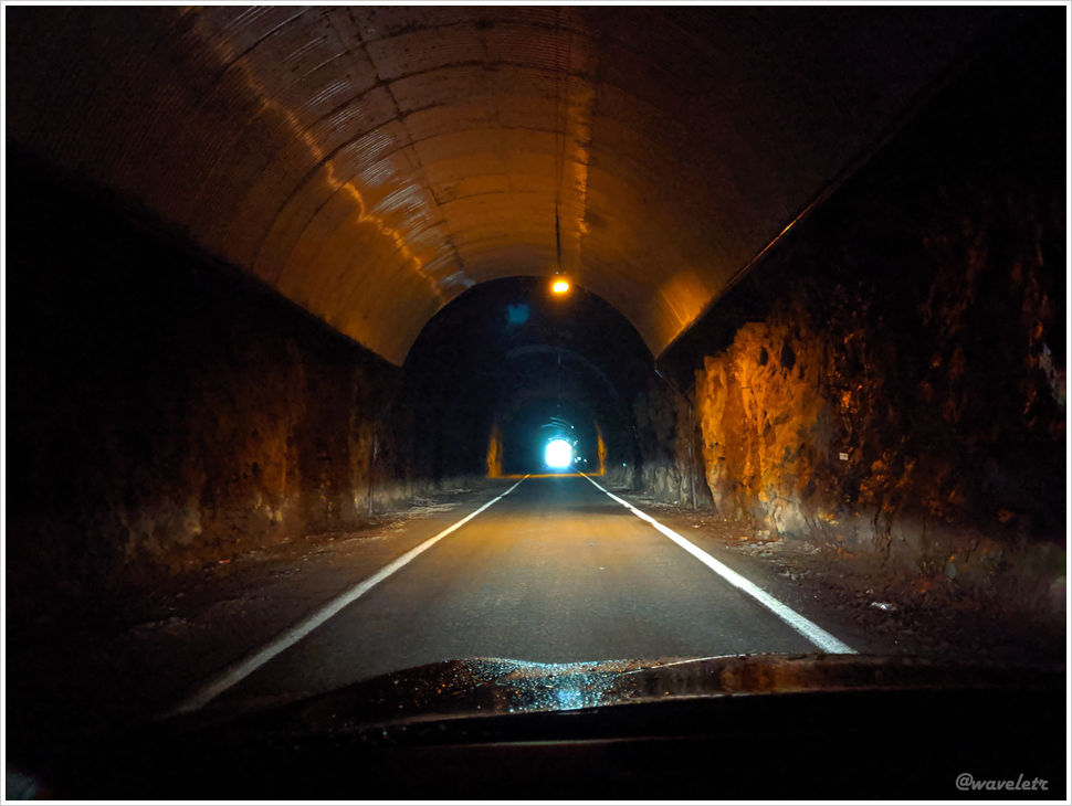
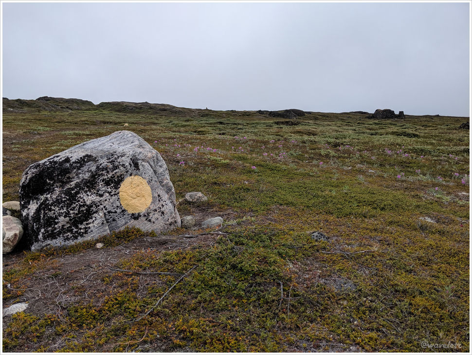
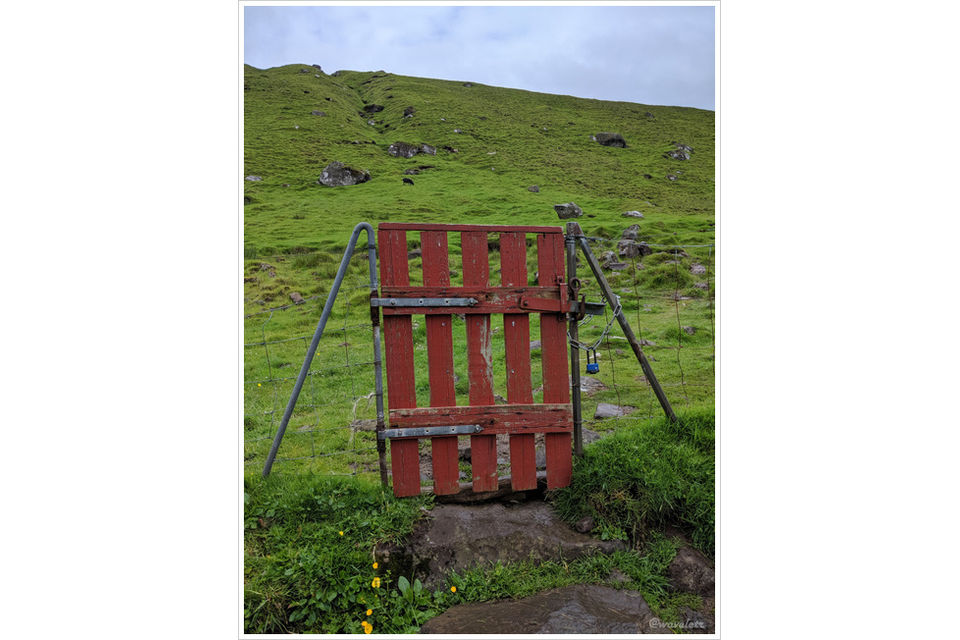
Our destination was the village of Trøllanes at the northern tip of Kalsoy Island. From there, it’s about an hour’s hike to the Kallur Lighthouse. The drive from the port to the village takes around 30 minutes and includes a stretch through a single-lane tunnel. After parking in the village, we soon spotted the red gate mentioned in many travel guides to the left, not far from the road. That’s where the hiking trail begins.

Kallur Lighthouse Trail

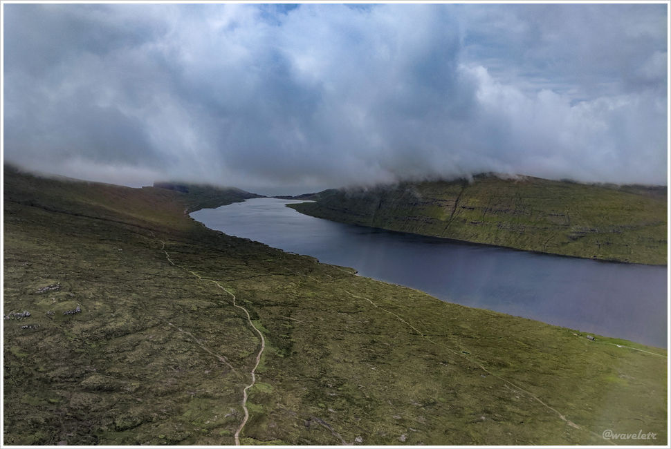
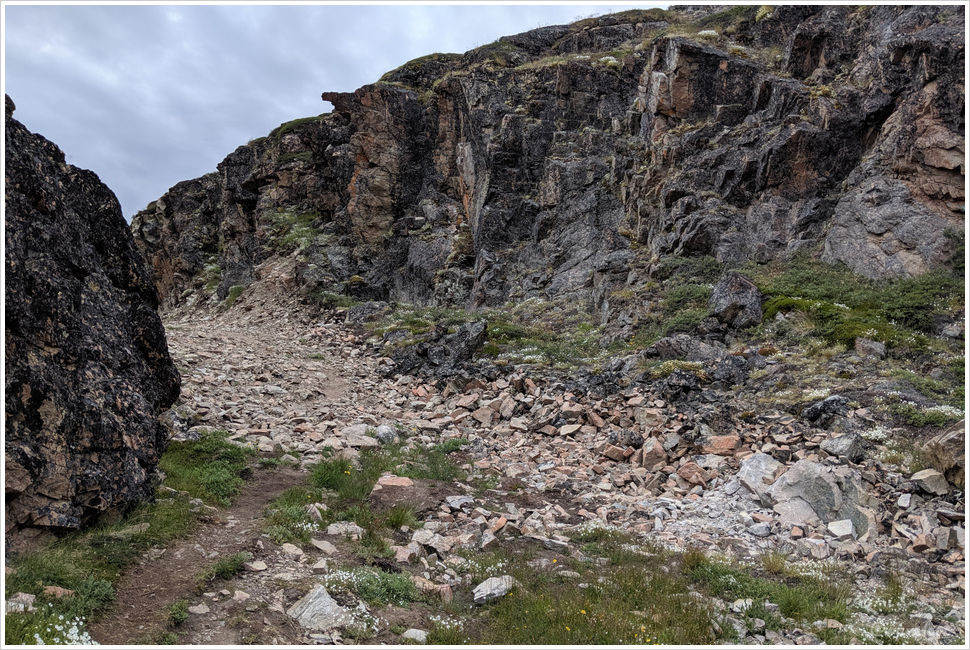
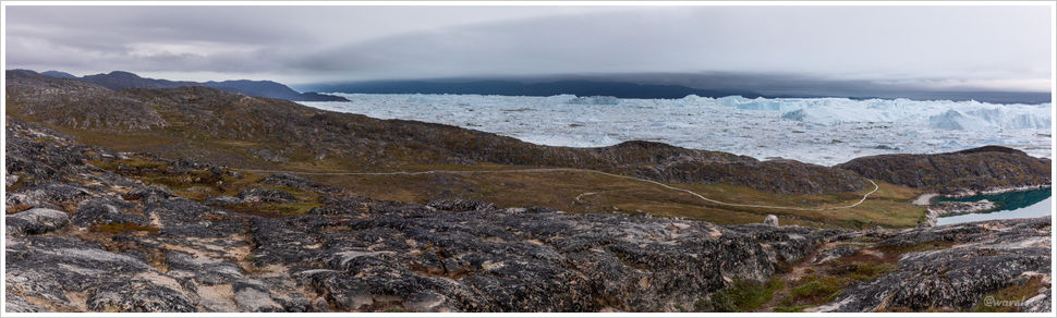
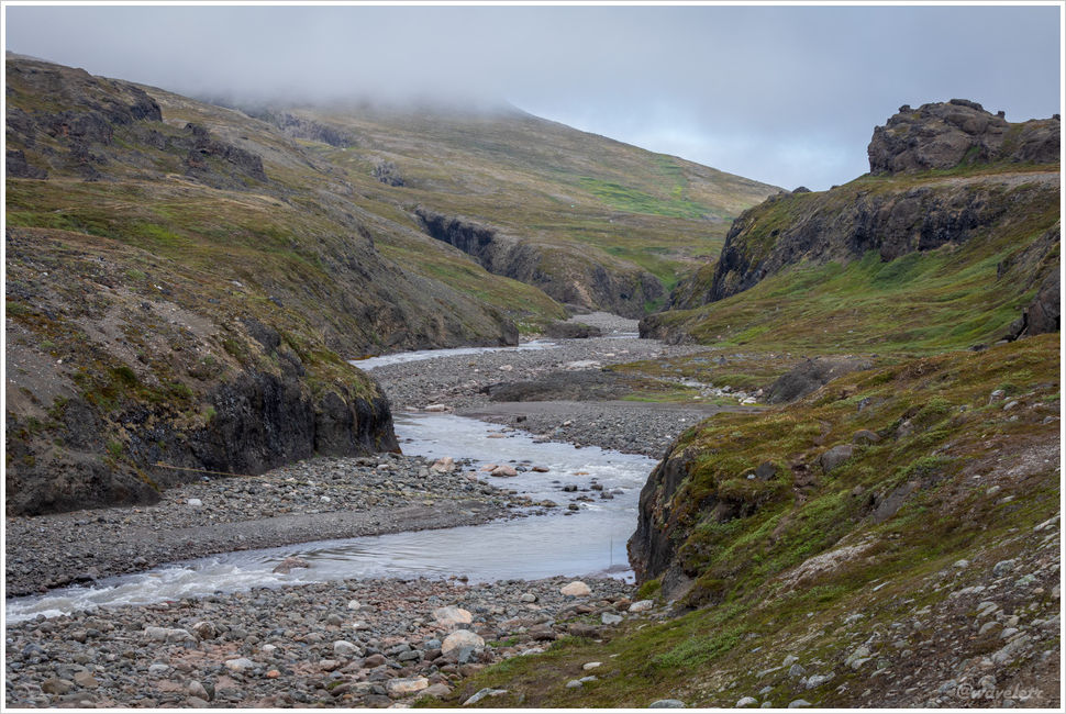
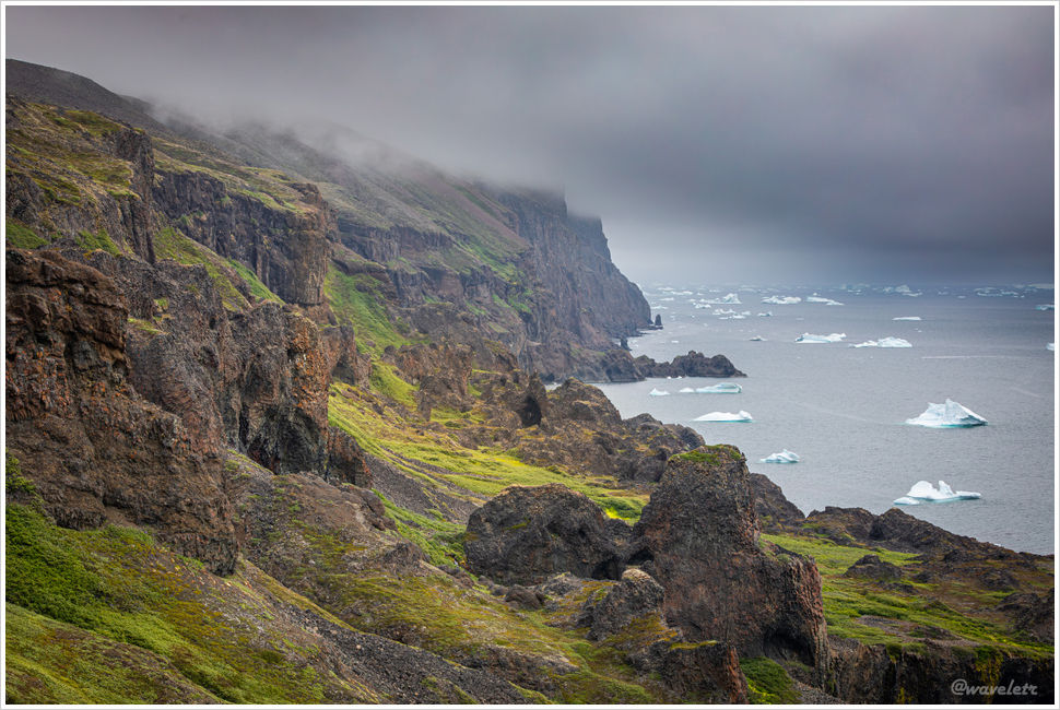
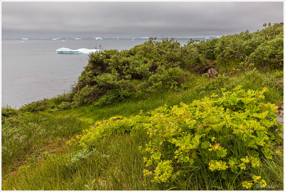
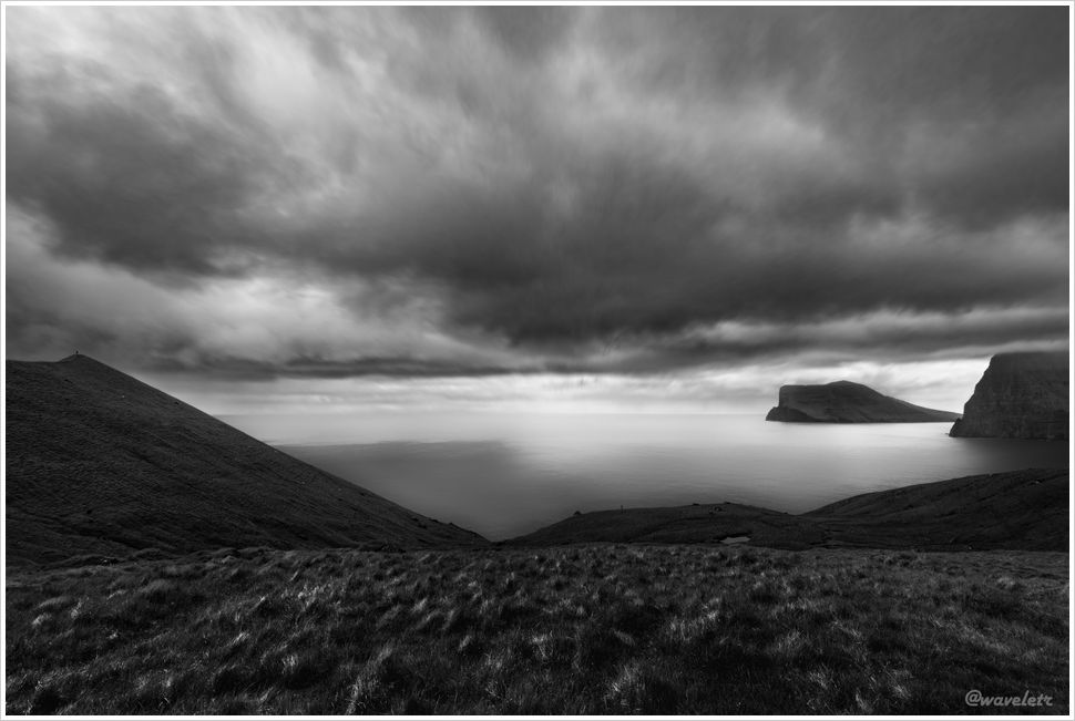
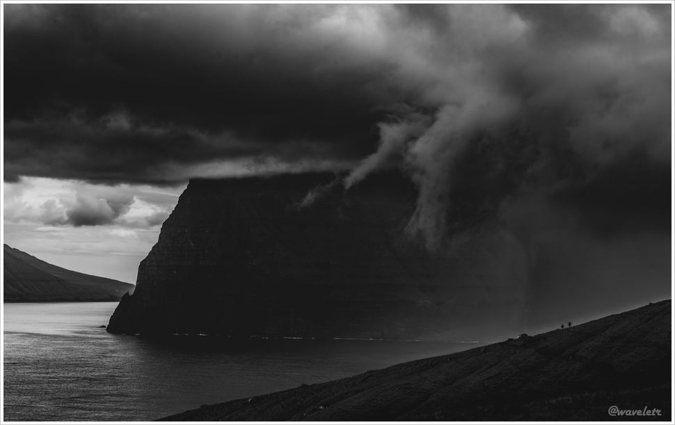
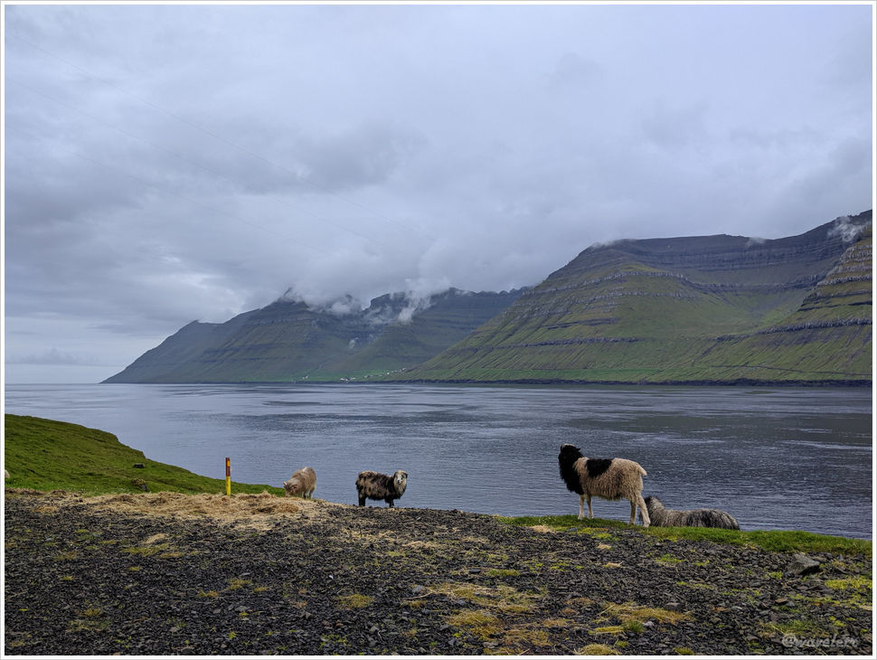
We walked along a hillside path with a gentle incline. Looking to the right, we could see Kunoy Island and the northern tip of Viðoy Island, where we had hiked the day before. The sky grew increasingly overcast, with occasional light rain. All we could hear were the sounds of wind and waves. The timeless mountains, sea, and wind felt cold and solemn, as if time itself had come to a standstill.

Kallur Lighthouse Trail

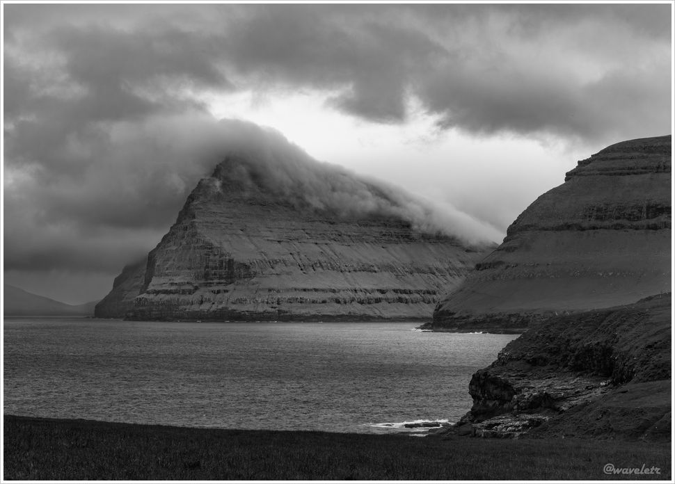
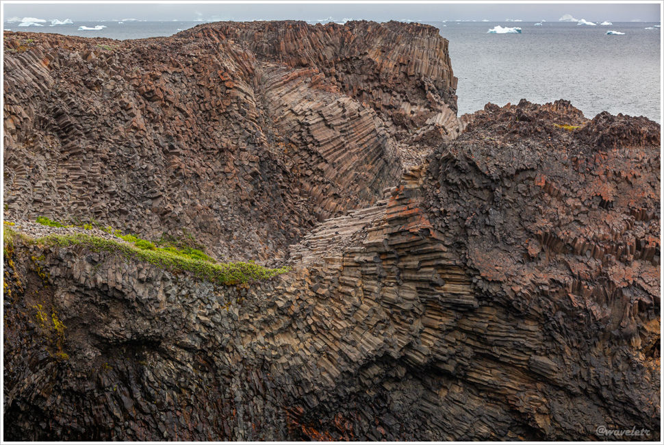
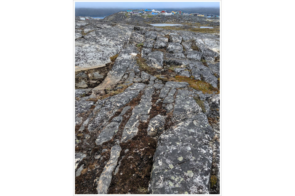
The Faroe Islands were formed 50 to 60 million years ago, during a period of intense volcanic activity as they gradually separated from Greenland. Layers of basalt, created by cooled lava, and softer volcanic ash were deposited alternately, forming the island’s distinctive geological strata. During quieter volcanic periods, vegetation was able to grow, only to be buried and compacted by later eruptions, eventually forming coal deposits. This cycle repeated many times until the shifting tectonic plates slowly moved the Faroe Islands away from the volcanically active zone.

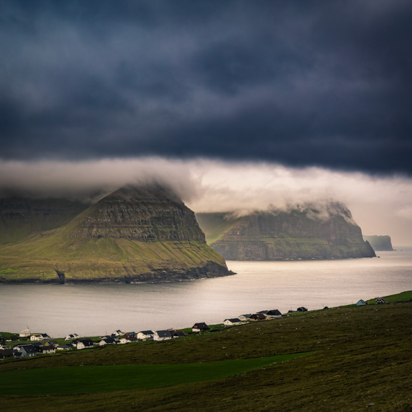
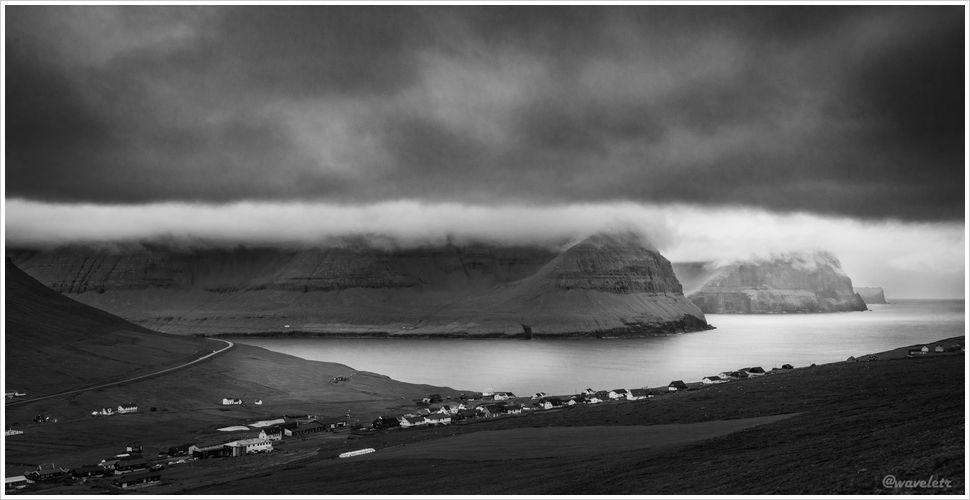
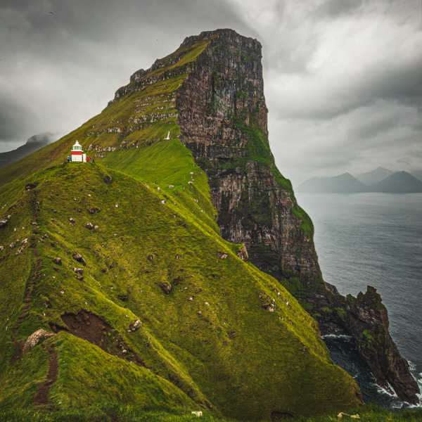
At the end of the trail stands the Kallur Lighthouse. The Faroe Islands actually have quite a few lighthouses, but Kallur is famous not only because it’s built atop a cliff, but also because, when viewed from the right side, the towering wedge-shaped mountain peaks behind it pierce the clouds – a breathtaking sight. The Faroe Islands are known for strong winds, especially atop these high cliffs. With light rain falling from the sky, the path leading to the small hill on the right was quite slippery, requiring us to crouch down and use both hands and feet to safely make our way across.

Kallur Lighthouse

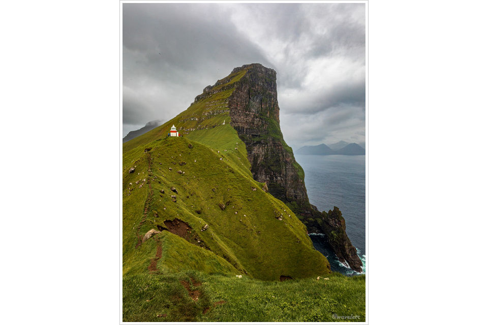
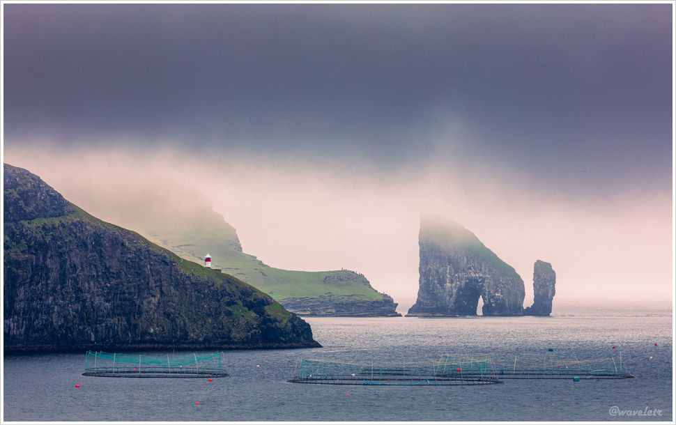
You can walk along the cliff to the other side of the lighthouse, where a narrow ridge juts out over the water with a sheer drop of several tens of meters. From here, looking past the lighthouse, you can see the northernmost tip of Eysturoy Island, with waterfalls plunging into the sea and rock pillars rising from the water’s surface.。

Kallur Lighthouse is one of the most iconic sights in the Faroe Islands. Standing atop the high ridge feels like standing at the edge of the world, surrounded by endless space in every direction. Past and future seem to vanish, and the moist sea breeze sweeps away the dust of the mundane world, leaving the spirit both full and somehow empty.。

Kallur Lighthouse
Kallur Lighthouse

We set off on the journey back. The rain had made the trail muddy and slippery, making every step a careful one, but we finally reached the starting point. On our way back, we had planned to stop by “the Seal Woman” statue, but somehow we couldn’t find it. We then waited for the ferry to return, as tonight we would be staying in Tórshavn.

Kalsoy

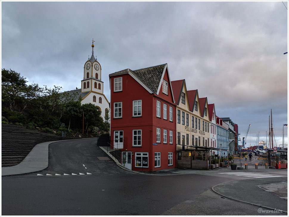
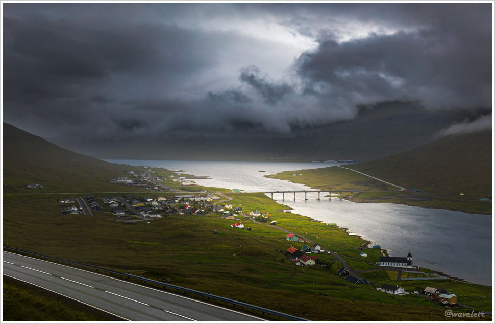
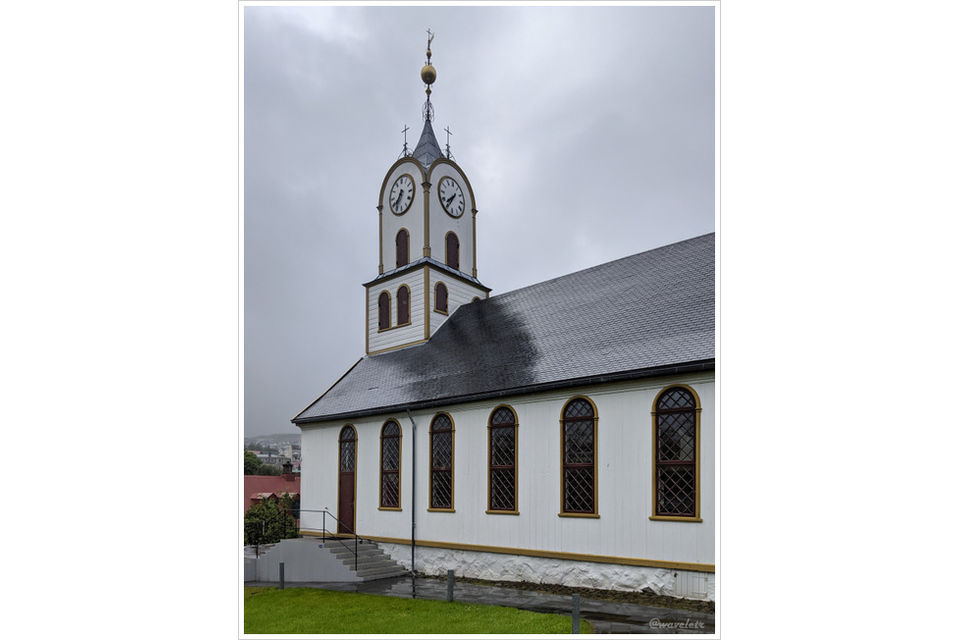
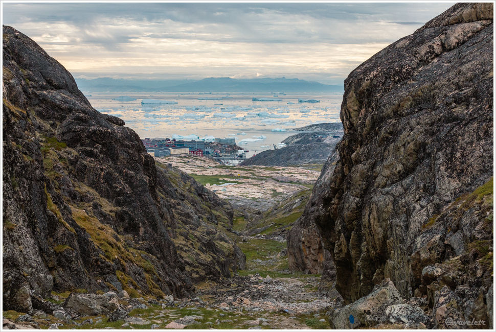
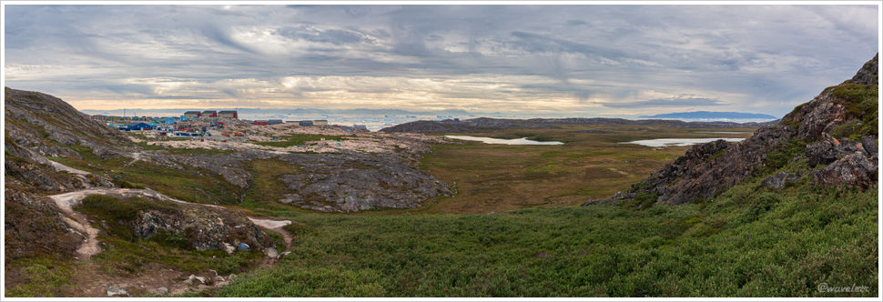
Approaching Tórshavn, the sun finally broke through the clouds, casting warm light over the land. From this vantage point, we could take in the full panorama of the city.

Tórshavn

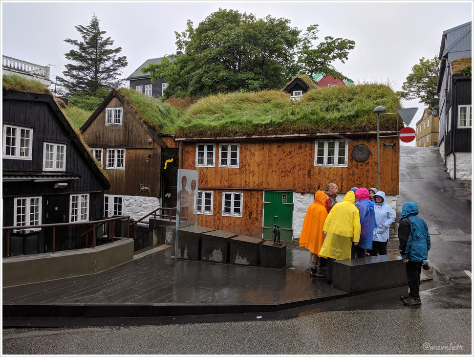
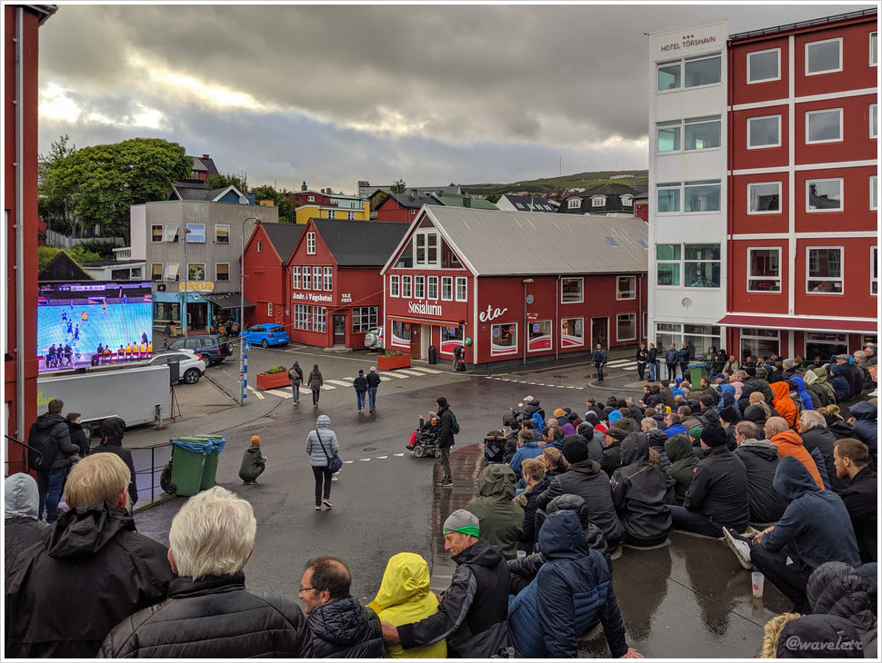
After a short rest, we headed to the city center for dinner. Passing by a small square, we saw the outdoor steps packed with people watching a handball match on a big screen. One of the teams was from the Faroe Islands. Light rain fell intermittently, but the crowd was undeterred, cheering passionately for their team.

Tórshavn

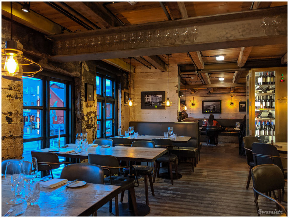
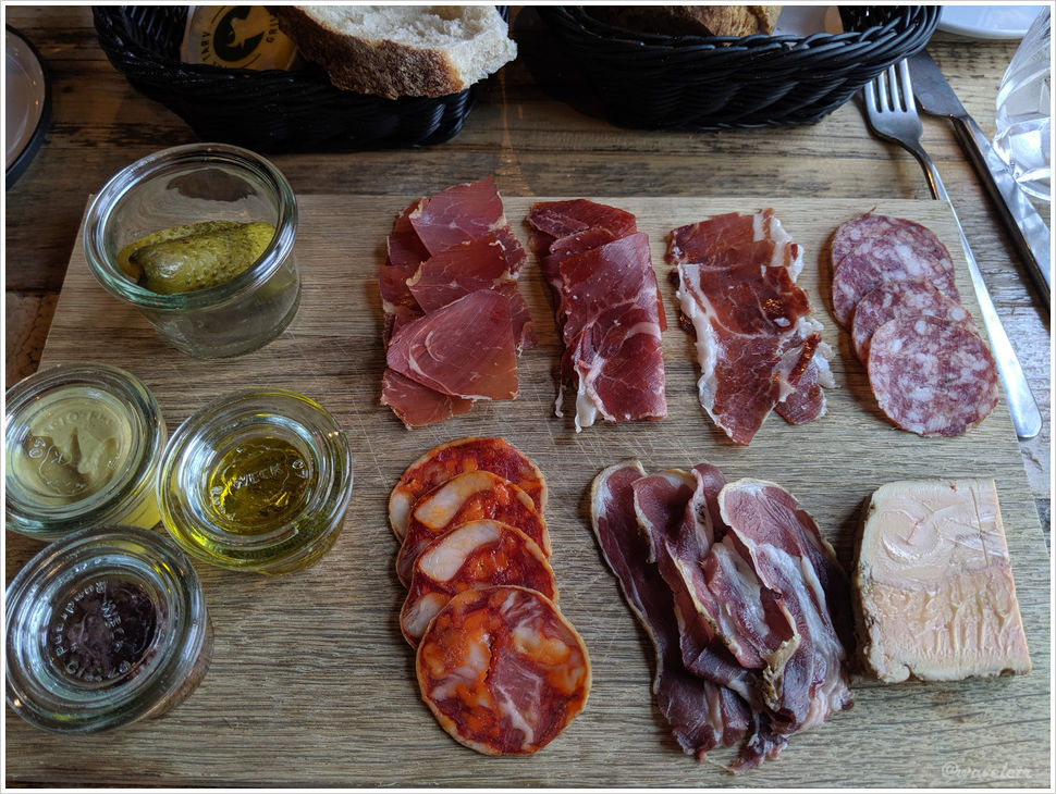
For dinner, we chose TARV, a spacious two-story restaurant by the harbor. I ordered a platter of local Faroese cured meats. It was decent, nothing too adventurous.

TARV Grillhouse, Tórshavn
Tórshavn
0 Comments

Faroe Islands – Northern Islands

2019.7.4Heading north from Tórshavn, there are two roads that lead out of the city. In the morning, we took the one that goes over the mountains. The road was shrouded in fog, obscuring the mountains on both sides and creating a bleak, moody atmosphere. Interestingly, down in the valley it was merely overcast. It is another example of the Faroe Islands’ famously varied weather.

Streymoy and Eysturoy are the two largest and most populous islands in the Faroe Islands, separated by the Sundini Fjord. On the Streymoy side, near the middle of the fjord, lies the small and scenic village of Hósvík. After crossing the Streymin Bridge, we reached the town of Norðskála. The Streymin Bridge, located at the narrowest point of the Sundini Fjord, is 226 meters long and is the only bridge connecting two islands in the Faroe Islands. It is fondly known as the “Bridge across the Atlantic” and plays a significant role in the islands’ road network.

The bridge opened to traffic in 1973, followed by the opening of the Norðskála Tunnel in 1976, which cuts through the central mountain range of Eysturoy. In 1988, the Norðoya Tunnel opened, finally linking the northern islands with the central parts of the Faroe Islands.

Hósvík
Norðskála and Streymin Bridge

We had lunch and took a short break in Klaksvík before continuing north. We soon entered the Árnafjarðar Tunnel, and just 50 meters beyond the exit was yet another tunnel. Between the two lies the village of Árnafjørður, in the central part of Borðoy Island.

Near Ánir
Árnafjarðar outlet

Not far after emerging from the Borðoy tunnel, we reached Viðoy, the northernmost island in the Faroe Islands. Borðoy and Viðoy are connected by a causeway, with the small towns of Norðdepil and Hvannasund facing each other across the strait. Fishing and aquaculture are the primary livelihoods of local residents.

Near Hvannasund

Our destination for the day was the village of Viðareiði, located at the northern tip of Viðoy and the northernmost settlement in the Faroe Islands. From here, if one climbs Villingardalsfjall mountain to the north of the village, the view is breathtaking. In the middle is Malinsfjall in Viðoy; to the left, you can see Fugloy and Svínoy islands; while to the right, the northern tips of Borðoy, Kunoy, and Kalsoy stand in sequence. Unfortunately, it was drizzling that day, and I wasn’t able to reach the summit of Villingardalsfjall.

Viðareiði
Viðareiði

There weren’t many visitors in Viðareiði, and the village itself felt quiet and empty. However, we did notice a few guesthouses under construction or renovation. The owner of one kindly invited us to rest in the lobby. Overall, tourism in the Faroe Islands is gradually increasing.

On our way back from Viðoy, we passed through the small town of Ánir, near Klaksvík, where a few sheep were wandering by the roadside. We stopped the car, and the sheep, completely unafraid of people, ran around us, want to be in the picture.

Near Ánir
Near Ánir

Klaksvík is the second-largest town in the Faroe Islands. Situated between two back-to-back fjords, it is an important port and fishing hub. Before entering the city, there is a roundabout with a sculpture shaped like a fish hook, perhaps symbolizing its fishing heritage.

Klaksvík
Klaksvík
Klaksvík

We had lunch in Klaksvík at a restaurant called Fríða Kaffihús, which we really enjoyed, so we returned there on our way back. Their curried chicken salad was especially flavorful.

Fríða Kaffihús, Klaksvík

In the evening, we stayed in Leirvík, on the other side of the Norðoya Tunnel. Tomorrow, we plan to take a boat to Kunoy Island.

0 Comments

Faroe Islands – Thor’s harbor

2019.7.3~4Tórshavn means “Thor’s harbor.” Thor is the hammer-wielding god from the movies, a nearly omnipotent figure in Norse mythology and a protector of humankind. His name appears frequently in various cultures and place names. Since the 9th century, when the Vikings first landed in the Faroe Islands, Tórshavn has been the islands’ main settlement. At that time, the Faroe Islands had only a few fishing villages and farms, with just a few hundred inhabitants. Tórshavn served as the main port for external trade. It wasn’t until the latter half of the 20th century that these villages gradually grew into towns.

To this day, the harbor still occupies a large portion of Tórshavn, while the city center remains small and retains the feel of a fishing village. Houses with grass-covered roofs, narrow winding alleys, and damp, gloomy weather – it’s as if the air could be wrung out like a wet towel.

Tórshavn
Tórshavn

The city’s oldest buildings have been converted into restaurants. Though they are connected back-to-back and belong to the same business, each has a unique style. Before the trip, a colleague recommended one called Ræst. Ræst refers to a traditional method of preserving meat by fermentation, not cooked or dried, but somewhere in between, essentially semi-rotted. Both fish and lamb can be prepared this way. Though uniquely Faroese, similar methods are used across the Nordic region, with Sweden’s Surströmming being the most famous example.

We stood outside Ræst for a while, sampling the smell coming from the restaurant. Ultimately, we found it a bit too challenging and opted for Barbara next door. This seafood restaurant, like the one we tried in Greenland, served very fresh ingredients, had beautiful presentation, and modest portions, definitely worth recommending.

Barbara, Tórshavn
Barbara, Tórshavn
Barbara, Tórshavn

After dinner, it was around 7 p.m., and we took a walk around town. Tórshavn has almost no large hotels, mostly small inns or private houses converted into guesthouses. We booked a stay with visitHOMES, which, while labeled as a homestay, is actually a set of apartments managed by a company. The rooms are rented individually and share common areas. We found the house not only very new but also mostly empty, aside from one night, we had the entire building to ourselves. It was just a five-minute walk from the city center, very comfortable and convenient.

Tórshavn Cathedral
Traðarmaðurin, Tórshavn
Tórshavn

The plan for the next day was to visit Viðoy, the northernmost island in the archipelago. In the morning, we had breakfast at Essabarr, located right across from the restaurant we dined at the night before. A light rain was falling. We saw a small group of people wearing brightly colored rain jackets – essential attire for traveling in the Faroe Islands due to the constantly changing weather. Breakfast at Essabarr was elegant, with especially delicious bread and crisp cereal.

Tórshavn
Essabarr, Tórshavn
0 Comments

Faroe Islands – Múlafossur Waterfall

2019.7.3The Faroe Islands? Where are they? Are they a country? Such questions are completely understandable—especially back in 2019, when we made our trip. At that time, the Faroe Islands were still relatively unknown, known mostly within photography circles. But as breathtaking landscape photos began circulating online, the islands gradually gained popularity. Though not a remote and inhospitable place, the Faroe Islands still lacked sufficient tourism infrastructure to handle the growing number of visitors. As a result, the local government and residents began considering various measures—such as periodically closing certain attractions—to limit tourist numbers.

We spent one night in Iceland, then took a flight to the Faroe Islands the next morning. The flight to Greenland had been on a small propeller plane, but the one to the Faroes was an Airbus 320—a mid-sized jet. Clearly, more people travel to the Faroe Islands than to Greenland. Before landing at Vágar Airport, the plane flew over Lake Sørvágsvatn. This was the view from the plane, and a few days later, I would be walking along that trail below all the way to the sea shore.

Lake Sørvágsvatn

We rented a manual Nissan Murano at the airport. The car was reliable and ran smoothly throughout the trip. After returning to the U.S., I considered renting one again but found that it didn’t have great reviews—perhaps the models differ between Europe and the U.S.

We first stopped at the nearby town of Sørvágur to stock up on supplies. There’s a sandy beach by the fjord there, where you can see all the way to the open sea beyond. It didn’t yet reveal the awe-inspiring beauty we were about to encounter.

Beach by Sørvágur

Before heading to the hotel, we decided to visit the Múlafossur Waterfall – the very waterfall that had first introduced me to the Faroe Islands. We drove west along the road on one side of the fjord. Not far along the way, we saw a few cottages with roofs covered in thick green grass – a characteristic look of the Faroe Islands. The clouds hung low, almost touching the sea, and it felt like these houses were meant to exist in just such gloomy, moody weather.

Houses by Sørvágsfjørður

Looking across the fjord from there, you can see one of the Faroe Islands’ iconic sights: Drangarnir – a small island shaped like an archway. Next to it is a sea stack shaped like a club, and behind them rises the triangular, steep cliffs of Tindhólmur Island. Drangarnir is very close to Vágar Island. From the cliffs of Vágar, especially when the sunlight illuminates the arch from the left, you can’t help but marvel at nature’s magnificent craftsmanship.

In the photo below, Tindhólmur is off to the right and not visible; on the left is Vágar Island, where you can see some photographers perched on the cliff’s edge. The circular shapes on the water are salmon farms – one of the Faroe Islands’ main industries.

Sørvágur Lighthouse and Drangarnir

To get to Gásadalur, we had to go through the Gásadalur Tunnel, which cuts through the mountain. Once entering the tunnel I was getting nervous. It was a one-lane road with no traffic lights on either end to control alternating flow. What if a car came from the opposite direction? Luckily, not far into the tunnel I spotted a pull-out area on the left, large enough for two cars, clearly meant for yielding. These passing bays appear every hundred meters or so. We hadn’t researched this in advance, so whenever we saw an oncoming car, we pulled into the nearest bay. In fact, if the bays are on your right, you should yield, but if the oncoming vehicle is a large truck, smaller cars have to give way regardless.

Road to Gásadalur Village

Looking back after exiting the tunnel, we could see the mountain we had just passed through. The Gásadalur Tunnel was opened to pedestrians in 2003 and to vehicles in 2006. Before the tunnel was built, the village was accessible only by boat or via hiking narrow cliffside paths over the mountains. The tunnel made travel far more convenient. One-lane tunnels like this are now considered outdated. Newer ones often have two lanes or even four, connecting different parts of the islands by cutting through mountains and crossing under the sea.

Road to Gásadalur Village

Just a few dozen meters off the roadside, you can see the Múlafossur Waterfall. The stream that feeds it originates from the mountaintop behind and flows just a few kilometers before plunging over 60 meters straight into the Atlantic Ocean. The towering mountain backdrop and the quaint village at its foot add a dreamlike quality to this breathtaking scene.

Múlafossur Waterfall

A few more steps down a small path lead to a slightly restored stairway, which brings you to a platform closer to sea level. On stormy days, the waves crash dramatically, making for even more powerful photographs. But on this particular day, the wind was calm, and low-hanging clouds shrouded the mountain peaks, which refused to show themselves. Looking out to the left, we could see several small islands in the sea. One of them is Mykines, which we would visit on our last day.

Mykines Island

Gásadalur is the small village nestled at the foot of the mountain. It likely has no more than a dozen or twenty houses, many with thick green grass covering their roofs. We didn’t see many people around, probably because the population is small. Located at the far edge of Vágar Island, the village is almost completely cut off from the world, nestled in a landscape that feels utterly otherworldly. Coming through the mountain tunnel, it felt as though we had stepped into a hidden utopia.

Gásadalur Village
Gásadalur Village
0 Comments

A Storyteller

2019.7.2Before hiking the blue trail, we took a stroll around the town of Ilulissat. The town is not very large and can mostly be divided into the residential area near the hotels and the commercial area near the harbor. In the “middle town”, there is a school, and by the roadside, a football field, which served as our meeting point.

Ilulissat, Greenland

Ilulissat is the major city on Greenland, with a variety of shops, supermarkets, cafes, and restaurants. If you don’t want to eat at the hotel all the time, the town offers food from other regions, though the options are limited, the quality is still quite good.

Ilulissat, Greenland

Of course, the most beautiful sights in the city are the icebergs on the sea and the wildflowers that blanket the land in summer. Paired with the colorful wooden houses, it creates the most picturesque and distinctive Arctic scenery.

Ilulissat, Greenland

The sunlight and clouds at 11 PM the night before departure and again at 4 AM on the day of departure. Looking at the photos afterward, I regretted not going to have a walk by the giant icebergs and taking some pictures. It wasn’t late at all at 11 PM, and I’m sure I would have got better pictures.

Ilulissat, Greenland

We flew back to Iceland at noon, and the next leg of our journey would be just as wonderful. I came across a quote in the magazine on the airplane: “Travelling – It leaves you speechless, then turns you into a storyteller.” This perfectly sums up our journey in Greenland!

Ilulissat, Greenland
0 Comments

Greenland – Ilulissat Blue Trail

2019.7.1Yesterday, I trekked the yellow trail in Ilulissat. Today I plan to take the blue trail. In the morning, we also walked around the town—more on that later.

Ilulissat trail map, Greenland

The starting point of the blue trail is the same place where I exited the yellow trail yesterday, not far from the city center. The blue trail is about 5 miles long. After finishing it, I still have to walk another one and half miles to get back to the hotel—more than three times the length of the yellow trail.

The first mile is a well-paved wooden boardwalk, built over the tundra in the yellow-green color. Not far from the entrance, one of the wooden planks is engraved with the UNESCO logo. For over 270 years, people have been exploring and studying this glacial fjord. It continues to provide crucial data for climate change and glaciology research. In 2004, Ilulissat’s Icefjord was designated a UNESCO World Heritage Site for its natural and cultural significance.

Ilulissat blue trail, Greenland

The winding boardwalk leads visitors closer to the fjord. Beyond this stretch of large rocks, towering icebergs come into view. This is where the boardwalk ends. If you come to Ilulissat, even if you don’t plan on a long hike, you should at least make it here to take in the breathtaking view above from the hill.

Ilulissat, Greenland

The section along the fjord is similar to the terrain I saw on the yellow trail yesterday—exposed granite and low vegetation growing between large rocks. The blue trail is, of course, marked with blue signs. About a third of the way in, there is a fork leading to a red-marked trail, which provides a shorter route back to the starting point, a lot of shorter in distance compared to completing the full blue trail.

Ilulissat blue trail, Greenland

Few people take the full blue trail. Along the way, I didn’t see a single person—except for a young girl running in the opposite direction. Yes, running! Keep in mind that the trail is far from smooth, mostly covered in loose rocks, with occasional large boulders to climb over. Back then, I hadn’t started running yet, and my endurance wasn’t what it is now. If it were today, I believe I could run the whole trail as well.

On the yellow trail yesterday, we stayed along the hillside without descending to the fjord’s edge. The blue trail, however, follows the fjord more closely. While it doesn’t hug the shoreline, it stays at nearly the same height as the icebergs. From this vantage point, their shapes are much clearer—some towering and sharp, others flat and smooth, and some jagged like a series of mountain peaks. One iceberg stood out in particular, resembling Mount Everest, with a blade-like ridge rising dramatically above the rest, making it truly striking.

Ilulissat blue trail, Greenland

The deeper I walked into the fjord, the more crowded the icebergs became. Looking back, I could see icebergs that had already drifted out of the narrow fjord, floating in the Disko Bay.

Ilulissat blue trail, Greenland

About halfway along the blue trail, the coastline curves south, and here lies a small cove where the icebergs cannot drift into. Only some small floating ice remains. The trail then continues deeper into the mountains, the terrain gradually rising, and eventually, the icebergs that had accompanied me start to fade into the distance.

Ilulissat blue trail, Greenland

At a higher point in the hills, there is a small lake with a beautiful view. I sat by the lake for a while to rest. After seeing the massive icebergs in the fjord, the tranquil little lake and its peaceful scenery felt like a refreshing change. It even started to drizzle lightly.

Ilulissat blue trail, Greenland

The trail turns left from here. This section feels like a canyon between two mountains. It almost looks man-made, as if carved out, because beyond the mountain lies a quarry. The trail is filled with loose rocks, making it quite difficult to walk, and I was starting to feel a bit tired. As I walked, I kept sensing something in the round-shape in my backpack but couldn’t figure out what it was. Only later, when I tried to find out, did I realize it was an small orange—sweet and juicy, just the perfect boost of energy. The unexpected surprise felt like a timely gift, and to this day, I still often reminisce about the delightful feeling that little orange gave me.

Ilulissat blue trail, Greenland

After crossing the highest point of the trail, I could already see the city of Ilulissat ahead. Behind it lay Disko Bay, with icebergs floating. In the distance, the mountains of Disko Island, which we had just visited, were visible.

Ilulissat blue trail, Greenland

When I reached the foot of the mountain, I had finally completed the entire blue trail. This was the farthest east of the city, and I passed an area where many sled dogs were tied up. Typically, it’s only in winter that sled dog tours are offered. In the summer, they are tied up. Because there are so many of them, and they still retain their wild nature, they can only be kept outdoors. If an adult sled dog is not tied up, it poses a safety risk to both residents and tourists. It is reportedly legal to have them killed. Although I understand there is no other way, seeing such a large group of dogs tied up still felt pitiful.

Ilulissat blue trail, Greenland

I left the hotel at 5 PM and didn’t get back to the hotel until after 9 PM, by which time the restaurant had already closed. I asked the kitchen for a beer. In my room, I enjoyed the takeaway my wife had brought back. It was just as relaxing.

0 Comments

Greenland – Ilulissat Yellow Trail

2019.6.30There are two hiking routes along the Ilulissat Fjord: the blue and yellow trails. The trail is right next to the city, with floating icebergs on one side — walking alongside giants. These are the most recommended hiking routes in Ilulissat.

Ilulissat trail map, Greenland

We returned to our hotel in Ilulissat around 5 PM. My plan for today was to complete a loop on the yellow trail. Since it wouldn’t get dark anyway, I had plenty of time. The yellow trail starts at a power plant. After leaving the main road, it didn’t take long to spot the trailhead sign. The yellow trail is only 2.7 km long, but in reality, there are ups and downs in the hills, occasional deviations from the marked route, and walking back to the hotel, making the total distance longer. However, the trail has little elevation gain and is quite easy.

Ilulissat yellow trail, Greenland

After climbing a short wooden ladder, the trail continues over large, exposed granite boulders. The slope is not steep, but there is no defined path, so occasionally, I had to use my hands for support. Looking back from a high point, I could see the city by the sea, still covered by a vast layer of dark clouds.

Ilulissat, Greenland

Moving forward and climbing higher, I gradually saw massive icebergs floating on the sea. This is where the fjord opens into Disko Bay.

Ilulissat yellow trail, Greenland

Suddenly, I heard a few bursts of air. I quickly climbed to a higher vantage point and saw two humpback whales swimming near the fjord entrance. Sometimes they lifted their tails before diving, sometimes they floated on the surface, releasing jets of mist. Sitting on a large rock, I was completely alone, surrounded by silence, except for the whales’ exhalations, the sound of their tails splashing in the water, and the gentle wind. In the distance, a speedboat was approaching, likely there to admire the icebergs and track the whales.

Ilulissat yellow trail, Greenland

Making a turn around the cape into the bay, I saw icebergs stretching endlessly into the horizon. I wondered where else in the world I could witness such a scene. Majestic mountains are found everywhere, and large glaciers are common in high latitudes, but here, enormous icebergs are packed tightly within a fjord only a few kilometers wide. Some icebergs are one or two kilometers long. If they weren’t wedged together, the water between them would still be covered with floating ice — probably fragments from their collisions.

Ilulissat yellow trail, Greenland

There were a few hikers scattered along the trail. In the photo below, you can see one person standing by the water, likely experiencing an even more breathtaking view from that angle. However, being too close to the water is risky. Icebergs occasionally collapse, sending waves toward the shore much faster than a person can run. I later witnessed an iceberg breaking apart and falling into the water — not too large, fortunately.

Ilulissat yellow trail, Greenland

Geographically, Greenland belongs to the North American tectonic plate, but most of its plants originate from the European continent. Low-lying vegetation covers the exposed rocks, reaching only a few inches high. Many plants creep along the ground, yet some produce brightly colored flowers.

Ilulissat yellow trail, Greenland

Continuing along the hillside, I saw the two humpback whales again, playing in the waters between the icebergs and the land.

Ilulissat yellow trail, Greenland

Among the large boulders along the trail, pools of water formed, creating a Zen-like atmosphere. The scenery appeared as if filtered through a desaturated blue-green tint. Combined with the cool weather, any lingering restlessness faded away.

Ilulissat yellow trail, Greenland

The rocks along the trail were marked with yellow paint, making it easy to navigate even when off-course.

Ilulissat yellow trail, Greenland

The highest point of the yellow trail is near the end, offering a 360-degree panoramic view of both the fjord and the city. On the other side of the mountain, I could see a winding trail — it was the start of the blue route, which I planned to hike the next day.

Ilulissat yellow trail, Greenland

Near the exit of the trail, I passed the Ilulissat cemetery. A little further, two signs stood, marking the starting points of both the yellow and blue trails.

Ilulissat yellow trail, Greenland

By the time I returned to the hotel, it was just 7 PM — perfect for dinner after a fulfilling day of hiking across Disko Island in the morning and trekking Ilulissat’s yellow trail in the evening.

Hotel Icefiord, Ilulissat, Greenland
Comments Off on Greenland – Ilulissat Yellow Trail

Greenland – Kuannit Hike

2019.6.30Walking through the town of Qeqertarsuaq and continuing along the coastline, we reached the Kuannit trail. Since we had a boat to catch back to Ilulissat at noon, we started early and had the entire trail to ourselves. On one side of the town, there was a school with a soccer field. Looks like the soccer fields by the sea aren’t unique to Lofoten, Norway.

Crossing a small wooden bridge marked the edge of town. The trail was well-marked with yellow signs, some painted on large rocks, others made of stacked stones, making it easy to stay on track.

Kuannit Trail, Disko Island, Greenland

The hike to Kuannit is less than 4 km one way. The initial part of the trail was quite flat, surrounded by patches of wildflowers and occasional exposed volcanic rocks. Along the coast, waterfalls cascaded into the sea, and icebergs floated offshore.

Kuannit Trail, Disko Island, Greenland

As we neared our destination, the terrain became rugged and steep. Looking ahead, jagged rocks and ridges extended into the sea. The vegetation also changed dramatically — what had been mostly tundra plants suddenly became lush greenery, with shrubs growing taller than a person. In Greenlandic, “Kuannit” refers to a plant called Angelica, which grows abundantly here with its small white umbrella-shaped flowers. I later looked up its Chinese name and realized it was Bai Zhi (白芷).

Kuannit Trail, Disko Island, Greenland

By the coast, there was a massive rock formation composed of columnar basalt, some neatly parallel and others radiating outward — clearly the result of cooling volcanic lava. Unlike the rest of Greenland, Disko Island was formed by volcanic activity, and the nutrient-rich volcanic soil allows plants to thrive.

Kuannit Trail, Disko Island, Greenland

I attempted to climb up the hill to get around the large rock, but the dense shrubs made it impossible. On the way back, we encountered a guided tour group. Their guide mentioned an alternate route higher up the hill, which offered more to explore.

Kuannit Trail, Disko Island, Greenland

On the way back, near the wooden bridge, we had a panoramic view of Qeqertarsuaq. If one doesn’t want to hike all the way to Kuannit, there’s a smaller waterfall called Qorlortorsuaq nearby. Given more time, one could even hike up to the glacier at the mountain’s peak, where dog sledding is available in summer.

Kuannit Trail, Disko Island, Greenland
Qeqertarsuaq, Greenland

Back at the hotel, we still had time before departure. We wandered into a local supermarket and saw locals dressed in traditional attire. Greenland is vast, and clothing styles vary by region. Ilulissat and Disko Island belong to West Greenland, where the outfits are particularly colorful — vibrant jackets and shawls, seal-skin pants, and knee-high white boots adorned with intricate designs.

Tranditional dress of Greenland, Qeqertarsuaq, Greenland

Just before departure, we were informed that our boat was delayed due to weather. After about 20 minutes, the hotel staff suddenly told us to hurry — it was time to board.

It was on a smaller speedboat that taking us back to Ilulissat. It cut the travel time from over four hours to just two. When we set off, near the coastline, we could see the Kuannit trail from the water. The scenery had changed completely — yesterday was clear and sunny, but now thick clouds loomed low over the sea.

Crossing Disko Bay, Greenland

Approaching Ilulissat, the boat slowed. Unlike yesterday, where only large icebergs dotted the sea, the water was now covered in small floating ice chunks — likely the weather issue we had been warned about. The captain navigated carefully, weaving through the ice until we finally reached Ilulissat’s harbor.

1 Comment

Greenland – Frozen Bay in the Mist

2019.6.29We returned to the hotel at dinner time. The hotel’s restaurant was quite high-end. A small bay was just outside the window. It was around 6:30 PM, and the sun was shining brightly. While waiting for our meal, I went outside to take a few photos. Qeqertarsuaq was once the capital of northern Greenland, and these small cannons were probably used for defense.

Qeqertarsuaq Harbor, Greenland
Qeqertarsuaqt Harbor, Greenland
Qeqertarsuaq Harbor, Greenland

Dinner was as exquisite as it had been in Ilulissat. In such a polar region, seafood was abundant, but fresh vegetables and fruits were extremely limited. A good restaurant had to rely on the freshness of ingredients and the art of plating to stand out.

Dinner at Hotel Disko Island, Greenland

Shortly after dinner started, the sky outside suddenly darkened as waves of fog rolled in, gradually enveloping the peninsula and covering the entire bay. It reminded me of our experience at Mount Rainier — one moment, the sun was shining brightly, and the next, thick fog set in and lingered for days.

After dinner, we took a stroll around the hotel, which was also the center of Qeqertarsuaq. A uniquely shaped church stood by the roadside, with a pointed roof, earning it the nickname “The Lord’s Ink Pot.” Not far away was the former governor’s house, now converted into a museum, though it was already closed at that hour.

The church of Qeqertarsuaq, Greenland
Qeqertarsuaq Museum, Greenland

Qeqertarsuaq is actually located on a very small peninsula on the southern part of Disko Island. A small bay extends into one side of the peninsula, making it a natural harbor. In the distance, icebergs floated on the sea. The sunlight was still able to pierce through the mist, illuminating the icebergs with a mysterious glow.

Qeqertarsuaq Harbor, Greenland

A small path on the south side of town leads to the southernmost point of Disko Island, a place called Udkiggen. I wanted to explore. Along the way, I passed an open area filled with abandoned machinery and piles of wood. It made me a bit uneasy, especially since it was already “nighttime” at 10 PM. The sky was dim, and there wasn’t a single person around. But beyond that area, the landscape turned back into a coastal tundra.

Following the planned route, I left the main road and headed toward the cape. The ground here consisted of exposed granite slabs, gray and white in color, covered with patches of black and green moss and lichen. Between the rocks, small shrubs and grasses grew sparsely. Walking on the rocks made the journey easier. I was alone, surrounded by a vast and desolate landscape.

Udkiggen, Qeqertarsuaq, Greenland

The deeper I went, the harder the terrain became — large uneven rocks, waterlogged tundra. I only made it halfway before deciding to turn back. From the coastal side near the town, I could see the colorful houses typical of the Arctic, perched on bare rock. Some stood alone, while others clustered together. The people living there must be used to the sight of icebergs floating just outside their windows.

Udkiggen, Qeqertarsuaq, Greenland

By the time I returned to town, it was already past 11 PM. Suddenly, a firework shot up into the sky, followed by the laughter of children. This was no Shangri-La, yet it still felt like a hidden paradise.

There are several theories about why people in the Arctic paint their houses in bright colors. One common belief is that red paint was cheap and durable, but this doesn’t explain why blue and yellow houses are also prevalent. Another theory suggests that different colors were used to indicate different professions or social statuses. Some say that in the harsh Arctic climate, with frequent snow storms, hunters returning home could easily spot their colorful houses from afar. In the end, there is no definitive answer.

Qeqertarsuaq, Greenland
0 Comments