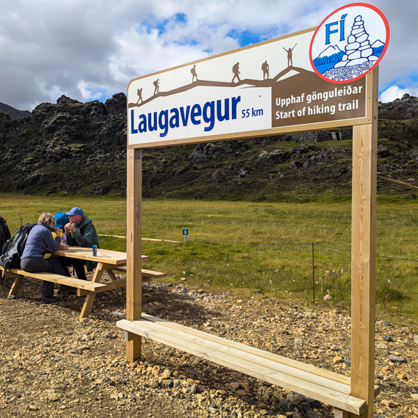
Iceland Highland Trek – Emstrur to Þórsmörk

2024.8.13On the morning of the second day, I was woken by some sound and activities. Glancing out the window, it was already light, and friends were rushing outside. Embarrassing. Days of overcast skies and rain must have made me lazy; I’d overslept.

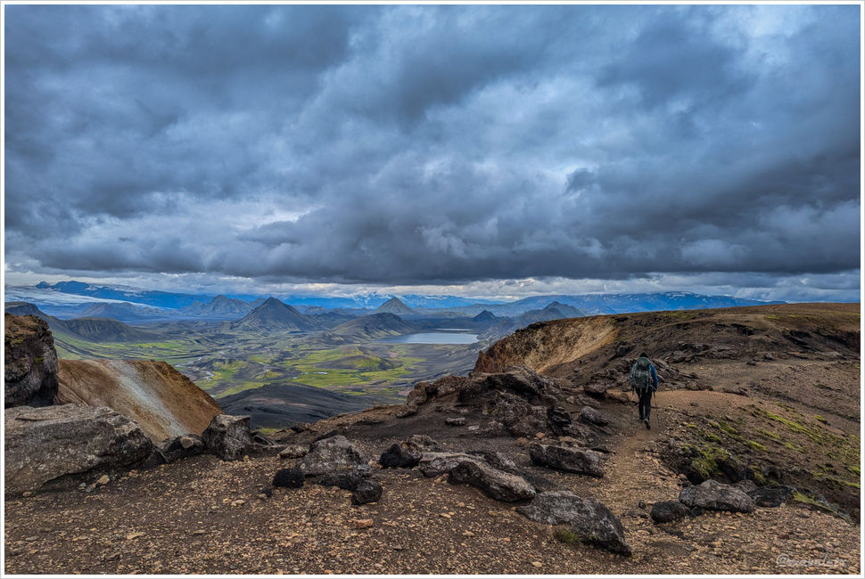
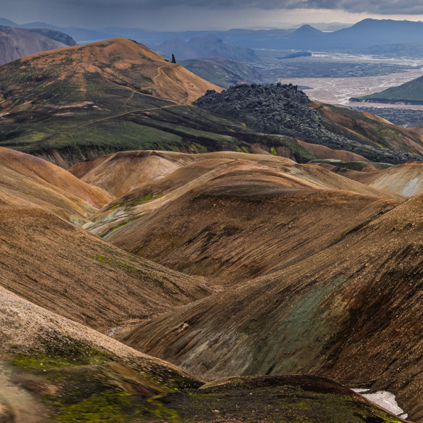
The sun had already risen, casting red light across the cliff face opposite. No time to scramble to higher ground, so I grabbed a few shots right beside the hut. My friends had beaten me out by no more than five minutes. She said the entire mountainside had been glowing just moments before, including the ridge to the left. But the red was already fading, and within minutes the sun ducked back behind the clouds.

Emstrur

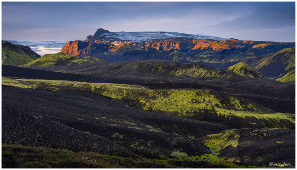
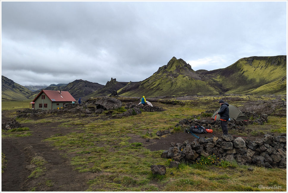
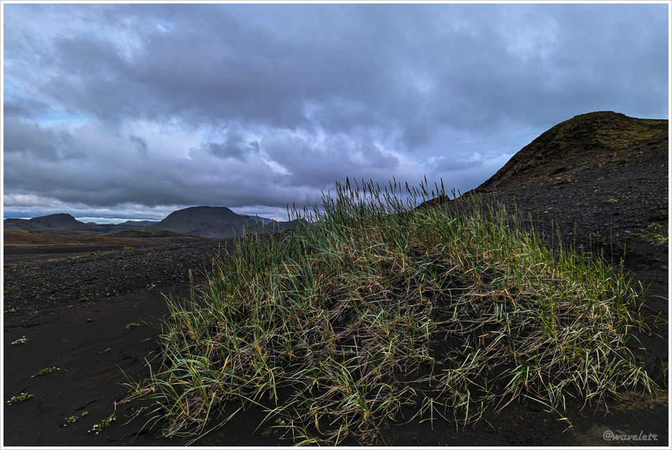
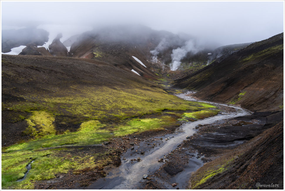
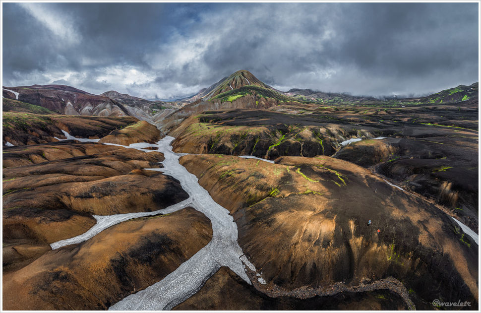
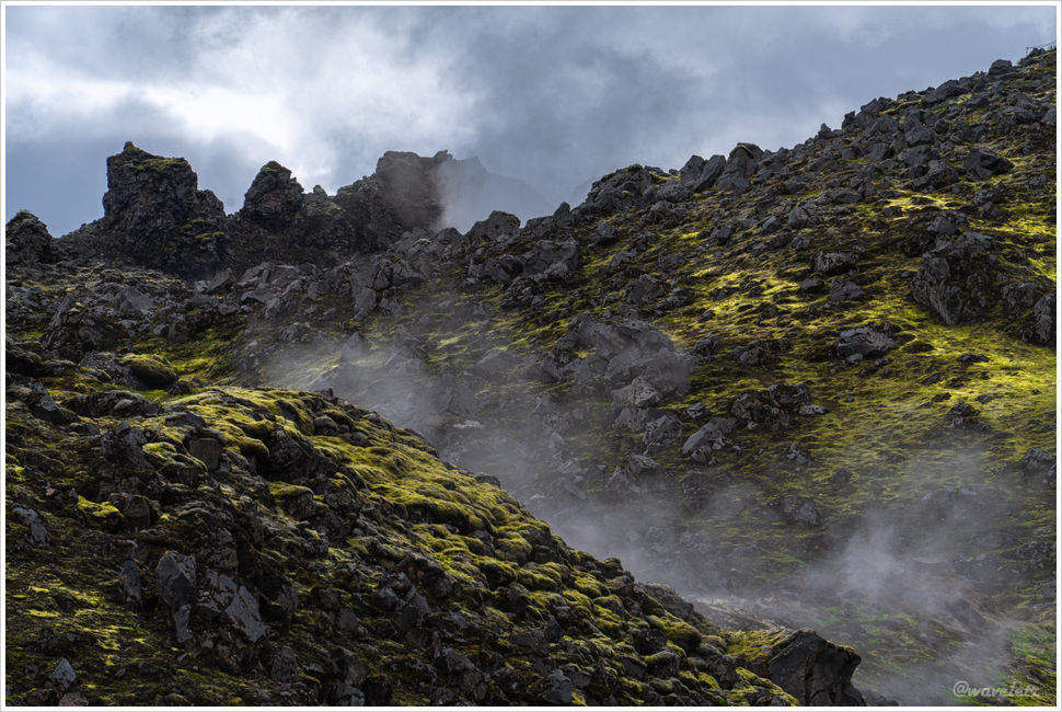
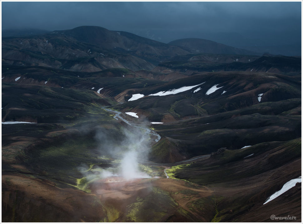
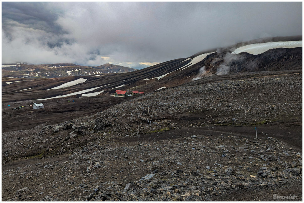
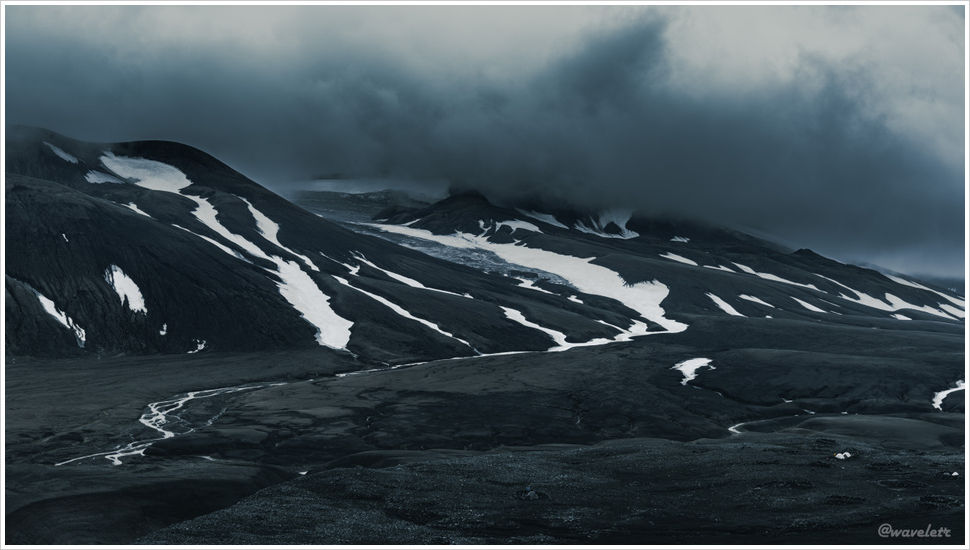
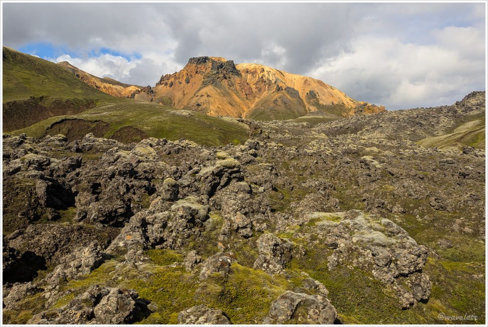
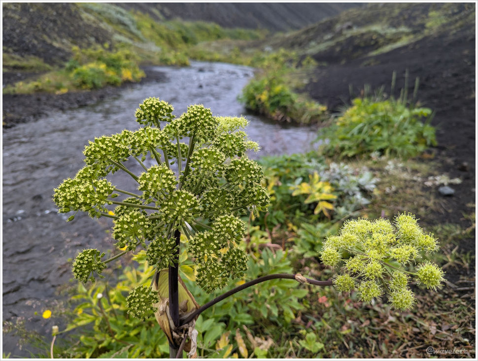
Once the alpenglow vanished, I climbed to the rise behind the hut, where some light still lingered. Patches of lichen stretched in broad strips down to my feet, like scabs slowly forming over scorched earth.

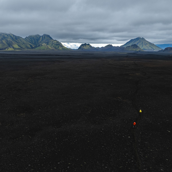
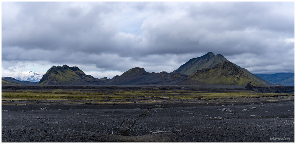
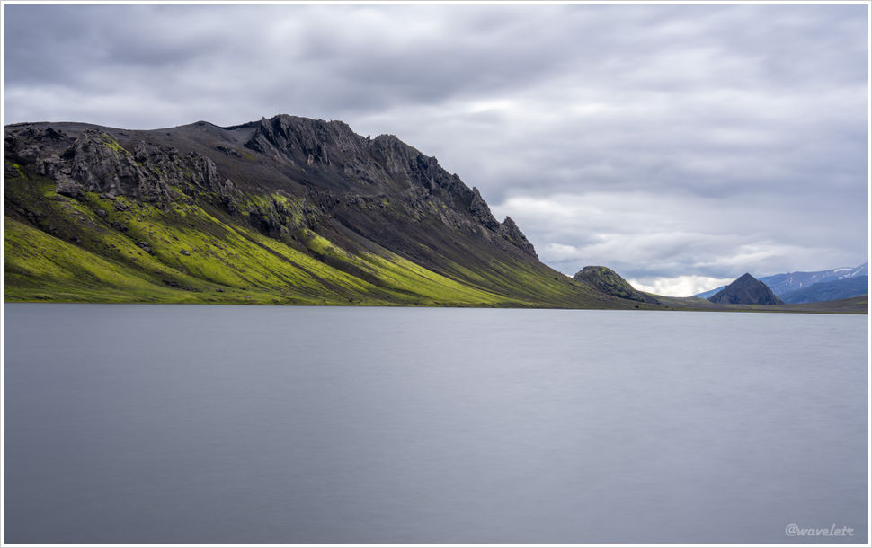
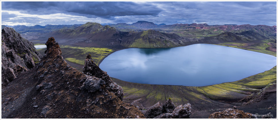
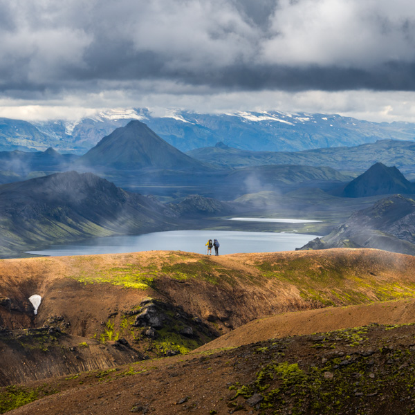
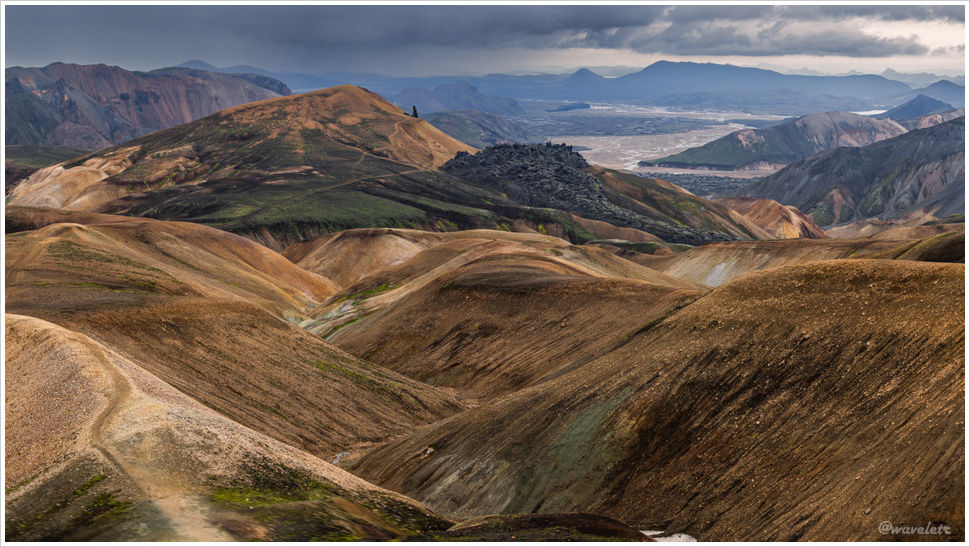
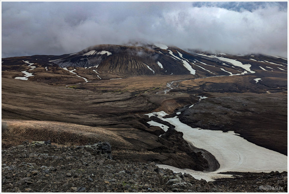
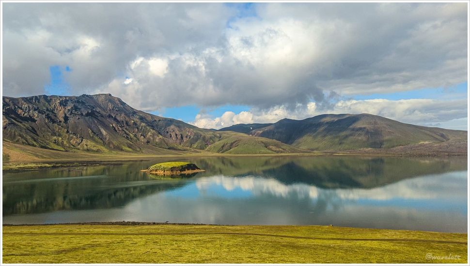
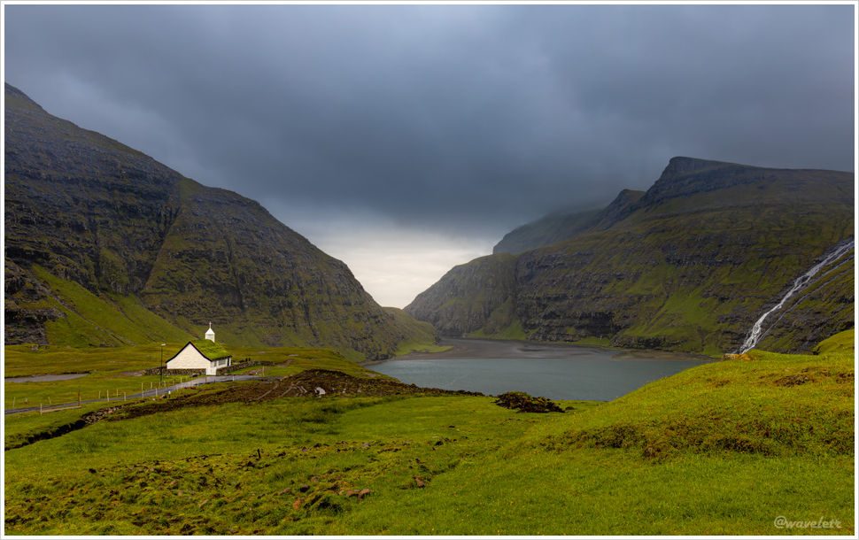
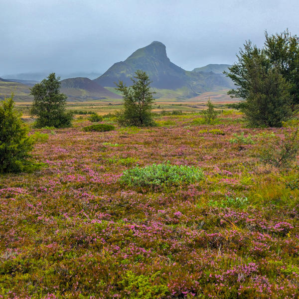
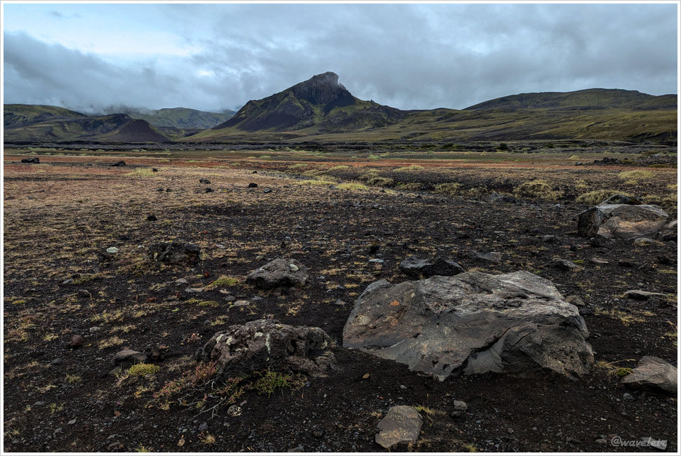
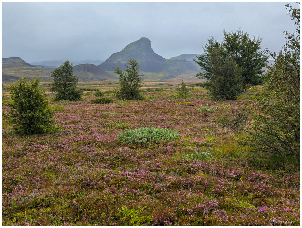
The pointed peak in the frame is likely Ýmir, the highest summit of the Tindfjallajökull glacier. Its elevation is only 1,462 meters. Our camp at Emstrur sits at roughly 465 meters, less than half the altitude of the first night’s hut at Hrafntinnusker (1,130 meters).

Emstrur

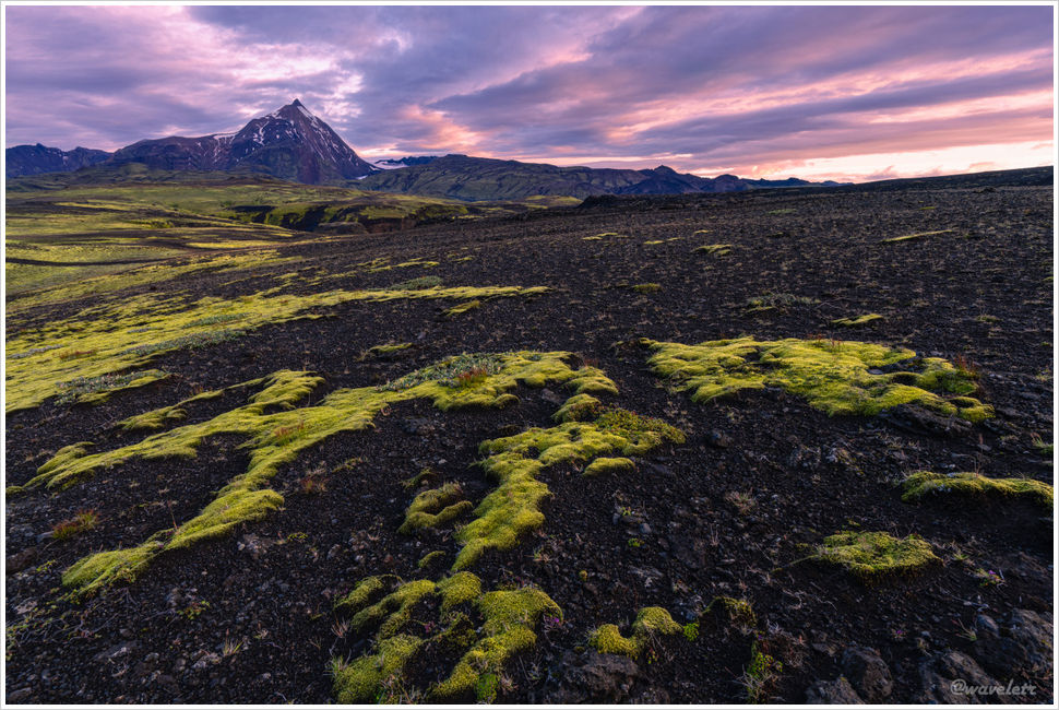
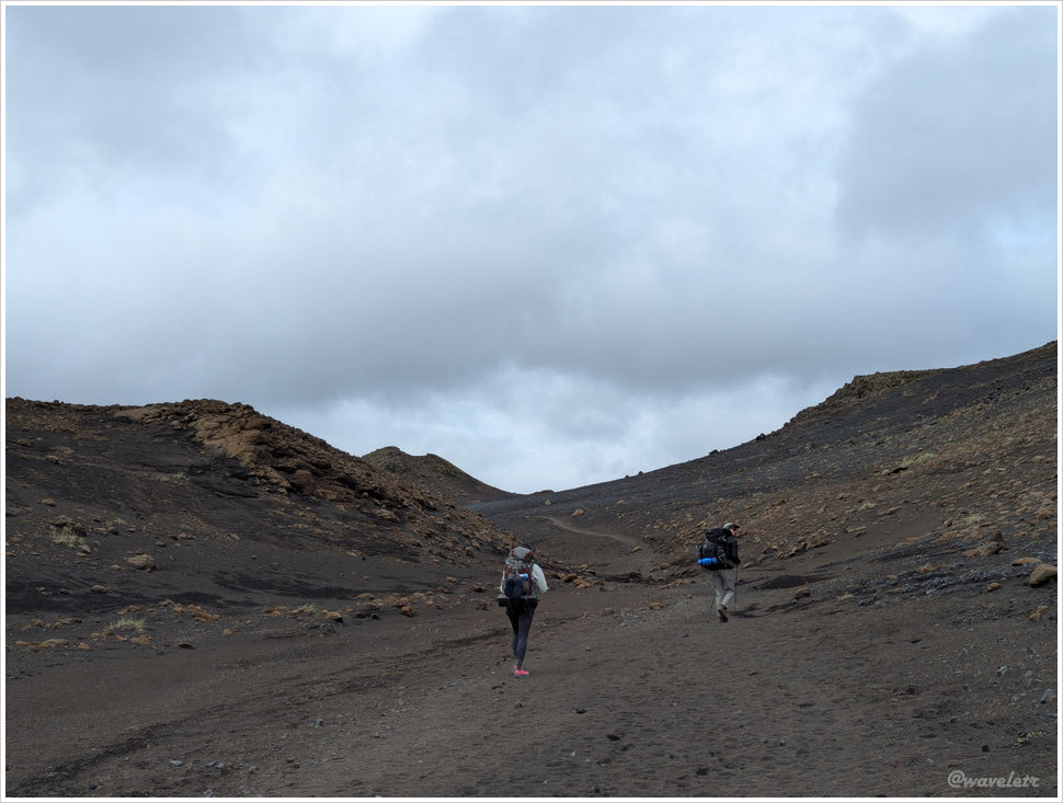
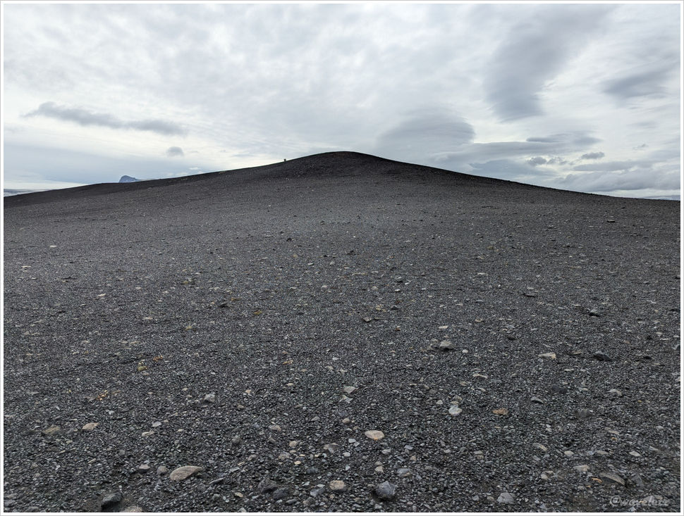
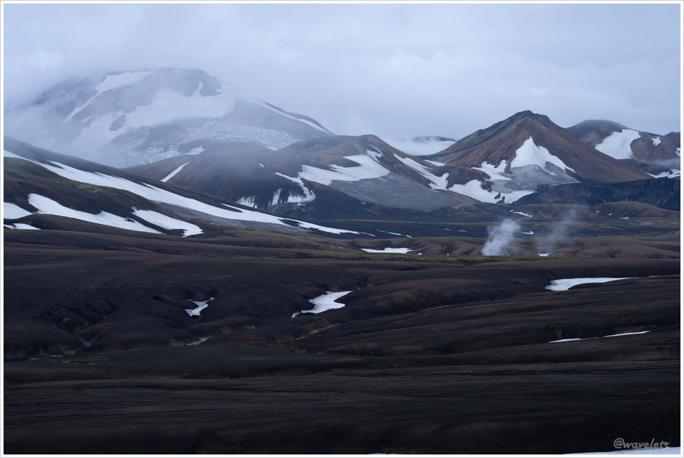
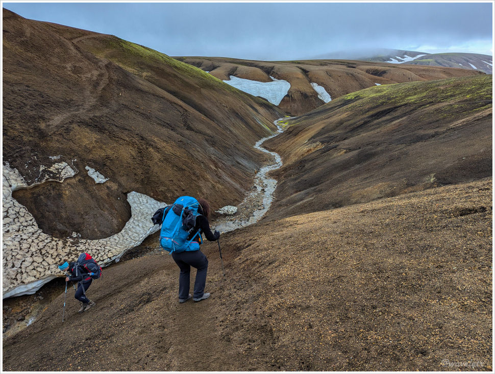
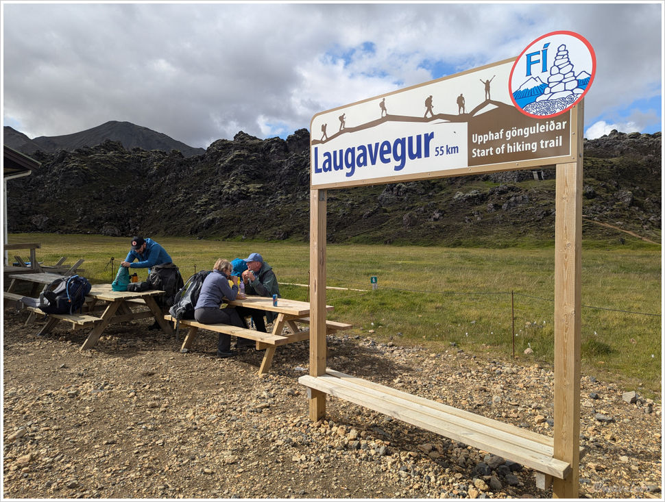
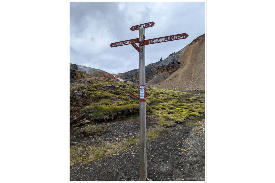
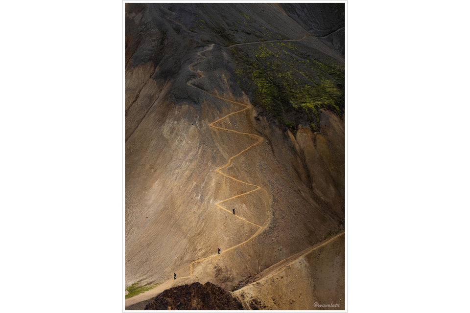
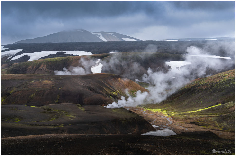
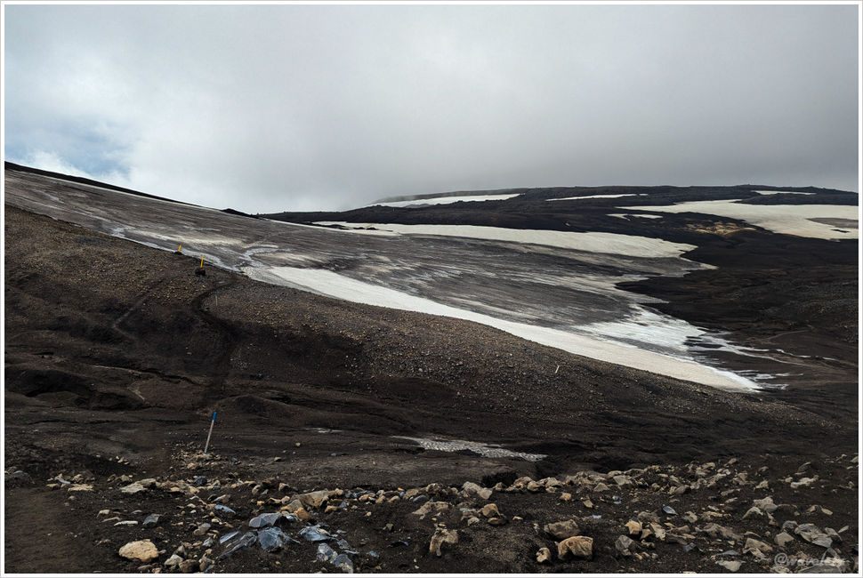
We set off around 7:45. Today’s distance was 15 kilometers. The opening stretch resembled yesterday’s, threading through rolling hills and gullies, black volcanic gravel crunching underfoot.

Laugavegur Trail
Laugavegur Trail

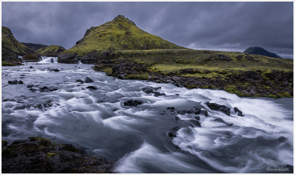
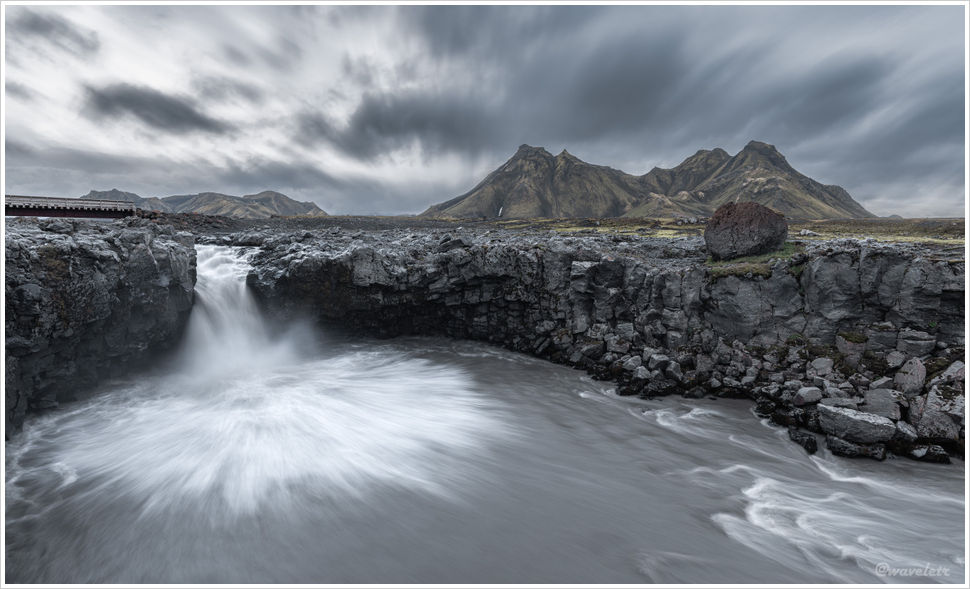
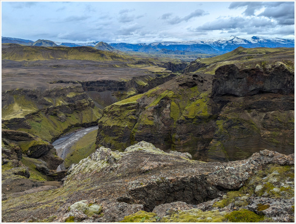
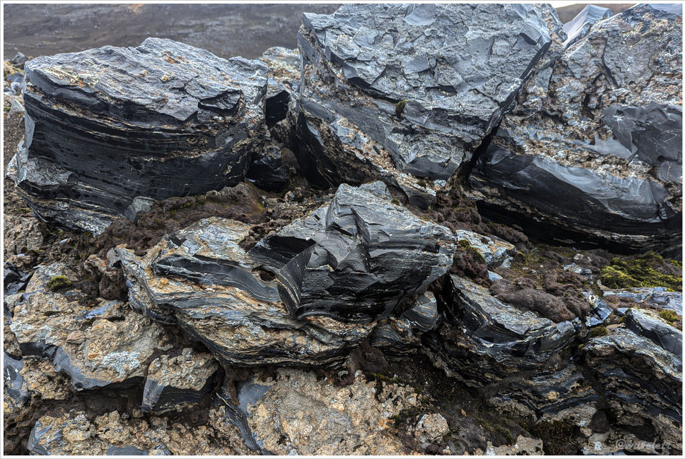
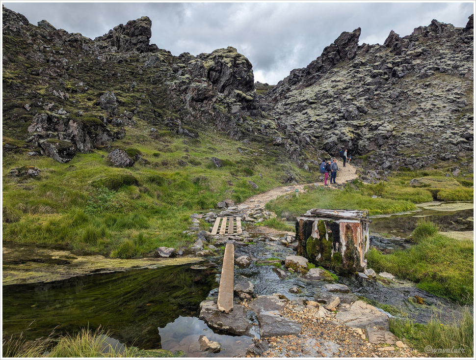
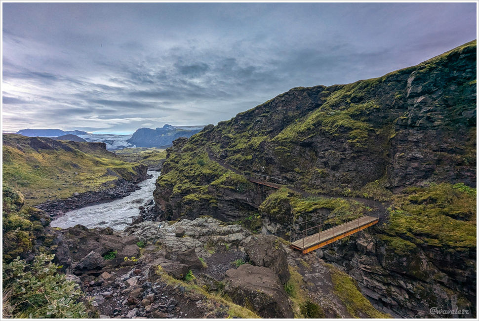
We forded several rivers along the way. The trail descends steadily through this section, and streams have carved into the valleys, twisting and doubling back between walls of dark volcanic rock. The channels are narrow, the current swift, but footbridges carry you across.

Fremri-Emstruá river
Laugavegur Trail

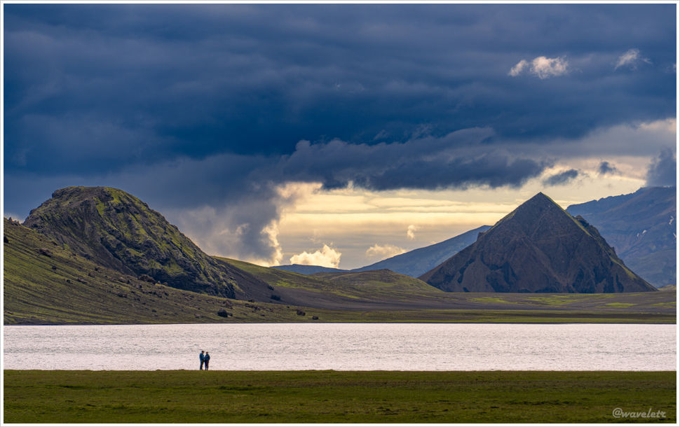
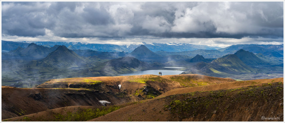
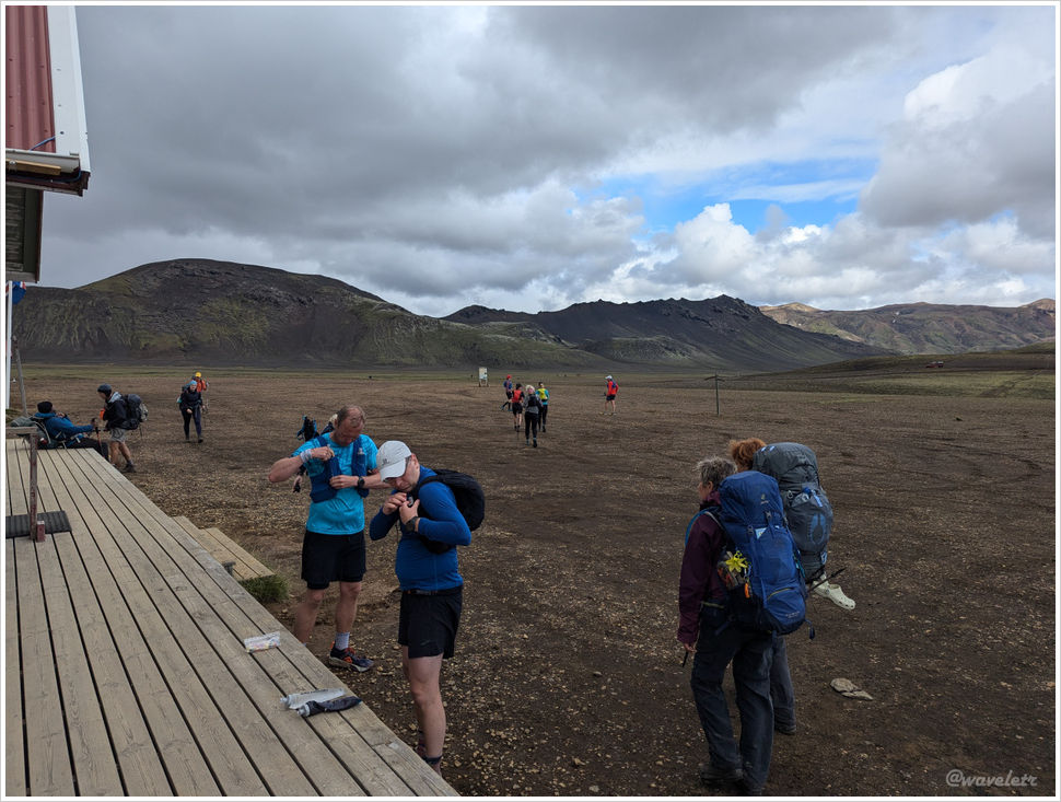
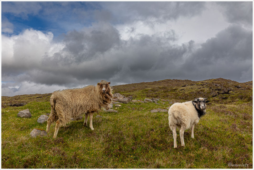
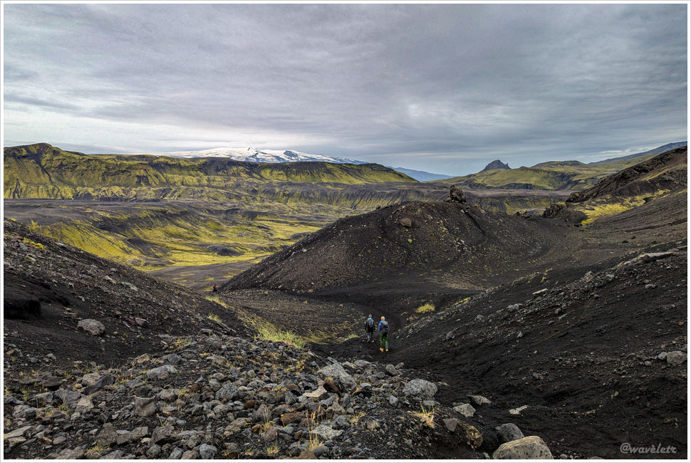
No more than a hundred or so hikers walk this route each day. People thin out quickly, most traveling in twos or threes. Often there is no one visible ahead or behind — just your own shadow. This is exactly what hikers seek: distance from the noise of the world, the walk itself as a form of meditation. You may marvel at the grandeur of mountains and rivers, or feel the smallness of being human, but each breath and each footfall will carry you toward the destination you set out to reach.

Laugavegur Trail
Laugavegur Trail

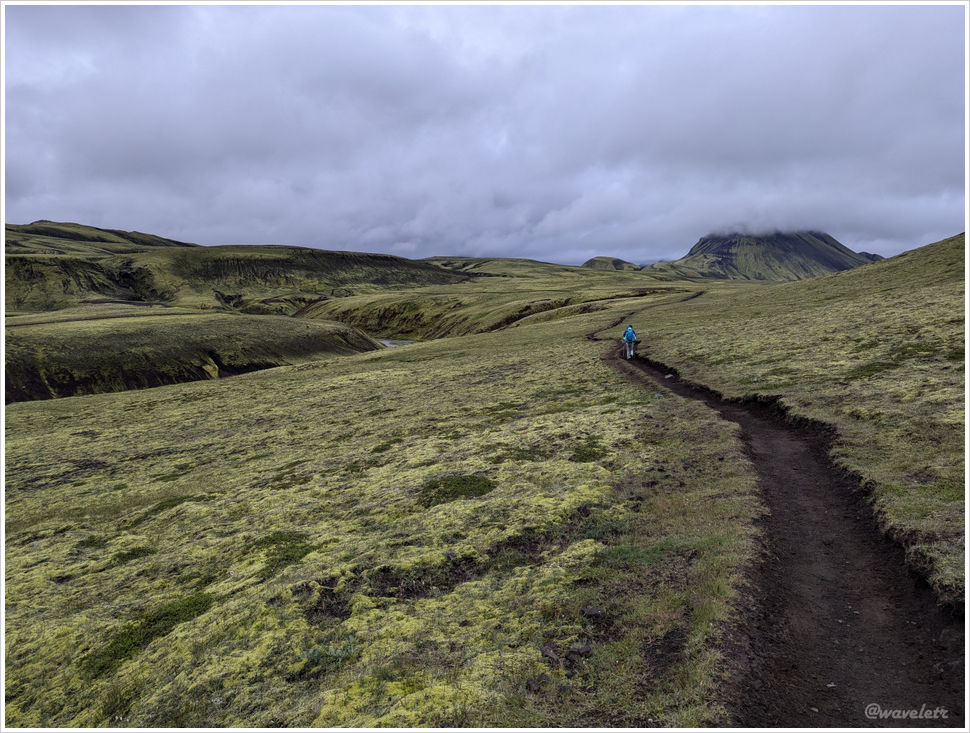
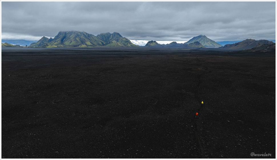
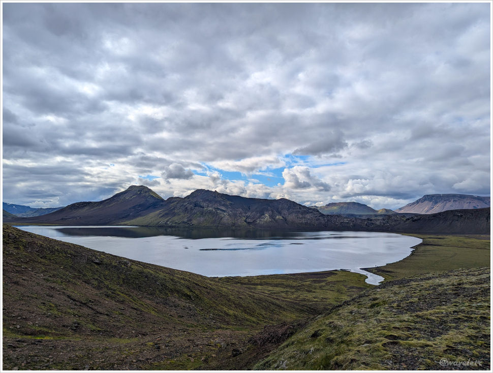
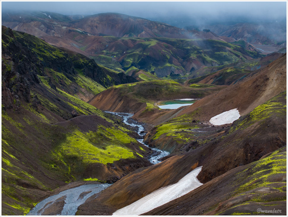
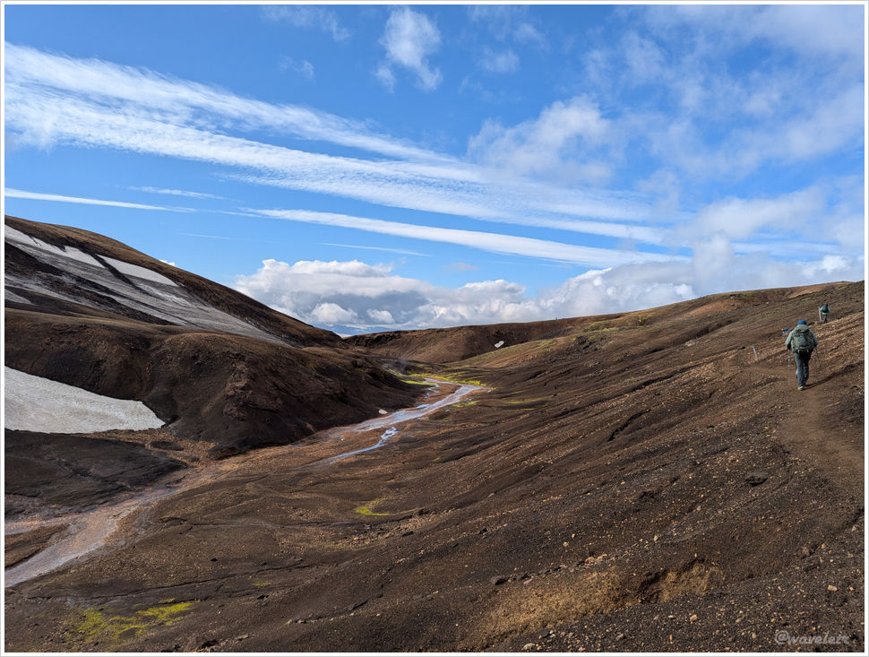
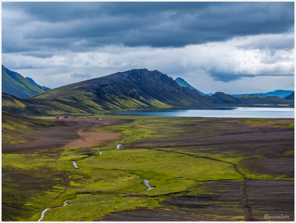
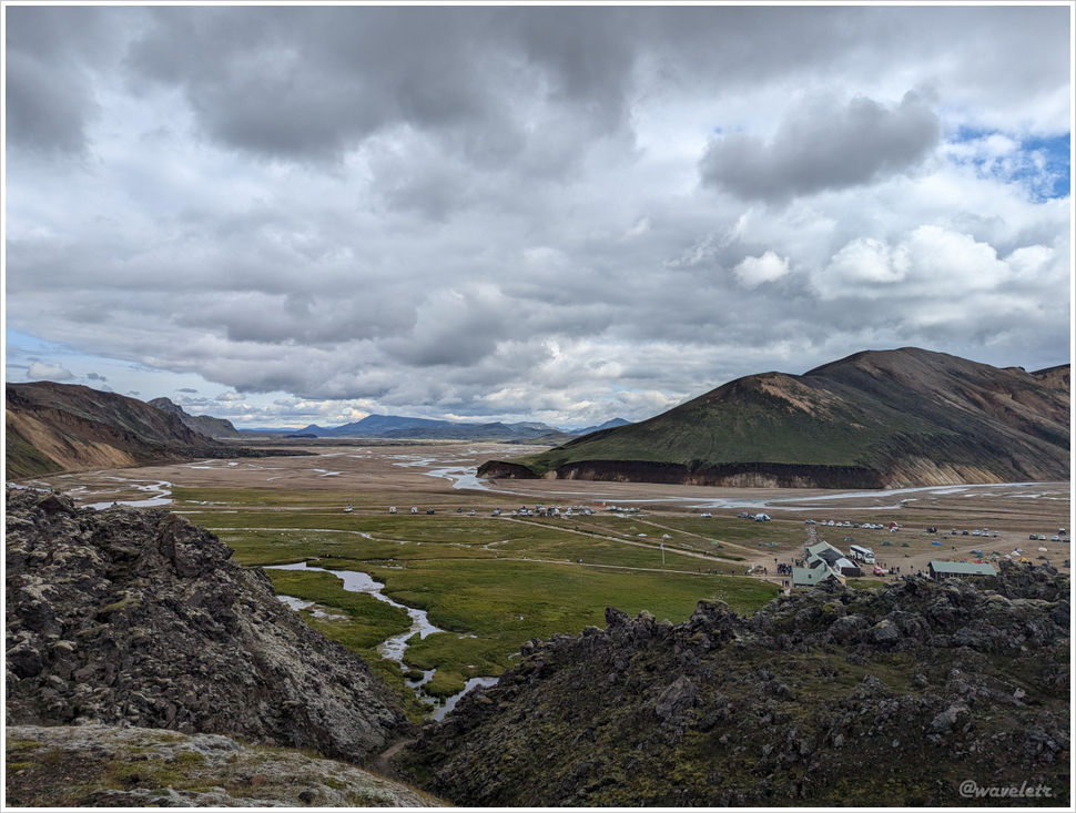
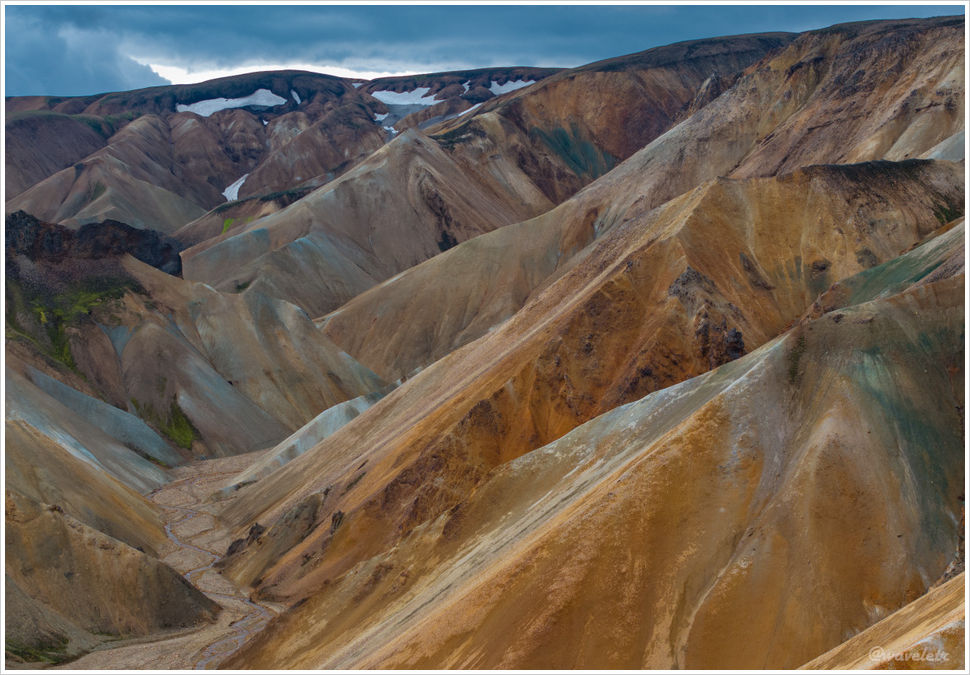
After about three hours, the crumpled, gully-scored terrain gradually gave way to a flat stretch. The trail followed the Markarfljót river, fed by tributary streams and freed from the confines of the mountains, the river had widened considerably.

Laugavegur Trail

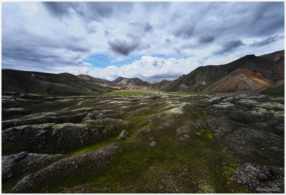
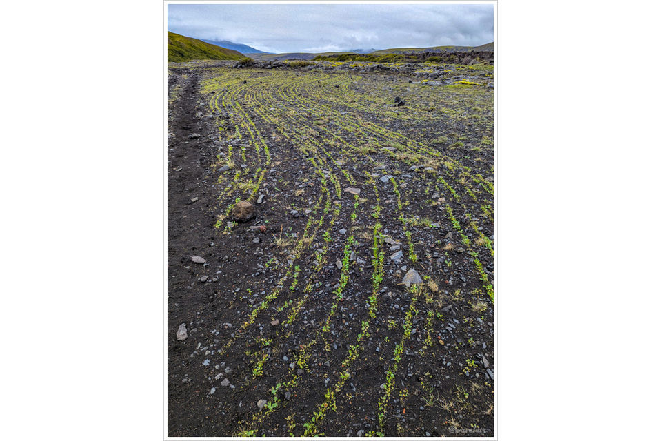
Along the way we passed several broad, level clearings where the ground was covered in low plants forming some patterns, arranged in lines as tidy as parallel rulers — some curving gently, others running arrow-straight like plowed furrows. It was hard not to suspect human planting. Yet in a place this remote, with no settlement in sight and harsh weather year-round, deliberate cultivation seems implausible.

I looked into it after returning home and found conflicting explanations. One theory holds that wind and water flow alone create the pattern, with plants colonizing only the sheltered strips between. Another claims that people did seed them to stabilize the soil, enabling wild grass to take hold so local farmers could graze their sheep. Comparing photos I found online, naturally weathered vegetation patterns tend to be bigger and more irregular — nothing like these fine, single-plant rows. It does appear to be human work, which also suggests we were drawing closer to land that people manage and inhabit.

Laugavegur Trail

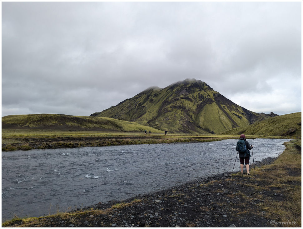
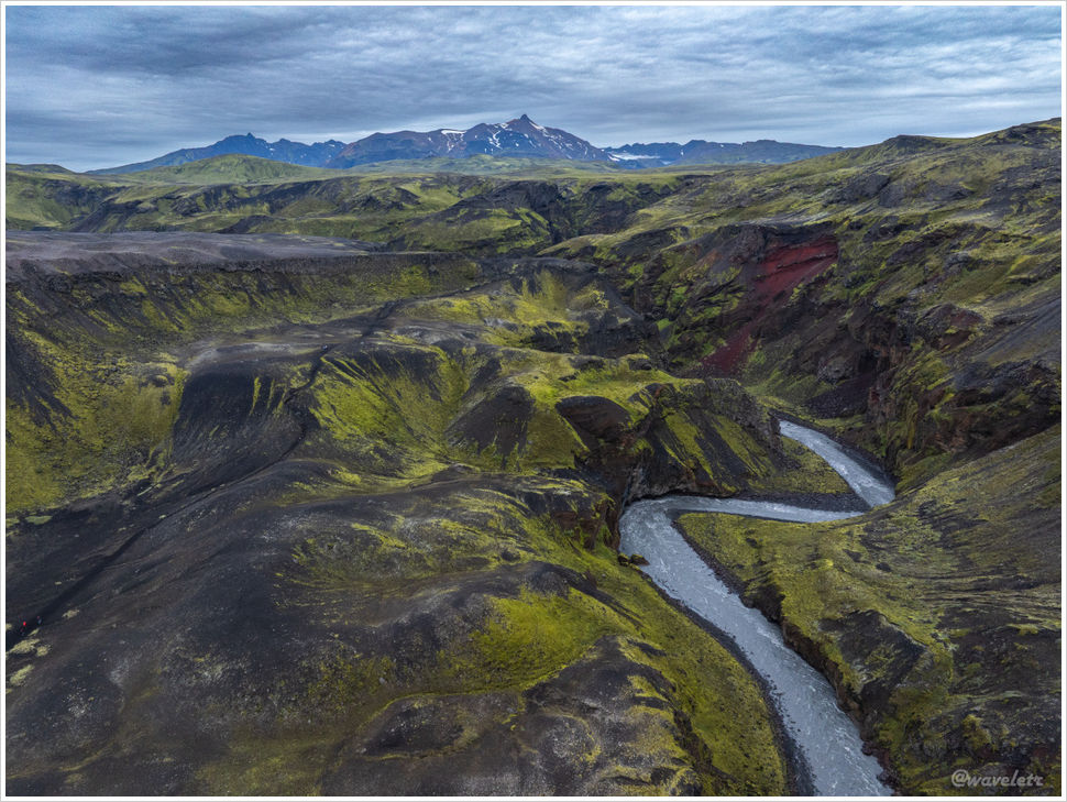
Nearly an hour later, the Ljósá river appeared like a dividing line: on one side, black volcanic rock with only lichen and scrub; on the other, meadows and low shrubs. The Ljósá here is no more than two or three meters wide with a brisk current, crossed by a narrow bridge. Not far downstream it joins the Markarfljót.

Laugavegur Trail
Laugavegur Trail

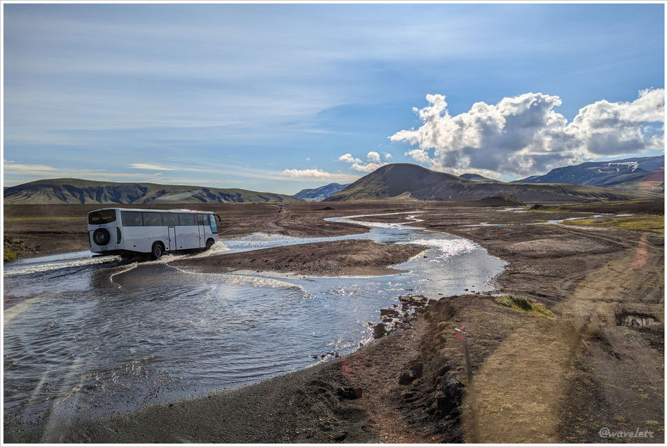
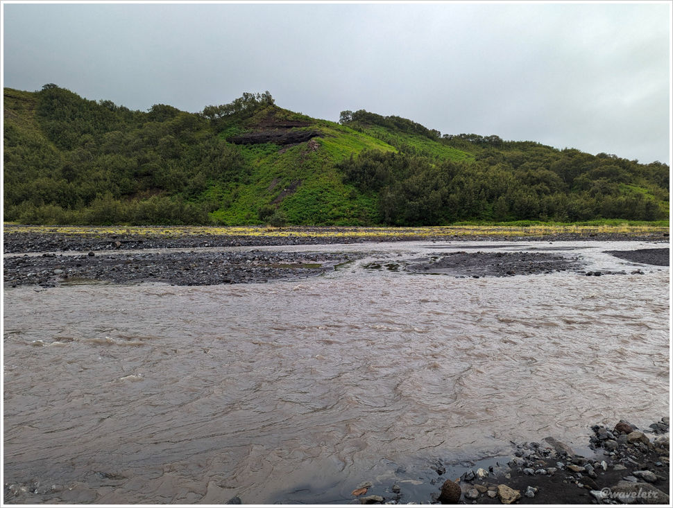
Another hour of walking, over a hill, and a broad river appeared ahead — the Þröngá. Multiple highland streams, their force spent, fan out and converge here before emptying into the Markarfljót. The Þröngá is wider and deeper than the earlier rivers, so picking the right crossing point matters. You can probe the depth with a trekking pole or toss a stone and gauge the splash. I took the easy route and followed a few hikers who were already wading across.

Þröngá river

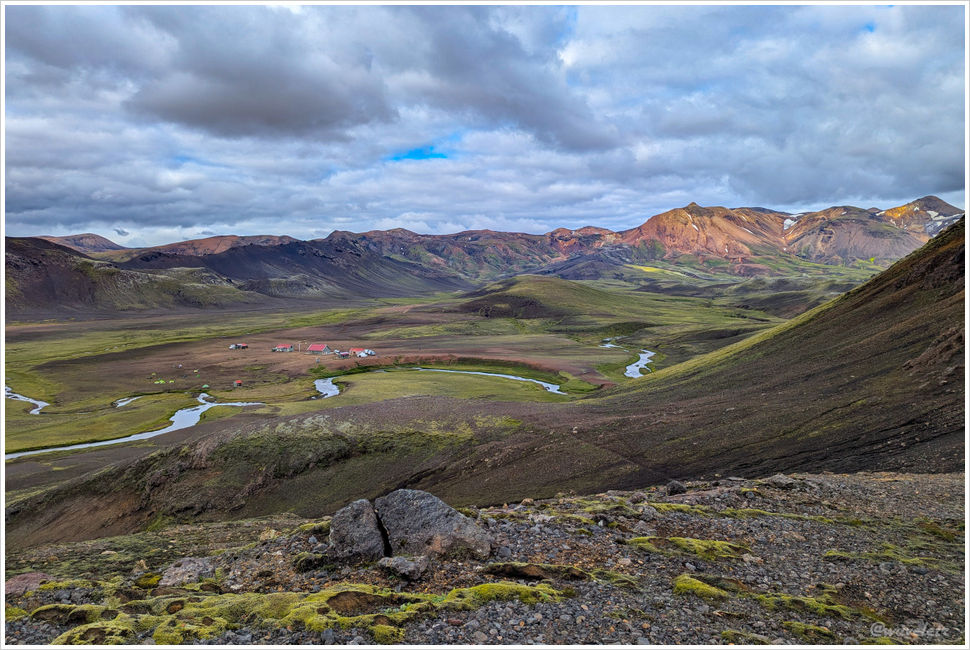
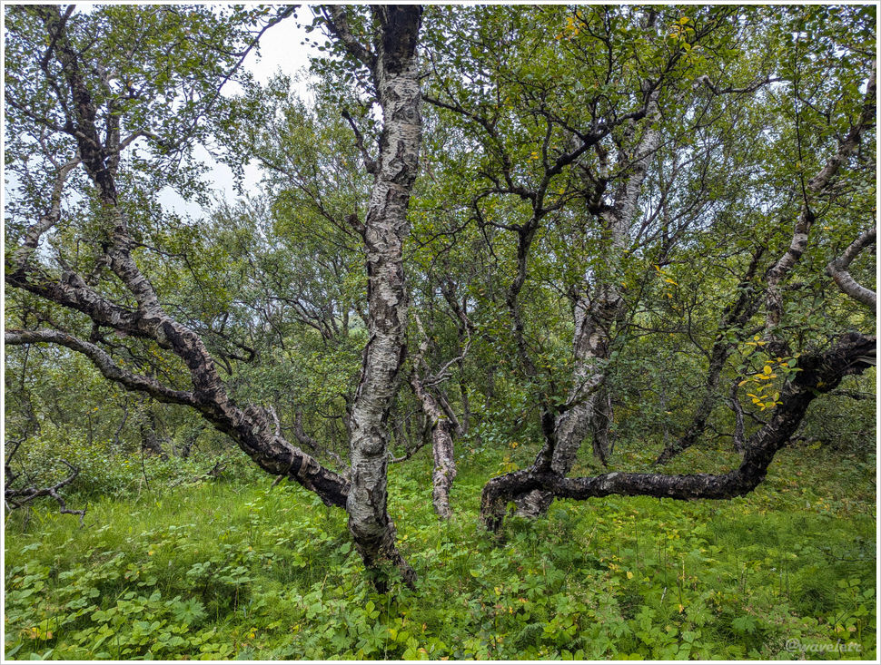
The elevation here is under 300 meters. Beyond the Þröngá, the landscape shifted from meadow and scrub to dense birch forest. By the 1920s, overgrazing and logging had stripped this woodland bare; dust storms were frequent, and every rainfall flushed sediment into swollen, flooding rivers. The area was fenced off to keep sheep out, and the birch gradually reclaimed the land. Trees are a rare sight elsewhere in Iceland, yet here stands a thriving forest. It is a testament both to nature’s resilience and to what happens when people step back and let it recover.

Hamraskógar forest
Laugavegur Trail

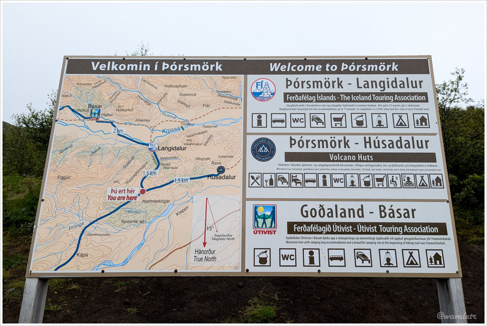
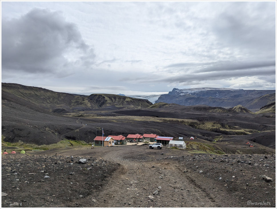
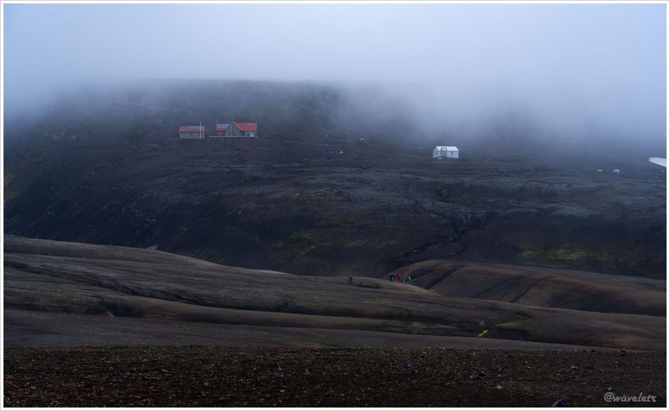
We weren’t heading to the Laugavegur endpoint today but stopping first at the Húsadalur campsite for the night. From the river crossing to the camp was another two or three kilometers, so one more hour of walking before we finally arrived. Today’s 15 kilometers took roughly six hours.

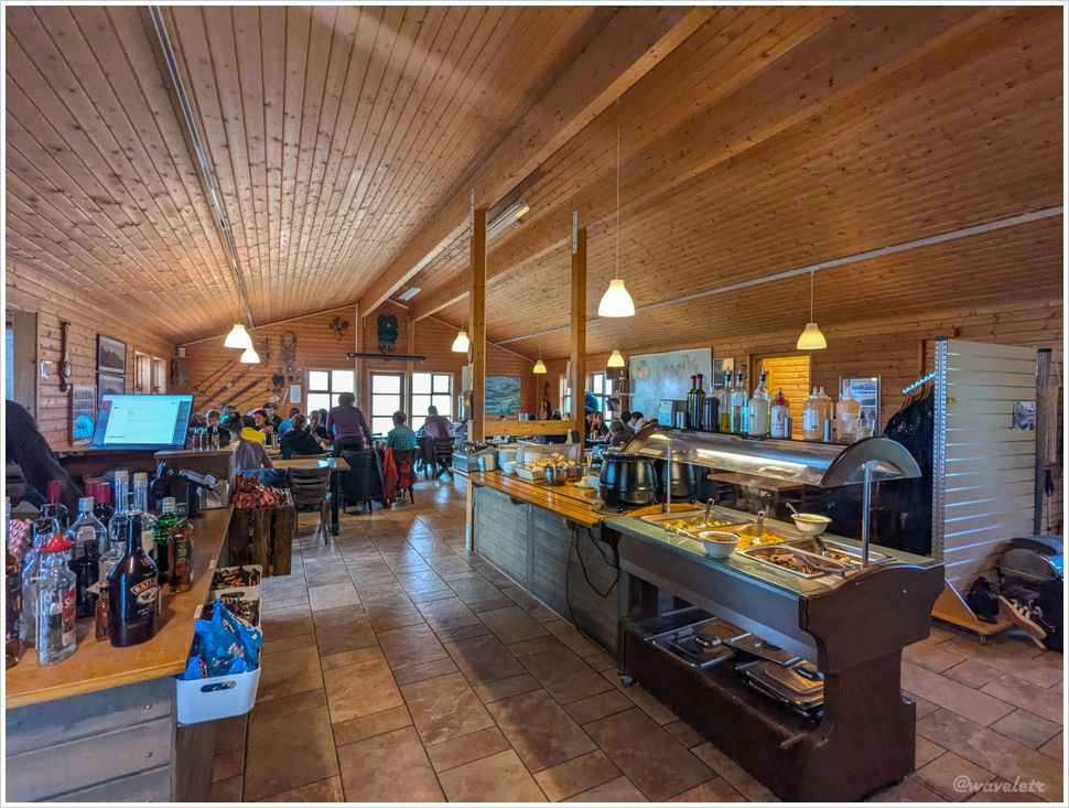
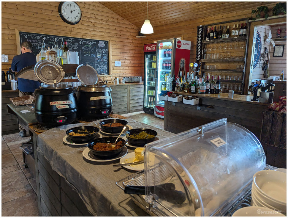
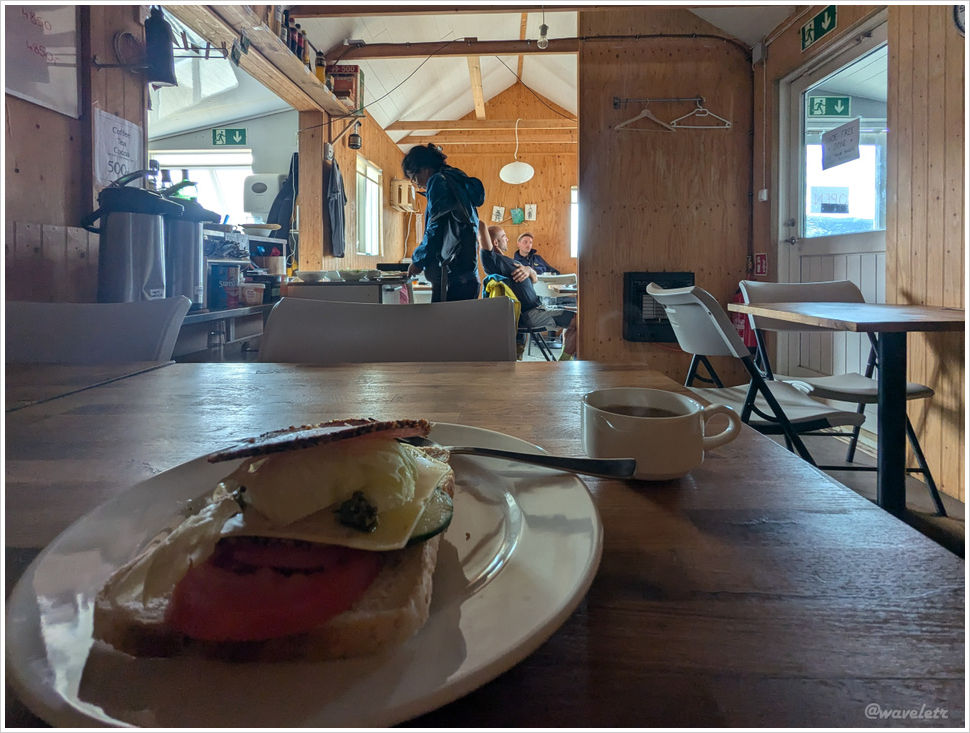
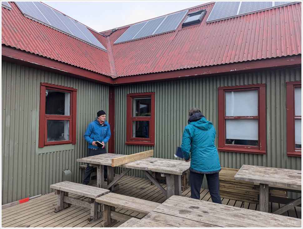
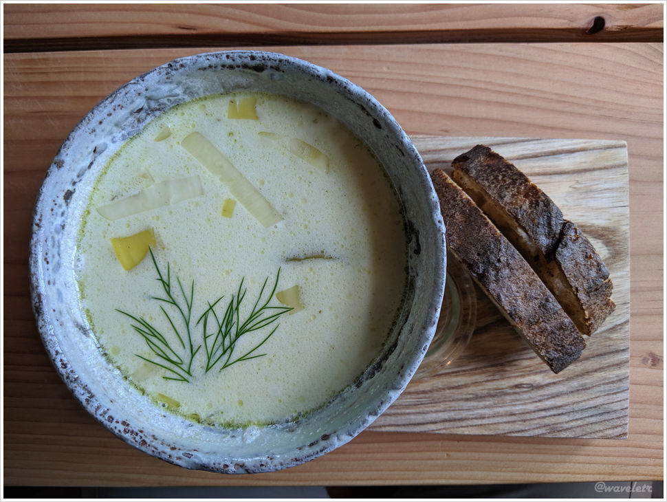
Húsadalur is served by highland buses, and its facilities are far better than the mountain huts. I wasted no time sitting down to a buffet meal. The lamb soup was rich and savory, delicious!

Húsadalur, Þórsmörk
Húsadalur, Þórsmörk
Húsadalur, Þórsmörk
0 Comments

Iceland Highland Trek – Álftavatn to Emstrur

2024.8.12Day three of the Iceland highland trek. The forecast called for afternoon rain, so we decided to set off at six in the morning. Crossing a stream and looking back at the Álftavatn camp, a cluster of tents was visible on the left. Mountain huts along the Laugavegur Trail can be booked through the official website. There are only a handful of huts with limited beds, and they typically sell out by early in the year. But joining the waitlist and checking in from time to time usually turns up cancellations. I didn’t start reaching out until March and still managed to secure beds at every hut. Bringing your own tent, of course, removes that constraint entirely.

Laugavegur Trail

The trail began with a gentle incline. There are four rivers along this route that must be forded on foot. After half an hour of walking, we reached the first. The water was about a foot deep, below the knee. It’s an easy barefoot crossing.

Laugavegur Trail

Past the river and over a low rise, we reached the Hvanngil hut – the one I had spotted from the hilltop the day before. I launched the drone here. A tender green valley sat ringed by dark, volcanic mountains, their jagged peaks evoking Middle-earth from Lord of the Rings. The sky hung overcast, yet shafts of light kept breaking through the clouds to illuminate the slopes, otherworldly and cinematic.

Laugavegur Trail
Laugavegur Trail

Another half hour brought us to the second river. The current ran faster, but the water was shallow.

Laugavegur Trail
Laugavegur Trail

Day three covers the longest distance, 16 kilometers, yet is the easiest. From the Hvanngil hut onward, the route crosses a valley floor: over 10 kilometers of flat, open terrain. We were lucky with the weather. Under a blazing sun, or in rain and snow, this exposed stretch with no shelter and nowhere to stop would be a serious challenge.

From the drone, the landscape below was a vast black desert. Two hikers, one in red and one in yellow, moved slowly across it, a scene with an almost epic quality.

Laugavegur Trail
Laugavegur Trail

The next river had a strong current and heavy flow, spanned by a footbridge. This is roughly the halfway point. Many hikers stop here to rest.

Laugavegur Trail
Laugavegur Trail

About three kilometers from the Emstrur hut, the trail entered low hills again. The ground was still black sand and gravel. There was no green lichen, just scattered tufts of dry grass.

Laugavegur Trail
Laugavegur Trail
Laugavegur Trail

The Emstrur hut is tucked into a hollow, invisible until you’re nearly on top of it. I arrived around noon – six hours for 16 kilometers.

Emstrur
Emstrur

The hut has three sleeping rooms and a separate shower block. Each room fits 20 people on two tiers of platform bunks, five per tier, each slot less than two feet wide. It is the most cramped of all the huts on the trail, though this is fairly standard for traditional European mountain refuges.

A short side trail near the hut leads to the Markarfljót river canyon. At its deepest, the gorge plunges 200 meters, sheer cliffs on both sides, which makes you awed by the river’s carving force. The Markarfljót is a major river in southern Iceland. In the highlands, hemmed in by mountains, it runs narrow. Beyond the trail’s endpoint at Þórsmörk, it fans out wide, which is precisely why private vehicles can barely reach Þórsmörk – crossing this river is too dangerous.

Markarfljótsgljúfur Canyon

After exploring for a while, the rain arrived as promised. We dashed back to the hut. A few bunkmates had brought board games. We joined in, shouting, scheming, sabotaging each other, a noisy, delightful way to spend the rest of the day.

0 Comments

Iceland Highland Trek – Álftavatn

2024.8.11We arrived at Álftavatn at 1:30 pm, leaving plenty of afternoon to spare. I walked down to the lakeshore and took a few photos. The ground near the lake was soggy, and streams kept cutting across the path. I decided to head up to the hilltop on the left.

Álftavatn
Álftavatn

AllTrails lists this hill as Brattháls. It looks steep from below, but the ridge ascent is gentle. Halfway up I turned around — the huts sat small at the foot of the mountain.

Álftavatn
Álftavatn

The lower half of the trail is loose scree; closer to the summit, solid slabs of rock jut out. The gradual slope turns abrupt and craggy at the top, with sheer drops along the edges. I lay flat at the cliff’s edge, the whole of Álftavatn lake spread out below.

Álftavatn

Álftavatn lake runs roughly east to west. Looking westward from the summit, a smaller lake appeared afar — worth a visit given the chance. The mountain in the distance is Stóra-Grænafjall, which translates to “Great Green Mountain.”

Álftavatn

To the south lies tomorrow’s route. The ice cap in the distance is the Mýrdalsjökull glacier, sitting atop an active volcano that last erupted in 1918. The pointed peak in the foreground is Stórasúla — we’ll skirt behind it tomorrow.

Álftavatn

This shot is angled further west, showing the Mýrdalsjökull ice cap more clearly. The hut in the foreground is Hvanngil, we will pass by tomorrow.

Álftavatn

One miscalculation today: I brought only one camera battery. It died shortly after reaching the summit, so I had to fall back on the drone. The telephoto shots from it left something to be desired.

I started back down around half past six and reached the hut in thirty minutes. The views from the top of Brattháls were outstanding — well worth the climb.

Álftavatn
Álftavatn

0 Comments

Iceland Highland Trek – Hrafntinnusker to Álftavatn

2024.8.11After a good night’s sleep at the mountain hut, I woke up before six the next morning — probably still jet lag. I stepped out to take a few photos, though the scene looked much the same as the night before.

Hrafntinnusker

I launched the drone and flew it around to the back side of the ridge. In contrast to the vast, desolate landscape in front of me, a river wound through the valley below, and patches of vivid green could be seen everywhere.

Hrafntinnusker

Near the Hrafntinnusker hut, there’s an ice cave. My friends checked it out and told me that it was quite small, so I gave it a pass. The sun had risen by then, and the dark volcanic hillsides, which had looked nearly black in the dim light, now revealed shades of tawny brown.

Hrafntinnusker

We set off from the hut at 8 a.m., descending steadily. Looking back after a short distance, the hut was still swallowed in mist.

Hrafntinnusker

Scattered across the highland terrain are piles of rock like these. Each piece has a layered structure; the fractures form shell-like curves, the surfaces are smooth, and the broken edges are very sharp. These are the products of rapidly cooled volcanic lava — obsidian.

Laugavegur Trail

There are no particularly towering peaks along this stretch, but from the second day onward the trail never stops rolling up and over one gully after another. Each one is only ten or twenty meters deep, yet they go on without end. The elevation here is already considerably lower than Hrafntinnusker, and with streams flowing through, more and more green began to appear underfoot.

Laugavegur Trail
Laugavegur Trail
Laugavegur Trail

This drone shot captures the deeply gully-carved character of the Icelandic highlands. We hiked in early August, and there was still some snow on the ground; a month earlier, the gullies would have held far more. White, yellow, and green in irregular, layered patches. It’s a landscape uniquely Iceland.

Laugavegur Trail

After nearly three hours of this, we climbed a ridge and the view suddenly opened up. A large lake appeared in the distance — Álftavatn. Every hiker knows the feeling: when you’ve been grinding uphill, gasping for breath, and then a breathtaking vista appears without warning. The saddle above Grey Glacier in Chile’s Torres del Paine. The clifftop at Lagazuoi in the Dolomites. In this moment, I felt it again.

Laugavegur Trail
Laugavegur Trail

There’s a saying: Iceland is green and Greenland is icy — but you can’t truly appreciate it until you’ve stood in the Icelandic highlands. A land of volcanoes, green? And yet, spread before us across the entire valley was green — a bright, tender green.

Most people see something low and lush hugging the ground and assume it’s moss. But what blankets the Icelandic highlands is actually lichen growing on volcanic rock. Lichen is more primitive than moss — a symbiosis of algae and fungi. They are the pioneers of Iceland’s harsh highland environment: when rainfall is plentiful and temperatures are higher, they appear green; in winter they stop growing and turn grey-brown or black. Because of their fungal relationship, lichens are edible, and locals have used them as herb medicine for hundreds of years.

Laugavegur Trail
Laugavegur Trail

We crossed a small stream lined with cottongrass and drew ever closer to Álftavatn. Cottongrass is a common arctic plant — we’d seen a great deal of it in Greenland as well.

Laugavegur Trail
Laugavegur Trail

We arrived at the Álftavatn hut at about 1:30 pm in the afternoon. Just as we pulled in, a group of runners came through. It turned out that day was Iceland’s highland ultramarathon, routed along the very same Laugavegur Trail we were walking — but in the opposite direction. What a brutal yet rewarding challenge.

Álftavatn

The Álftavatn hut sits close to the lake. Because it’s accessible by vehicle, it’s better appointed than the other huts on the route. The main sleeping cabin is quite roomy. To the right is a restaurant serving lunch and dinner — I ordered a sandwich there to take along for the next day’s hike. There were charging outlets inside too, which let me top up the drone’s batteries.

Álftavatn
Álftavatn
0 Comments

Iceland Highland Trek – Landmannalaugar to Hrafntinnusker

2024.8.10Around 11am, we took a group photo at the Landmannalaugar trailhead, marking the start of our 4-day, 55-kilometer trek.

Start post of Laugavegur Trail

After crossing a small stream, we quickly entered a volcanic lava field. As far as the eye could see, the flats and hills were covered in jagged black rocks. Lichen and moss clung to the lower rocks, their vibrant yellow-green hues contrasting sharply against the dark volcanic rock, while geothermal steam rose from the crevices.

Laugavegur Trail
Landmannalaugar

This section of the route is gentle, with the path winding through rolling hills. Signs are posted among the rocks prohibiting drone flight. Once past the lava field, the trail begins a gradual ascent. Due to frequent stops for photography, it took me nearly two hours to cover the first 2.5 kilometers.

Landmannalaugar

Looking back from the mountain ridge, Landmannalaugar remains visible. The area surrounding Landmannalaugar offers numerous trails ranging from hour-long walks to full-day hikes. To the north lie even more highland attractions, certainly worth a return visit.

Landmannalaugar
Landmannalaugar

Continuing forward, the trail enters a steeper climbing section. The slopes here lack lava coverage, exposing the striped formations of the mountains. The rocks near Landmannalaugar are rhyolite. It is a volcanic rock whose name reflects its curved and banded appearance.

Landmannalaugar

Halfway up the climb, my friends catching up asked if I had taken a detour. I recalled seeing a sign earlier but had bypassed it. Hesitating for a moment, I decided I didn’t want to miss out and turned back down the hill.

Standing on the detrou sign, you can see the switchbacks on the opposite mountain, though I didn’t want to go there but walked toward the right. Following the ridge to its end reveals a valley of striking colors. It is a place you shouldn’t miss for anyone on this trail.

Laugavegur Trail
Laugavegur Trail

I launched my drone; under the wide-angle distortion, the valley below resembled a mask, with two lakes serving as eyes. We had traversed the lava field on the right and now had to climb toward the summit.

Laugavegur Trail

Crossing this mountain leads to a landscape of deeply eroded hills. The trail becomes a series of constant ascents and descents, making for a physically demanding stretch. Under an overcast sky with clouds nearly touching our heads, steam rose from streams in the valley, filling the ravines with mist. Gloomy and ethereal, this was the defining impression of the first day in the Icelandic Highlands.

Laugavegur Trail
Laugavegur Trail

Occasionally, we spotted scattered mountain goats. They are skittish creatures, turning and fleeing the moment they sense humans; capturing a clear forward-facing photo was difficult.

Laugavegur Trail

On a flat stretch of the trail stands a small memorial made of volcanic stones. On June 25, 2004, 25-year-old Ido Keinan set out alone into the highlands. Caught in a multi-day storm with poor visibility and insufficient gear, he lost his way just a short distance from the next hut and ultimately died of hypothermia. This stackof stones serves as a somber reminder to all who explore the Highlands: the greatest risks often hide within the most beautiful landscapes. Nature demands constant respect.

Laugavegur Trail

This is the highest section of the trek. A barren landscape defined only by shades of grey, black, and the stark white of lingering snow.

Laugavegur Trail
Laugavegur Trail

The site of Ido Keinan’s passing is less than a kilometer from Hrafntinnusker. After another half hour of hiking, a few small huts appeared behind a mountain notch.

Hrafntinnusker

We arrived at the hut at 5:30pm. While it was freezing outside, the interior was warm. The hut has two levels, housing roughly 30 to 40 people. Our group of eight took up most of the floor space on one side of the second level, which felt relatively spacious.

Hrafntinnusker
Hrafntinnusker

The Laugavegur trail spans 55 kilometers. If completed in four days, the daily distances are roughly 12, 12, 16, and 15 kilometers. Many choose to finish in three days by skipping the overnight stay at Hrafntinnusker and pushing through to Álftavatn. However, I believe these two 12-kilometer stretches contain the most stunning scenery in the highlands and deserve the extra time.

The sky remained overcast, making it impossible to tell if the sun had set. Judging only by the dropping temperature and the fading light, it was time to head inside and sleep.

Hrafntinnusker
0 Comments

Iceland Highland Trek – Start

2024.8.9~10Writing travelogues rarely keeps pace with the speed of travel itself, so there is no need to obsess over chronological order. Since I am writing about Iceland, I will continue with the journal of my trek through the Icelandic Highlands.

Returning to Iceland after more than five years, Keflavík Airport seems largely unchanged, though it lacks the sense of freshness it once had, likely due to the wear and tear of heavy tourism.

Keflavík Airport

I took the airport shuttle into the city and met up with my friends at Bus Hostel Reykjavik. This hostel offers budget-friendly dormitory-style rooms for six to eight people and is conveniently located near the domestic airport and bus terminal. The lobby is bright and clean, with luggage lockers available, though their limited number means they book up quickly. There are no restaurants around; the vending machines in the lobby offer only basic snacks.

After settling in and preparing my pack for the next day, I walked into town for dinner. Over the last five years, Reykjavík hasn’t changed much, though the quality of Asian restaurants seems to have improved significantly. I stopped by a few landmarks on the way.

Sun Voyager, Reykjavík
Skólavörðustígur Street, Reykjavík
Hallgrimskirkja, Reykjavík

Due to jet lag, I woke up early the next morning. I grabbed a coffee and sat in the lobby. As the sun rose, a brilliant dawn filled the windows. The lobby was quiet, and I had this peaceful morning all to myself.

Hallgrimskirkja, Reykjavík

Our group left the hostel around six in the morning and walked to the bus station. The Highland bus departs at 7:00 AM, taking about four hours to reach the trailhead at Landmannalaugar. Compared to the mountain huts on the Highlands, bus tickets are usually plentiful; there is no rush to buy them until your hut reservations are confirmed.

Bus to Landmannalaugar, Reykjavík

Heading east out of the city along the Ring Road, we reached Hella in about two hours for a quick break. The bakery near the parking lot offered an impressive selection; I bought two sandwiches. It’s my food for the next two days.

Hellisheiðarvirkjun
Deli in Hella

The bus turned around at Hella and soon drove onto Route 26, truly beginning our venture into the Highlands. Route 26 is paved, but half an hour later, we transitioned onto F225, which turned into a dirt and gravel road. These “F-Roads” are the primary pathway in the Highland, mostly unpaved, open only during the summer months, and requiring a 4×4 vehicle for safe passage.

F225
F225
F225

We crossed several streams along the way. Crossing rivers is the main obstacle to driving in the Highlands; it requires not only high ground clearance and elevated exhaust intakes but also experienced eyes for the right crossing point. The streams on F225 are manageable for larger SUVs, with the only tricky part being a river near the end of the route. Many travelers choose not to cross it, instead parking their vehicles and walking to the camp site.

After two hours of jolting along, the Highland bus arrived at Landmannalaugar at 11:00 AM. From here, we begin our four-day, 55-kilometer journey across the Icelandic Highlands.

Landmannalaugar
0 Comments

Iceland – Reykjavík

2019.7.8~9During this trip, we passed through Iceland three times. The first time was upon arrival, transiting through Iceland, from Keflavík Airport to Reykjavík Airport, with only a few hours’ stopover in Iceland.

Keflavík Airport, Iceland

On our way from Greenland to the Faroe Islands, we stayed one night in Iceland. The flight to the Faroes departed from Keflavík Airport, so we chose a small hotel very close to the airport for convenience.

Compared to Reykjavík, Keflavík feels much quieter with far fewer people. In the evening, we had dinner at a seafood restaurant called Kaffi Duus, then walked back to our hotel along the coast. Not a single person was in sight, just a serene blue hours surrounding us.

Keflavík
Keflavík

After returning from the Faroe Islands, we planned to spend a day in Reykjavík to explore the city. Our flight landed just before noon. When we arrived at our hotel, we were told we had been moved to another hotel within the same chain. The new place was closer to the city center, making it much more convenient to step out and explore the streets.

Keflavík Airport

We had lunch at a food hall near our hotel. Unlike the typical mall food courts, this type of food hall is an open space where many individual restaurants gather under one roof. It is quite common in Europe.

Hlemmur Mathöll

Reykjavík’s city center is quite compact, featuring a main street running parallel to the coast that stretches all the way to the newly built convention center on the other side. Nearby are a few streets around the cathedral. Compared to other major European cities, Reykjavík’s downtown feels less trendy. Its look is a bit older and more modest.

Reykjavík
Reykjavík
Reykjavík
Prime Minister’s Office, Reykjavík

The Nordic countries definitely serve as a testing ground for modern architecture. It is clearly visible throughout the city.

Reykjavík
Reykjavík

Several landmarks in the city center are also worth a visit. All within walking distance and easily covered in under an hour.

Harpa Concert Hall and Conference Centre, Reykjavík
Sun Voyager, Reykjavík
Hallgrimskirkja, Reykjavík

We departed in the afternoon the next day, leaving us with half a day in the morning. I visited the National Museum of Iceland, located not far from the city center. The museum primarily exhibits artifacts and photographs documenting Iceland’s history from the earliest settlements in the 9th century to its independence in 1944 and into modern times.

National Museum of Iceland, Reykjavík
Tjörnin, Reykjavík

This trip marked our first time venturing into the Arctic and crossing the Arctic Circle. We wandered among towering icebergs and walked along cliffs above floating lakes. Along the way, we were accompanied by stunning landscapes and delicious food, while also gaining deeper insights into the geography, culture, and current affairs of Greenland and the Faroe Islands. Perhaps this is the true meaning of travel.

0 Comments

Faroe Islands – Puffins

2019.7.7This was our last day in the Faroe Islands. The plan was to take a ferry to Mykines Island. When we first made our itinerary, I hadn’t paid much attention to the ferry schedule. Only when booking the tickets did I realize that this was the only day with any availability left. Had we waited any longer, we might not have been able to go at all.

The ferry departs from the town of Sørvágur on Vágar Island, which is very close to the airport. We had stopped there for some shopping on our first day in the Faroes.

Ferry Port, Sørvágur, Vágar

As soon as we exited the fjord, we saw the arch-shaped Drangarnir islet and the triangular peak of Tindhólmur. Just days earlier, we had only seen them from afar across the fjord, but now, from the boat, we were up close – the ferry passed right between the two islands. After several days of cloudy skies, we were finally treated to a beautiful day of blue skies and scattered white clouds.

Drangarnir & Tindhólmur

Mykines is the westernmost island of the Faroe Islands, and it takes about 50 minutes to reach it by ferry. The island is roughly triangular in shape, with its westernmost tip extending into a small islet about one kilometer long. Though technically separated from the main island, it’s connected by a narrow footbridge. Mykines is home to large colonies of seabirds, most famously puffins. Most visitors come specifically to cross the bridge to the western islet to see the birds. Unless staying overnight, there’s usually not enough time to explore the vast eastern side of the island.

Mykines

Climbing up a small hill, we soon came across a modest memorial built along the ridge. It was erected in 1930 to honor the islanders who lost their lives at sea. As is common on the islands, there were plenty of free-roaming goats nearby. One of them kept repeatedly butting its head into the ground, perhaps a territorial behavior.

Memorial Monument, Mykines

In the distance, we could already see the lighthouse at the far western tip of the islet. A group of hikers making their way along the trail toward it.

Hólmur Lighthouse, Mykines

We began spotting puffins here and there. They have a stout build and are actually smaller than I had imagined. Their large, brightly colored beaks, disproportionate to their bodies, give them a slightly comical appearance, which is probably why they’re so beloved. The puffins here are Atlantic Puffins, found along the coasts and islands of Northern Europe and northeastern Canada. They belong to a different subspecies than those found in Alaska.

Puffins, Mykines

To cross the bridge, we had to descend from the ridge to the lower slopes. This is an area filled with puffin nests. Puffins are social birds that prefer to nest in colonies, building their burrows in the grassy cliffs near the sea. They fly out over the ocean to catch small fish and crustaceans. Before taking off, puffins are extremely cautious, often standing at the mouth of their burrows for a long time, scanning the surroundings. At the slightest disturbance, they retreat back inside.

On the hillside, the puffins tend to leave for feeding around the same time. Just as we were about to head down, a ranger stopped us on the trail, explaining that we needed to wait about 20 minutes to allow the local puffin colony to safely head out to sea.

Puffins, Mykines
Puffins, Mykines

This is the bridge that connects Mykines to the narrow islet at its western tip. The surrounding cliffs are home to large numbers of kittiwakes, a type of small gull that resembles pigeons at first glance. Many of them perch in pairs. Unlike puffins, which nest in burrows on grassy slopes, kittiwakes build their nests directly on the steep cliff faces, often on ledges barely wide enough to hold two birds.

Mykines
Kittiwake, Mykines

After crossing the footbridge, we began climbing up the ridge again. Here, we started to see many Northern Gannets, which nest along the north-facing cliffs. Different bird species seem to occupy their own distinct territories, coexisting without much interference. Adult Northern Gannets have an impressive wingspan, up to 1.8 meters, and they rely mostly on gliding for flight. They are the largest seabirds in the North Atlantic.

Despite their large size, the nesting space on the cliffs is surprisingly limited, and many gannets crowd together in tight colonies. Taking off is relatively easy. They simply leap off the edge and glide into the air. Landing, however, is a different story. Gannets often come in at near full speed, flapping their wings furiously to slow down while thrusting both legs forward, aiming for a tiny patch of grass beside their nest. It’s not uncommon to see them misjudge the landing and end up face-planting into the dirt, an awkward, if slightly comical, scene.

Northern gannet, Mykines

Northern Gannets form monogamous pairs and remain faithful for life unless one partner dies. Each year, the pair raises their chicks together, which is why you can often capture many intimate photos of male and female birds close and caring for one another.

Northern gannet, Mykines

Looking back from here, you can see the entire western side of Mykines. To the north, steep, layered cliffs rise almost vertically. This is where most of the Northern Gannets nest. The southern side is comparatively gentler in slope, and it’s primarily on this side that the puffins are active.

Mykines
Mykines

I didn’t continue all the way to the lighthouse and instead turned back here. Passing through the puffin colony, We saw more of these charming birds. Puffins with their beaks full of small fish are an iconic sight, but sometimes they carry a blade of grass or a wildflower, almost as if bringing a gift to their beloved.

Puffins, Mykines
Puffins, Mykines

When we returned to the harbor, there was still over an hour before the ferry return. The town is small, only about twenty or so buildings, mostly likely catering to the few overnight visitors. According to 2018 statistics, the island had just 10 residents. Near the harbor, there’s a café where waiting passengers gather to rest. Although the ferry was 40 minutes late, everything went smoothly, and we had a safe trip back.

Mykines
Ferry Port, Mykines

When we planned our trip, we didn’t really know the road conditions in the Faroe Islands. Worried that getting to the airport from Tórshavn the next day might be too far, we booked a night’s stay in Miðvágur. However, upon arrival, the accommodations there were nowhere near as comfortable as the apartment we had in Tórshavn. Since we still had that apartment reserved for another night, we decided to return to Tórshavn. Fortunately, we were able to retrieve the keys from the owner’s locker and spent our final night there.

Miðvágs kirkja, Miðvágur, Vágar

In the evening, we had dinner at Áarstova, a traditional restaurant in the city center. Afterwards, we took a stroll along the harbor before ending the night with a relaxed drink at a pub called Mikkeller. From our experience, in such a remote place, it’s best to stick to European-style restaurants. Trying Asian cuisine often leads to disappointment. Of course, that was our experience back in 2019; with more tourists now, things may have improved since then.

Áarstova, Tórshavn, Streymoy
Tórshavn, Streymoy
Mikkeller, Tórshavn, Streymoy

The next day, we flew out of the Faroe Islands, heading back to Iceland. Shortly after takeoff, to our surprise, we spotted the Múlafossur waterfall plunging into the sea from the plane window, a perfect farewell to our brief journey at the edge of the world.

Vágar Airport
Múlafossur Waterfall
0 Comments

Faroe Islands – Floating Lake

2019.7.6Today, we were headed to another famous landmark of the Faroe Islands: Trælanípa. The weather here is always shifting between sun and clouds. In the morning sunlight, the bay was a soothing blend of vibrant greens and soft yellow tones, a true feast for the eyes.

Faroe Island

Trælanípa is located on the island of Vágar. To get there from Tórshavn, you have to pass through the Vágar Tunnel. When we visited the Faroe Islands in 2019, the 11-kilometer-long Eysturoy Tunnel had not yet opened. The longest subsea tunnel connecting the islands was the Norðoyatunnilin, which we had driven through a couple of days earlier. The Vágar Tunnel is the second longest, stretching nearly 5 kilometers. Compared to the narrow, single-lane mountain tunnels, these undersea tunnels feel like grand highway, with wide lanes and even colorful light displays on the ceilings.

We first stopped in the town of Sandavágur. The most striking building there is a red-roofed church built during World War I. Unfortunately, it was closed when we visited.

Sandavágur, Vágar

The walk to the end of Trælanípa is about 3 kilometers long, starting from one side of the town of Miðvágur. A small maintenance fee is required to access the trail. As this is a uniquely popular site, the growing number of visitors has prompted local residents to take measures to protect the surrounding environment. I later heard that they were discussing plans to periodically close the area to limit foot traffic – an effort to balance tourism with environmental preservation.

From the trailhead, you can see another striking landmark along Vágar’s coast: Trøllkonufingur, which translates to Troll’s Wife’s Finger. In Nordic folklore, a troll is a creature that dwells in remote places, far from human settlements. This sharp stone spire rises dramatically from the coastline and is hard to miss. As I stood there taking photos from a distance, a few goats wandered over, circling me curiously.

Trøllkonufingur, Vágar
Miðvágurt to Bøsdalafossur Trail Head, Vágar

Walking along the hillside trail, I could already see the jagged cliffs near Trælanípa in the distance, with tiny silhouettes of visitors scattered across the top. The weather was overcast, and the sparse human presence added to the feeling of being at the edge of the world, remote, quiet, and hauntingly vast.

Trælanípa, Vágar
Lake Sørvágsvatn, Vágar

Getting closer to Trælanípa, I could finally see the full form of the cliff – sloping outward into the sea, then dropping straight down into the water. Turning back, the same cliff framed a narrow bay between its steep edges. In the distance, I could see Koltur and Hestur, two of the smaller outlying islands of the Faroes. And yet, this breathtaking scenery wasn’t even the main highlight of Trælanípa.

Trælanípa, Vágar
Trælanípa, Vágar

Climbing up the cliffs of Trælanípa, the southern half of Lake Sørvágsvatn came fully into view. The lake curves in an S-shape, but from this vantage point, only the southern portion is visible. Due to the upward-sloping terrain on the right and the sheer cliffs in the foreground, it creates the striking illusion that the lake is floating high above the ocean. In reality, the elevation difference between the lake and the sea isn’t nearly as dramatic as it appears. It’s the perspective that makes the scene so surreal.

Lake Sørvágsvatn, Trælanípa, Vágar

This is a panoramic stitched photo taken from a very precarious spot, right at the edge of a cliff over a hundred meters high. Back then, I didn’t have a drone, so I had to lie flat on the ground and stretch my arm out just to capture the entire cliff face across from me. Trælanípa means “Slave Mountain,” and according to legend, this is where the Vikings would push old or infirm slaves off the cliff.

Lake Sørvágsvatn, Trælanípa, Vágar

It was overcast when I first arrived, but by the time I reached the top of Trælanípa, the sky began to clear, revealing blue skies and drifting white clouds. From the western edge of the cliff, I could see the Bøsdalafossur waterfall, where Lake Sørvágsvatn flows into the sea. From this angle, it becomes clear that the lake is actually only about 30 meters above sea level. In the distance, another dramatic sea stack comes into view, Geituskoradrangur, which translates to “Goat’s Ear”. Cliffs and sea stacks like this are a common and striking feature of the Faroe Islands’ rugged coastline.

Trælanípa, Vágar

On the way back, light rain began to fall once again. The mountains of the Faroe Islands aren’t particularly high, but situated in the middle of the North Atlantic, the weather is unpredictable. Along the trail, I spotted a few scattered goats, draped in long shaggy coats, standing alone in the landscape.

Lake Sørvágsvatn, Trælanípa, Vágar
Sheep by Lake Sørvágsvatn, Trælanípa, Vágar

My wife had been waiting for me at a restaurant in Sandavágur for two or three hours by the time I made it back. While Nordic restaurants are generally known for their creativity, this one, called Fiskastykkið, was particularly imaginative. The chandelier on the staircase was made from dried salmon skin. In earlier times, indigenous peoples across the Nordic regions would hang and air-dry salmon for preservation, and the design of the chandelier was inspired by that traditional practice. Another example was the creamy soup we ordered: the herbs on top were arranged to resemble underwater seaweed, both visually beautiful and delicious.

Fiskastykkið, Vágar
Fiskastykkið, Vágar
Fiskastykkið, Vágar

With plenty of time left in the afternoon, we decided to take a detour to Saksun on our way back to Tórshavn. Located on the northwestern tip of Streymoy Island and surrounded by steep mountains, Saksun is a remote and peaceful village. The small bay was once a natural deep-water harbor, but a powerful storm deposited sand and silt at its mouth, turning it into a lagoon. Now, boats can only reach the sea during high tide. At low tide, the sandy seabed is exposed, allowing visitors to walk all the way out to the mouth of the bay.

The white church in Saksun is the village’s most iconic landmark. It’s said to still be in use today, however, the traditional turf-roofed houses nearby didn’t show any obvious signs of habitation. Perched on land that juts out toward the open sea, the village feels truly remote. When we visited, wind and rain were sweeping through the valley, so we could only make a brief stop before moving on.

Saksun
Saksun

On the way back to the city, and just as expected, the sun came out again. The Faroe Islands, forever unpredictable, and always full of surprises!

Faroe Island
0 Comments