Iceland Highland Trek – Emstrur to Þórsmörk
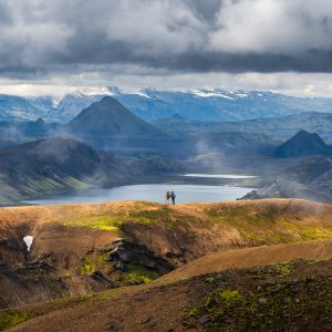
The highland trail thins its hikers out quickly. As grand as the nature is, you are assured that each breath, each footfall, will carry you toward the destination you set out to reach.
The highland trail thins its hikers out quickly. As grand as the nature is, you are assured that each breath, each footfall, will carry you toward the destination you set out to reach.

Ten kilometers of flat, black desert, no shelter, totally exposed, just volcanic sand stretching to the horizon. Two hikers walk across the emptiness. Small, unhurried, resolute.
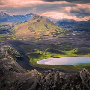
From the top of Brattháls, the whole of Álftavatn lake and the surrounding mountains unfold beneath me. Well worth the climb on a long highland afternoon.
Hours of grinding over endless volcanic gullies, suddenly, Álftavatn lake spreads below in an impossible sweep of green.
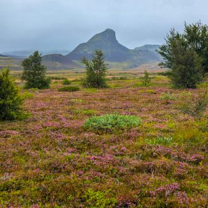
Beginning at Landmannalaugar, the Laugavegur Trail’s first 12KM climb through lava fields and colorful rhyolite mountains to a stark, fog-shrouded plateau near Hrafntinnusker.
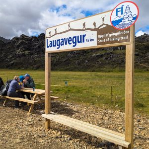
Crossing glacial streams and shifting into raw volcanic terrain, the specialized bus took us to Landmannalaugar, the starting point for a 55-kilometer trek through the Icelandic Highlands.
This trip marked our first time venturing into the Arctic and crossing the Arctic Circle, while also gaining deeper insights into the geography, culture, and current affairs of Greenland and the Faroe Islands.
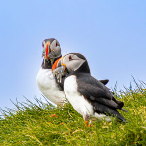
Puffins fly out over the ocean to catch small fish and crustaceans. Before taking off, puffins are extremely cautious, often standing at the mouth of their burrows for a long time and retreat back at the slightest disturbance.
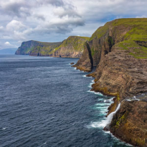
Due to the upward-sloping terrain on the right and the sheer cliffs in the foreground, it creates the striking illusion that Lake Sørvágsvatn is floating high above the ocean.