2019.7.1
Yesterday, I trekked the yellow trail in Ilulissat. Today I plan to take the blue trail. In the morning, we also walked around the town—more on that later.
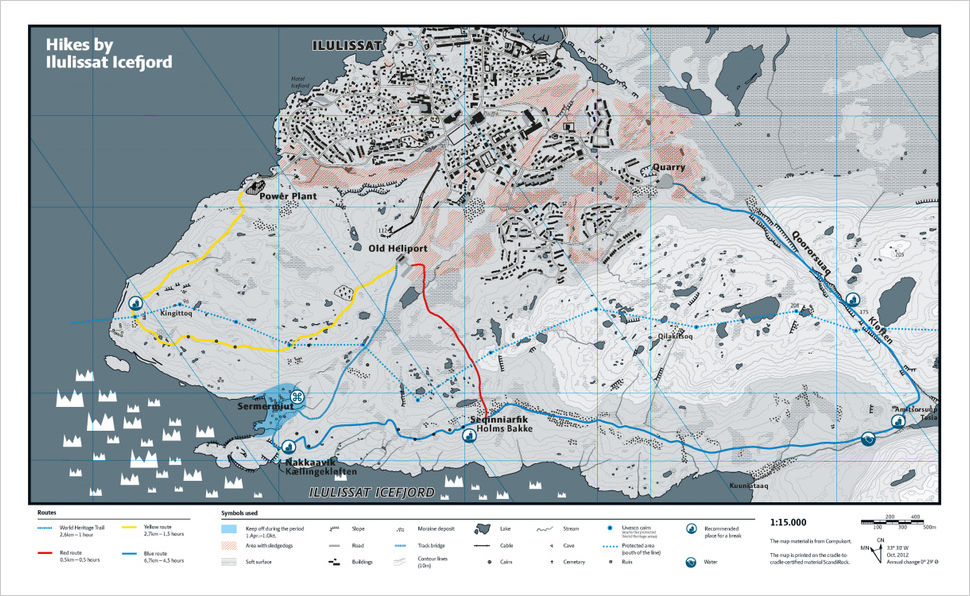
The starting point of the blue trail is the same place where I exited the yellow trail yesterday, not far from the city center. The blue trail is about 5 miles long. After finishing it, I still have to walk another one and half miles to get back to the hotel—more than three times the length of the yellow trail.
The first mile is a well-paved wooden boardwalk, built over the tundra in the yellow-green color. Not far from the entrance, one of the wooden planks is engraved with the UNESCO logo. For over 270 years, people have been exploring and studying this glacial fjord. It continues to provide crucial data for climate change and glaciology research. In 2004, Ilulissat’s Icefjord was designated a UNESCO World Heritage Site for its natural and cultural significance.
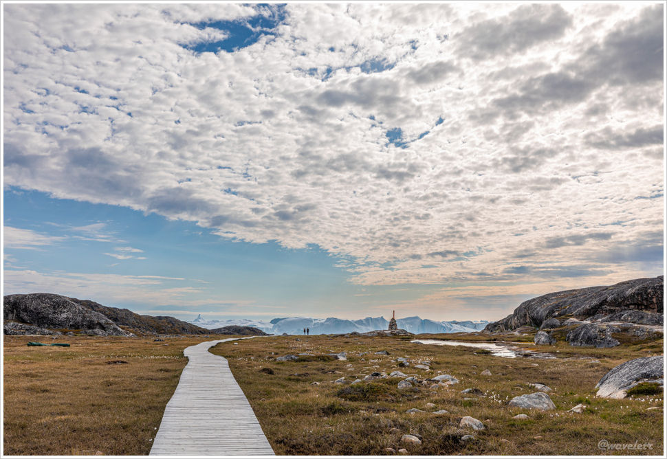
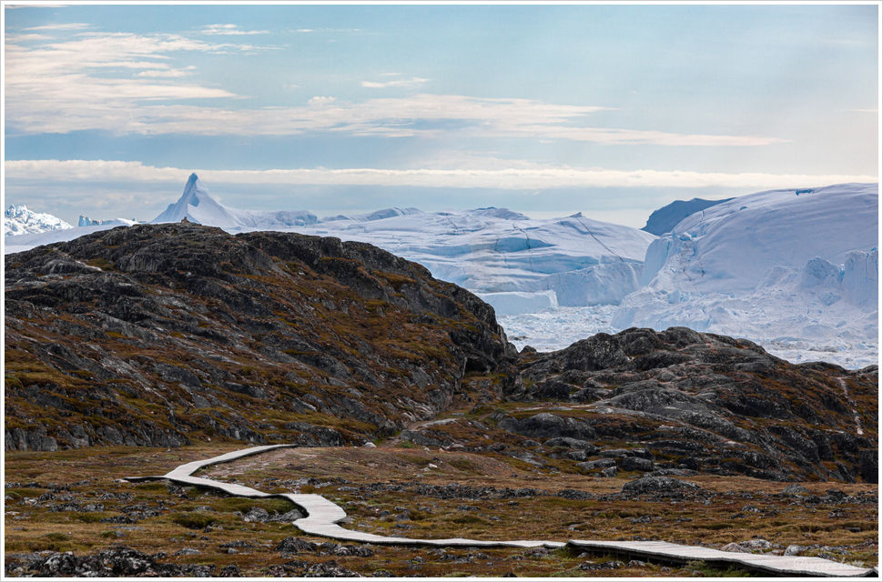
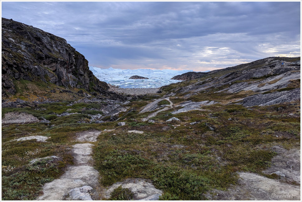
The winding boardwalk leads visitors closer to the fjord. Beyond this stretch of large rocks, towering icebergs come into view. This is where the boardwalk ends. If you come to Ilulissat, even if you don’t plan on a long hike, you should at least make it here to take in the breathtaking view above from the hill.
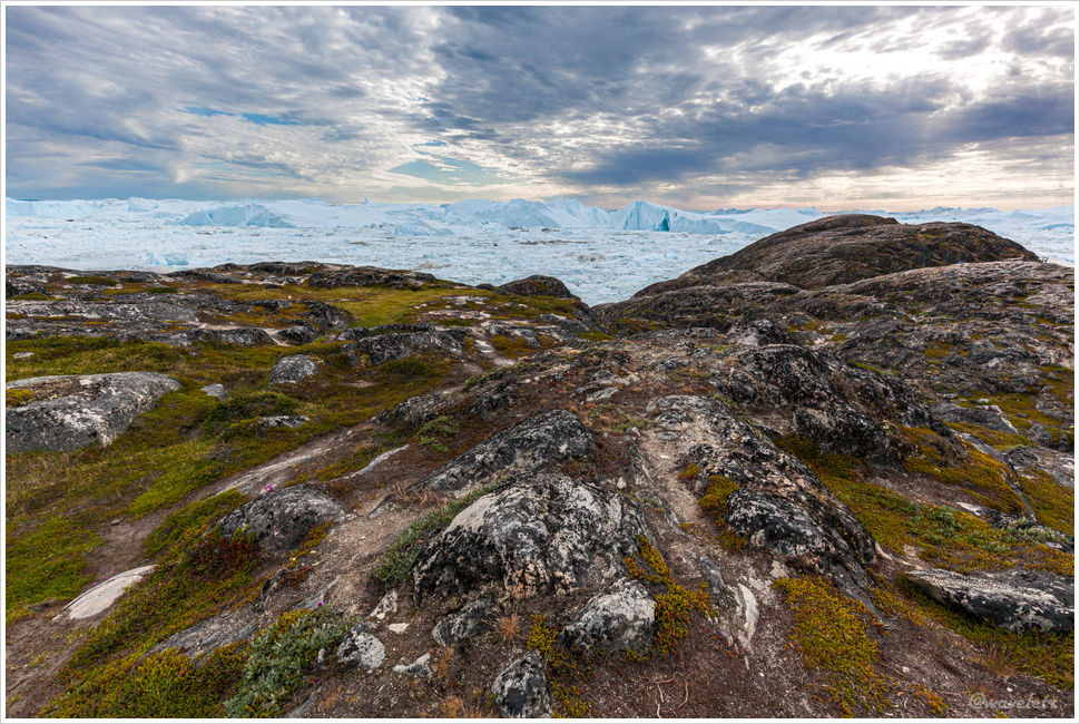
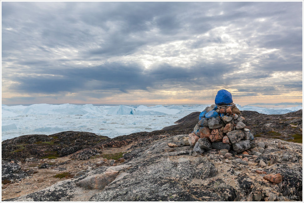
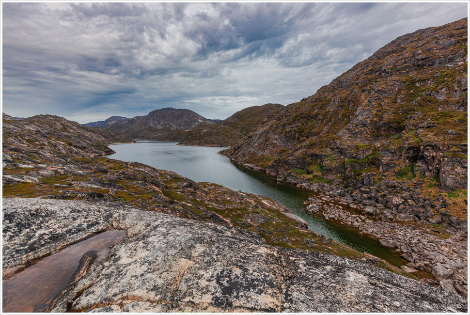
The section along the fjord is similar to the terrain I saw on the yellow trail yesterday—exposed granite and low vegetation growing between large rocks. The blue trail is, of course, marked with blue signs. About a third of the way in, there is a fork leading to a red-marked trail, which provides a shorter route back to the starting point, a lot of shorter in distance compared to completing the full blue trail.
Few people take the full blue trail. Along the way, I didn’t see a single person—except for a young girl running in the opposite direction. Yes, running! Keep in mind that the trail is far from smooth, mostly covered in loose rocks, with occasional large boulders to climb over. Back then, I hadn’t started running yet, and my endurance wasn’t what it is now. If it were today, I believe I could run the whole trail as well.
On the yellow trail yesterday, we stayed along the hillside without descending to the fjord’s edge. The blue trail, however, follows the fjord more closely. While it doesn’t hug the shoreline, it stays at nearly the same height as the icebergs. From this vantage point, their shapes are much clearer—some towering and sharp, others flat and smooth, and some jagged like a series of mountain peaks. One iceberg stood out in particular, resembling Mount Everest, with a blade-like ridge rising dramatically above the rest, making it truly striking.
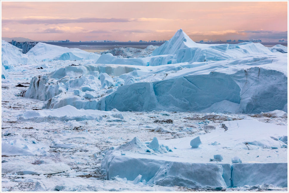
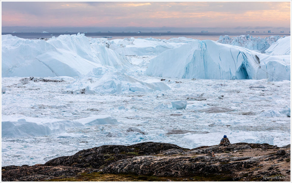
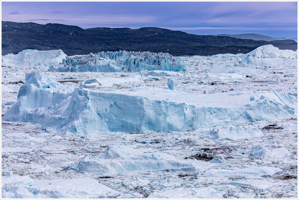
The deeper I walked into the fjord, the more crowded the icebergs became. Looking back, I could see icebergs that had already drifted out of the narrow fjord, floating in the Disko Bay.
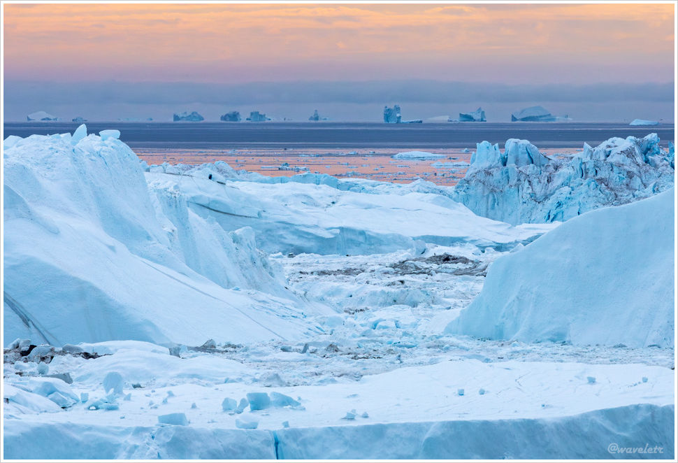
About halfway along the blue trail, the coastline curves south, and here lies a small cove where the icebergs cannot drift into. Only some small floating ice remains. The trail then continues deeper into the mountains, the terrain gradually rising, and eventually, the icebergs that had accompanied me start to fade into the distance.
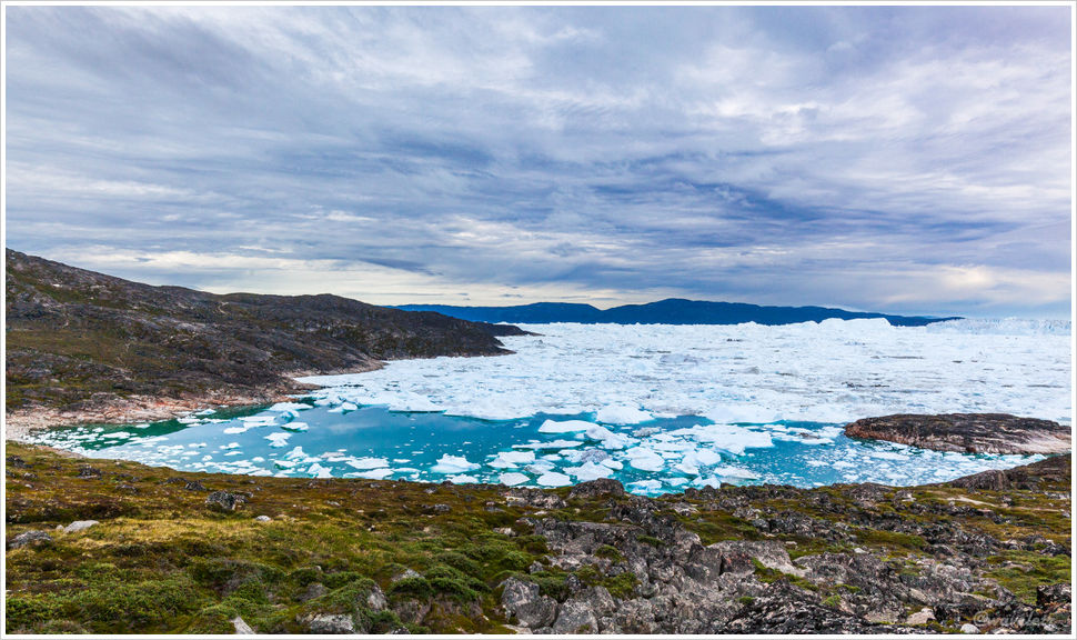
At a higher point in the hills, there is a small lake with a beautiful view. I sat by the lake for a while to rest. After seeing the massive icebergs in the fjord, the tranquil little lake and its peaceful scenery felt like a refreshing change. It even started to drizzle lightly.
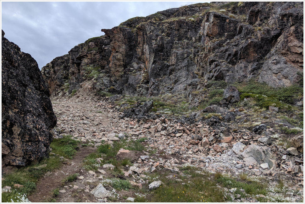
The trail turns left from here. This section feels like a canyon between two mountains. It almost looks man-made, as if carved out, because beyond the mountain lies a quarry. The trail is filled with loose rocks, making it quite difficult to walk, and I was starting to feel a bit tired. As I walked, I kept sensing something in the round-shape in my backpack but couldn’t figure out what it was. Only later, when I tried to find out, did I realize it was an small orange—sweet and juicy, just the perfect boost of energy. The unexpected surprise felt like a timely gift, and to this day, I still often reminisce about the delightful feeling that little orange gave me.
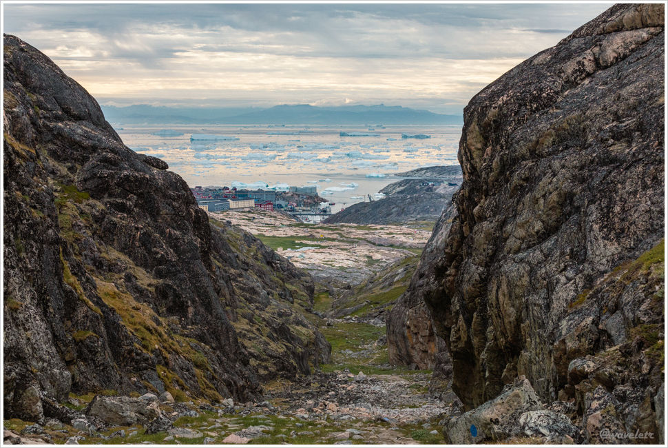
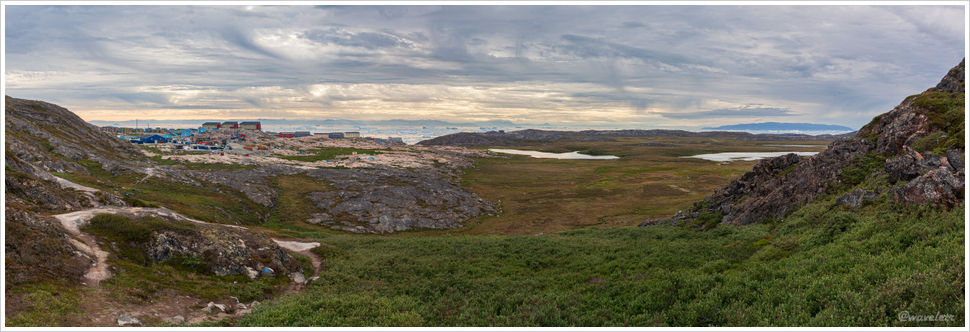
After crossing the highest point of the trail, I could already see the city of Ilulissat ahead. Behind it lay Disko Bay, with icebergs floating. In the distance, the mountains of Disko Island, which we had just visited, were visible.
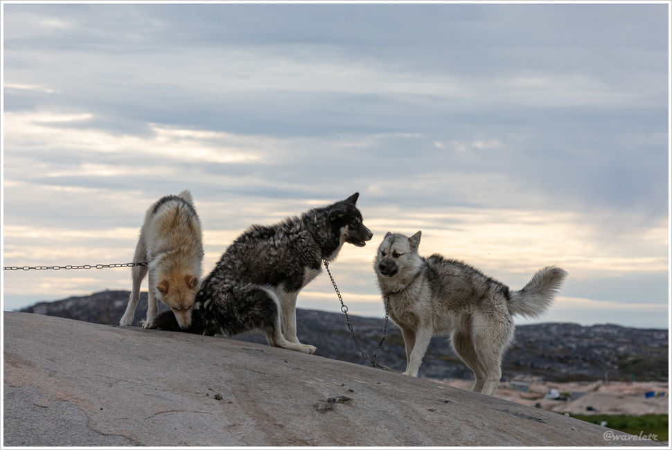
When I reached the foot of the mountain, I had finally completed the entire blue trail. This was the farthest east of the city, and I passed an area where many sled dogs were tied up. Typically, it’s only in winter that sled dog tours are offered. In the summer, they are tied up. Because there are so many of them, and they still retain their wild nature, they can only be kept outdoors. If an adult sled dog is not tied up, it poses a safety risk to both residents and tourists. It is reportedly legal to have them killed. Although I understand there is no other way, seeing such a large group of dogs tied up still felt pitiful.
I left the hotel at 5 PM and didn’t get back to the hotel until after 9 PM, by which time the restaurant had already closed. I asked the kitchen for a beer. In my room, I enjoyed the takeaway my wife had brought back. It was just as relaxing.