2014.10.31We had planed to see Notre-Dame in the morning. After having breakfast at the hotel, we were on our way at 8am. Place Saint-Michel was very quiet in the early morning, barely saw anyone there; but it’s a busy place during the day, where French like to meet. On the right side of the following picture, is Fontaine Saint-Michel. Given its popularity, I feel that it requires some maintenance to say the least. With so many people around it during the day, it’s not looking good in the picture.

Place Saint-Michel, Latin Quarter, Paris
Cathedral of Notre Dame is located at the east end of Île de la Cité. The construction started in 1163. From choir to nave to the western Façade, it’s 90 years later when two towers were built. After that, the north and south transepts were redesigned and flying buttresses were added, plus remaining touches and elements, it took over 180 years for the Cathedral to be fully completed. The cathedral opens at 8 am, there were not many visitors yet. Notre Dame’s western Façade is famous for its well-proportioned imposing presence and exquisite carvings and statues; but the interior is quite simple.

The nave looking toward the chancel, Notre-Dame, Paris

Chancel windows of Notre-Dame, Paris

A chapel of Notre-Dame, Paris
Talked with the keeper, we learned that the tower wouldn’t open until 10 o’clock and now it’s not even 9 yet. We decided to see Panthéon first. The distance between Notre Dame and Panthéon is only 1 km, we just need follow Rue Saint-Jacques. On our way, we passed the backdoor of Sorbonne, but the entrance was jammed with trash bins and traffic cones. I couldn’t even take a picture.

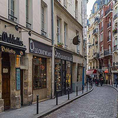
A small stree on Rue Saint-Jacques, Latin Quarter, Paris
Panthéon is located in the center of an oval plaza. We first walked to a small plaza in triangle shape at its back. Here sits a small church called Saint-Étienne-du-Mont. Several churches had been constructed on this location in the past 1500 years. The latest one was completed in 17th century to honor St. Geneviève, who in the legend protected Paris from destroyed by Huns. Her shrine is located in the church. Pascal and Jean Racine were also buried here. The building combines different architecture styles, rose window in Gothic and the nave in Renaissance. One of the most famous features in the church is the rood loft with delicate carvings left no surface untouched. It’s said to be one of kind in Europe. Unfortunately, we came to early, the church was not open yet.

Saint-Étienne-du-Mont, Latin Quarter, Paris
Those who have seen movie “Midnight in Paris” should recognize this location. Gil was sitting on those stairs, picked up by an old car and his fantasy time travel started there.

The side door of Saint-Étienne-du-Mont, Latin Quarter, Paris

The street next to Saint-Étienne-du-Mont, Latin Quarter, Paris

Place Emmanuel Levinas near Panthéon, Latin Quarter, Paris
We circled around the small street around the plaza and returned to the Panthéon. Panthéon was constructed at the end of the 18th century. It was originally planed to replace Abbey of St. Genevieve on the same site, but as the construction completed, it’s the time that French Revolution started. The church was repurposed as the place dedicated to the great intellectuals of France. Voltaire, Rousseau, Hugo, Zola, Marie Curie were all buried here. It’s a building in neoclassical style, with its façade modeling Pantheon in Rome. With its dome 70 meters in height, Foucault performed its famous Foucault pendulum experiment here in 1851 to demonstrate the rotation of the earth.

Panthéon, Latin Quarter, Paris

Look through Rue Soufflot from Panthéon, Latin Quarter, Paris
We strolled back along Rue Saint-Jacques as the street began to stir with life. We stopped for a coffee and picked up a few small souvenirs along the way.

Collège de France, Latin Quarter, Paris

Eglise St-Severin, Latin Quarter, Paris
By the time we returned to Notre-Dame, it was nearly 11:00 AM. A long queue of tourists waiting to climb the towers lined along the right side of the cathedral. Since we had two more nights on the Left Bank, there was still plenty of time.

Notre-Dame in autumn, the eastern side of the cathedral, Paris

Pope John Paul II statue and the South Rose Window, Notre-Dame, Paris
While my wife rested at the hotel, I headed out to scout the 6th arrondissement. Weaving through the narrow lanes behind our hotel, I soon reached Boulevard Saint-Germain. This stretch runs parallel to the Seine and serves as the main artery of the Left Bank; the commercial atmosphere here is noticeably more intense than in the Latin Quarter. I happened upon a Starbucks, I’d assumed a city so proud of its coffee culture wouldn’t have much of a market for it, but it turns out there are quite a few shops.

Boulevard Saint-Germain, Paris

Boulevard Saint-Germain, Paris
Continuing on to the Luxembourg Gardens, my first sight of the Medici Fountain, dappled in the shadows of the midday trees, was truly striking. Such beauty felt wrong to enjoy alone, so I hurried back to the hotel to bring my wife along.
We first grabbed lunch at Khao Thai near the hotel. Like most spots on the Left Bank, the tables were packed so tightly you could barely squeeze past. Their duck with tamarind was excellent. A quick tip: if you want plain water in Paris, remember to ask for “tap water.” Simply saying “water” will almost certainly result in a bottle appearing on your bill.

Canard au tamarins, Khao Thai on Rue Dauphine, Paris
The number of small shops tucked into the alleys flanking Boulevard Saint-Germain is seemingly endless, especially around the Marché St-Germain between the boulevard and the park. The pastry shops are particularly dazzling; high-end patisseries are spacious and bright, decorated more like jewelry boutiques. Famous names like Un Dimanche à Paris and Pierre Hermé always have queues out the door. After visiting a few, I realized that macarons aren’t exclusive to Ladurée, every shop sells its own version.

Pastry store near Marché Saint-Germain, Paris

A butcher store near Marché Saint-Germain, Paris
The Luxembourg Gardens were commissioned in 1615 by Marie de’ Medici, widow of King Henry IV. The Medici name carried immense weight in Renaissance Europe. Rising from the banking sector in Florence, the family’s influence permeated European royalty, religion, and politics. Beyond their wealth and power, they were renowned patrons of the arts, often called the godfathers of the Renaissance. I remember a sign we saw in Florence that read, “It is a pity many contemporary collectors lack the taste of the Medici family.” Queen Marie’s own life was a whirlwind of court intrigue, regency, and eventual exile by her own son; many even link her to the assassination of Henry IV.
Entering from the northeast, the first thing you encounter is the Medici Fountain. A long, narrow pond leads to the sculpture at the far end. Surrounded by greenery, with ducks and fish gliding through the water, the setting is incredibly serene. The fountain underwent major reconstruction in the 19th century, which is when the current statues were added. While the dappled light is beautiful to the eye, the harsh midday sun makes photography a challenge.

La fontaine Médicis in Jardin du Luxembourg, Paris
Despite the lush greenery and flowers, the Luxembourg Gardens isn’t designed to be secluded; instead, it features wide vistas and orderly rows of trees, giving it a grand, open feel, said to be modeled after the Pitti Palace in Florence. The Luxembourg Palace now serves as the seat of the French Senate. The green iron chairs around the large circular pond were nearly all occupied, mostly by locals. Many parents were helping their children launch model sailboats into the water. For a Friday afternoon, Parisians seemed remarkably leisurely—I later learned about the 35-hour work week; perhaps the weekend truly begins on Friday afternoon here.

Luxembourg Palace, Jardin du Luxembourg, Paris
The western side of the park features wooded areas and children’s playgrounds, offering everything from pony rides to rollerblading. Nearly a hundred sculptures are scattered throughout the grounds.

Statue in Jardin du Luxembourg, Paris

Statue in Jardin du Luxembourg, Paris
Near the northwest gate and the Musée du Luxembourg sits Angelina, a famous Parisian tea house. While the original is next to the Tuileries Garden, this branch is much smaller. Angelina is renowned for its hot chocolate and the noodle-like Mont Blanc. Wary of too much sweetness, we shared one Mont Blanc and a coffee.

Le Mont-Blanc, Angelina, near Musée du Luxembourg, Paris
Walking back along Rue Bonaparte, we soon arrived at the Église Saint-Sulpice. Construction began in the mid-17th century and spanned 130 years. Ultimately left unfinished due to funding issues, its north and south towers remain asymmetrical to this day. It is the second-largest church in Paris after Notre-Dame, though its western facade is far more austere. Many key plots from The Da Vinci Code unfold within these walls.

Église Saint-Sulpice, Paris

Fontaine Saint-Sulpice, Paris
Heading further north, we returned to the vibrant heart of the Left Bank: Saint-Germain-des-Prés. The area is most famous for its two legendary cafés, Les Deux Magots and Café de Flore. These spots were icons of early 20th-century literary and artistic history—you can practically point to a chair where Picasso sat or a table where Sartre dined. Of course, that was a century ago; today, they feel more like landmarks for tourists to capture a slice of that past life.
Across the street from Café de Flore is the Abbey of Saint-Germain-des-Prés, one of the oldest churches in Paris and the namesake of the district; Descartes is buried here.

Les Deux Magots, Saint-Germain-des-Prés, Paris

Saint-Germain-des-Prés at dusk, Paris
Back at the hotel, we had some time before dinner, so I went out to catch the city lights. The tourist sights in Paris are all pretty close; the walk from our hotel to the Louvre took barely fifteen minutes.

Institut de France and Pont des Arts with Notre-Dame at the background, Paris

Palais du Louvre at night, Paris
In the plaza before the Louvre stands the Arc de Triomphe du Carrousel. From here, you can see the Obelisk at Place de la Concorde and the Arc de Triomphe at the far end of the Champs-Élysées. I waited quite a while for a clear shot without people in the frame. A cyclist rode past me and called out, “What a city!” Yes, what a city!

Arc de Triomphe du Carrousel, Paris


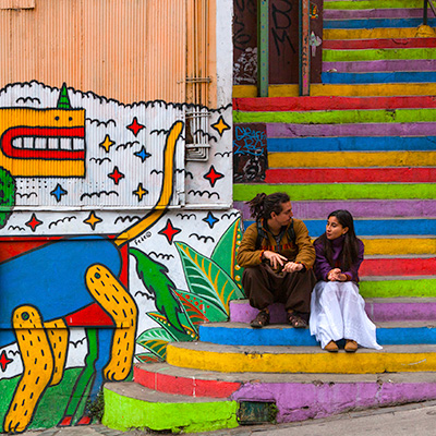


, Plaza Sotomayor, Valparaiso")


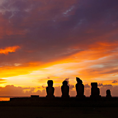


, Papa Vaka, Easter Island")


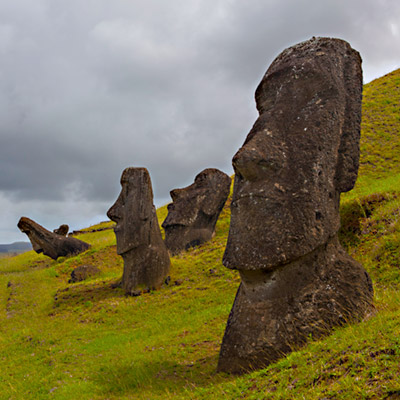
, at Puna Pau, Easter Island")


