2019.7.3
The Faroe Islands? Where are they? Are they a country? Such questions are completely understandable—especially back in 2019, when we made our trip. At that time, the Faroe Islands were still relatively unknown, known mostly within photography circles. But as breathtaking landscape photos began circulating online, the islands gradually gained popularity. Though not a remote and inhospitable place, the Faroe Islands still lacked sufficient tourism infrastructure to handle the growing number of visitors. As a result, the local government and residents began considering various measures—such as periodically closing certain attractions—to limit tourist numbers.
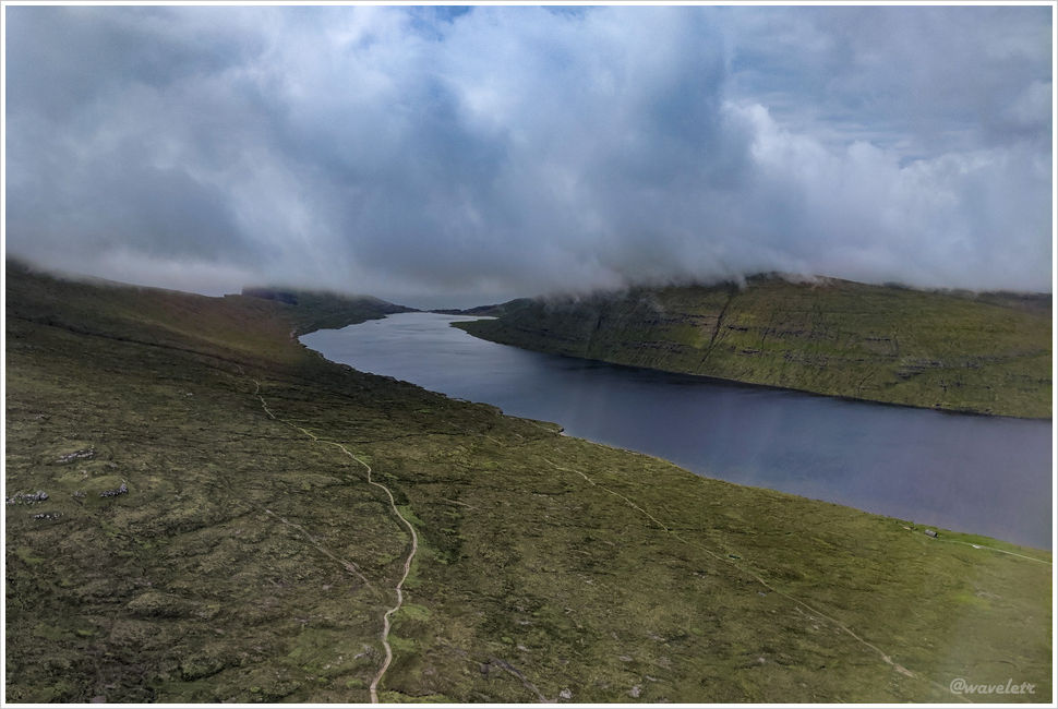
We spent one night in Iceland, then took a flight to the Faroe Islands the next morning. The flight to Greenland had been on a small propeller plane, but the one to the Faroes was an Airbus 320—a mid-sized jet. Clearly, more people travel to the Faroe Islands than to Greenland. Before landing at Vágar Airport, the plane flew over Lake Sørvágsvatn. This was the view from the plane, and a few days later, I would be walking along that trail below all the way to the sea shore.
We rented a manual Nissan Murano at the airport. The car was reliable and ran smoothly throughout the trip. After returning to the U.S., I considered renting one again but found that it didn’t have great reviews—perhaps the models differ between Europe and the U.S.
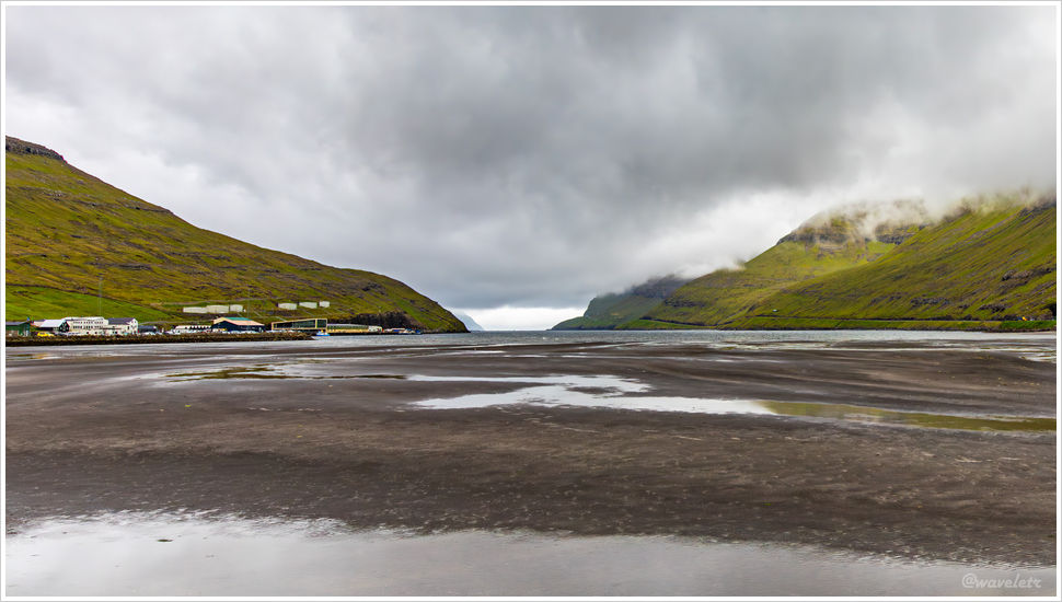
We first stopped at the nearby town of Sørvágur to stock up on supplies. There’s a sandy beach by the fjord there, where you can see all the way to the open sea beyond. It didn’t yet reveal the awe-inspiring beauty we were about to encounter.
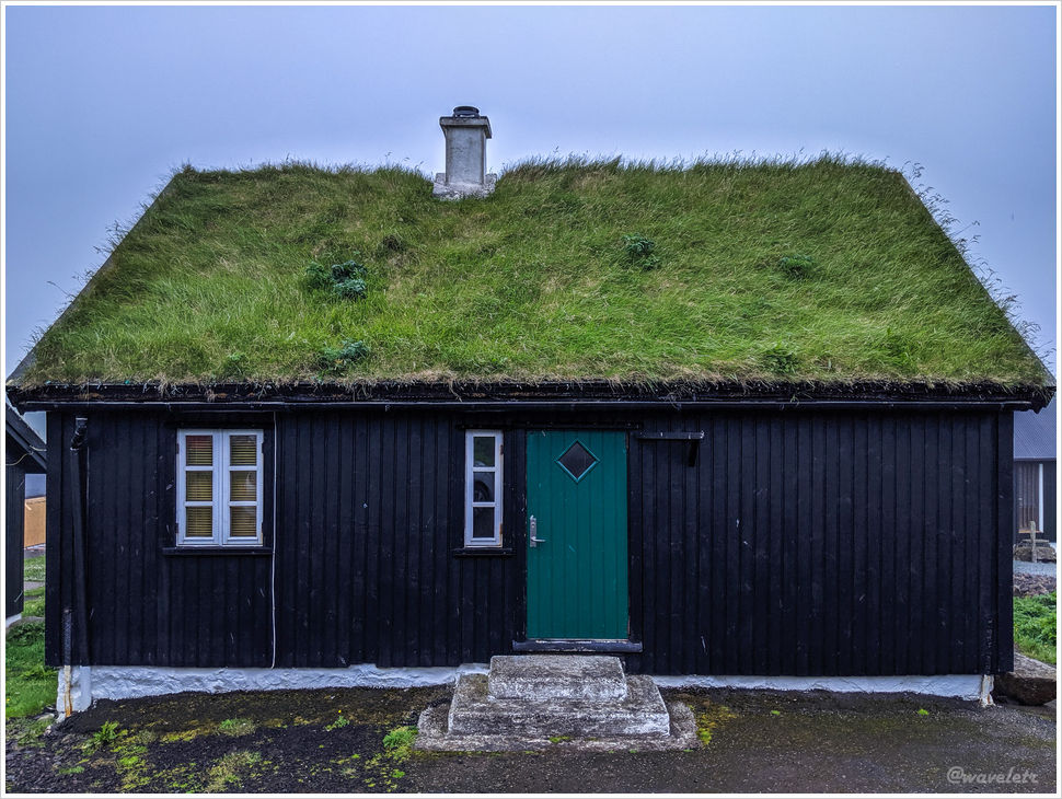
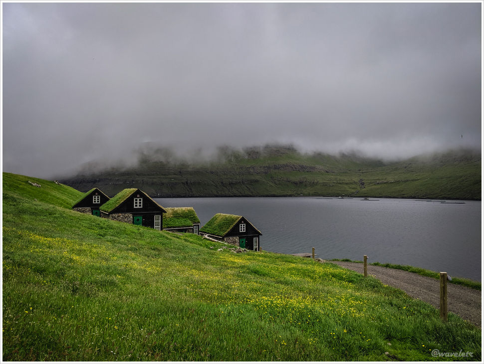
Before heading to the hotel, we decided to visit the Múlafossur Waterfall – the very waterfall that had first introduced me to the Faroe Islands. We drove west along the road on one side of the fjord. Not far along the way, we saw a few cottages with roofs covered in thick green grass – a characteristic look of the Faroe Islands. The clouds hung low, almost touching the sea, and it felt like these houses were meant to exist in just such gloomy, moody weather.
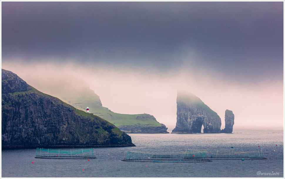
Looking across the fjord from there, you can see one of the Faroe Islands’ iconic sights: Drangarnir – a small island shaped like an archway. Next to it is a sea stack shaped like a club, and behind them rises the triangular, steep cliffs of Tindhólmur Island. Drangarnir is very close to Vágar Island. From the cliffs of Vágar, especially when the sunlight illuminates the arch from the left, you can’t help but marvel at nature’s magnificent craftsmanship.
In the photo below, Tindhólmur is off to the right and not visible; on the left is Vágar Island, where you can see some photographers perched on the cliff’s edge. The circular shapes on the water are salmon farms – one of the Faroe Islands’ main industries.
To get to Gásadalur, we had to go through the Gásadalur Tunnel, which cuts through the mountain. Once entering the tunnel I was getting nervous. It was a one-lane road with no traffic lights on either end to control alternating flow. What if a car came from the opposite direction? Luckily, not far into the tunnel I spotted a pull-out area on the left, large enough for two cars, clearly meant for yielding. These passing bays appear every hundred meters or so. We hadn’t researched this in advance, so whenever we saw an oncoming car, we pulled into the nearest bay. In fact, if the bays are on your right, you should yield, but if the oncoming vehicle is a large truck, smaller cars have to give way regardless.
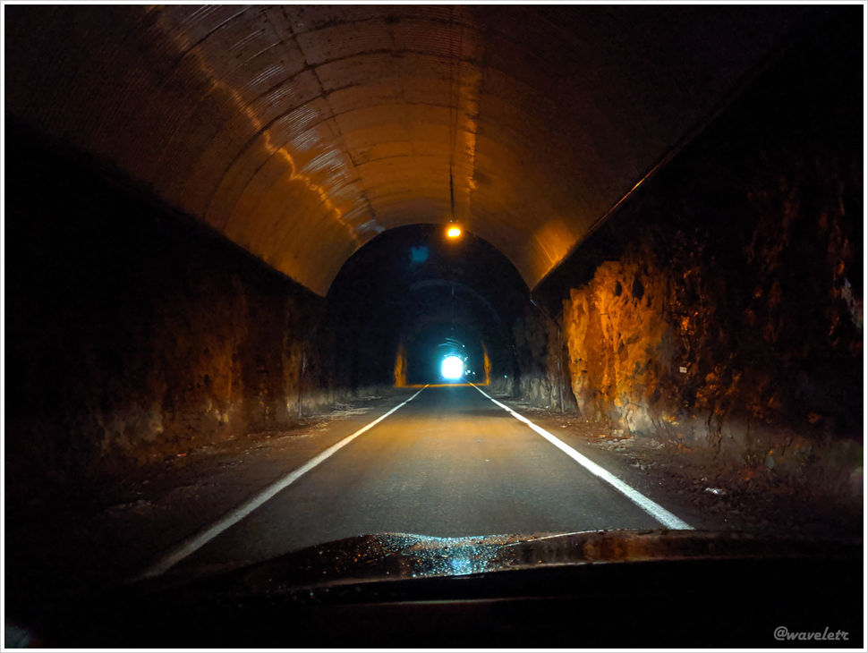
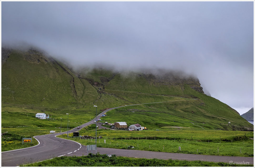
Looking back after exiting the tunnel, we could see the mountain we had just passed through. The Gásadalur Tunnel was opened to pedestrians in 2003 and to vehicles in 2006. Before the tunnel was built, the village was accessible only by boat or via hiking narrow cliffside paths over the mountains. The tunnel made travel far more convenient. One-lane tunnels like this are now considered outdated. Newer ones often have two lanes or even four, connecting different parts of the islands by cutting through mountains and crossing under the sea.
Just a few dozen meters off the roadside, you can see the Múlafossur Waterfall. The stream that feeds it originates from the mountaintop behind and flows just a few kilometers before plunging over 60 meters straight into the Atlantic Ocean. The towering mountain backdrop and the quaint village at its foot add a dreamlike quality to this breathtaking scene.
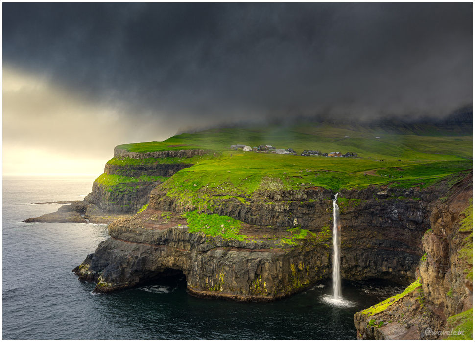
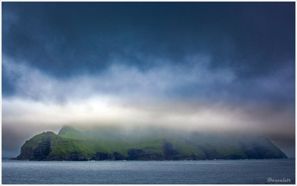
A few more steps down a small path lead to a slightly restored stairway, which brings you to a platform closer to sea level. On stormy days, the waves crash dramatically, making for even more powerful photographs. But on this particular day, the wind was calm, and low-hanging clouds shrouded the mountain peaks, which refused to show themselves. Looking out to the left, we could see several small islands in the sea. One of them is Mykines, which we would visit on our last day.
Gásadalur is the small village nestled at the foot of the mountain. It likely has no more than a dozen or twenty houses, many with thick green grass covering their roofs. We didn’t see many people around, probably because the population is small. Located at the far edge of Vágar Island, the village is almost completely cut off from the world, nestled in a landscape that feels utterly otherworldly. Coming through the mountain tunnel, it felt as though we had stepped into a hidden utopia.