2021.9.30
In the morning, my wife went shopping in the downtown, and I went hiking in Monument Canyon to the northwest of the city. The name of this place first reminds people of Monument Valley in Utah, famous for its towering rock formations. Monument Canyon also has similar landscapes, but on a smaller scale. It takes about 20 minutes to drive from Grand Junction, which is enough to produce a weather difference. The weather forecast said it would rain in the city, but the rain would not pass through the park. It turned out that the weather forecast was reliable.
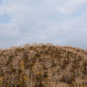
After leaving the starting point for the trail, after 600 feet, the path splits in two directions to the north and south. I followed the counterclockwise loop. This part is called Wedding Canyon Trail. The path is not well maintained and not well marked. There is a section where I walked to a low cliff, but this section is gentle and easy to walk down from the cliff.


Starting from the left turn from here, the terrain gradually steepened, extending into the depths of Wedding Canyon. Because it was on a hillside, the road was harder to find and often I had to walk back, compared to the map before moving forward. The opposite side of the valley can already see towering rocks.


The end of the Wedding Canyon Trail is at the foot of Independence Monument. John Ott was the first non-native to discover this valley. For many years starting in 1906, he is almost the only person that built and maintained the trails here. On Independence Day in 1911, he put an American flag on the top of this rock, which may be the origin of the name Independence Monument.


It was much easier to walk back from Monument Canyon Trail, all downhill, and the trail was also very smooth. The trail is about 5-mile long. It took me about two and a half hours to complete, quite an easy trail with beautiful scenary.

While I was hiking, my wife was doing some shopping in the downtown, and it rained heavily for a while. When I came back and looked at the photos on our phones, I could tell exactly where I was when my wife was in a certain store, as if we shared our experiences but in different time and space together, which was quite interesting. We had a walk again around the downtown area, going to a nice coffee shop and a musical instrument store. The streets on both sides of the downtown have many sculptures, some realistic, recording historical characters and events, some abstract, and some very funny and interesting, worth a visit.


We had lunch at a Thai restaurant outside the city center, took a break in the afternoon, and visited Monument Canyon again in the evening. This time, we drove up to the top of the canyon, and the road twisted along the edge of the cliff. When we went up the mountain, the cliff drops hundreds of feets on one side. It was really a bit nervous.
Below the canyon is the place where I walked this morning. It looks somewhat like the Grand Canyon from above. The sky was already dark, and we saw a photographer taking pictures by the cliff. He put two identical cameras at the each end of a frame separated by a certain distance, and used a homemade synchronization device to trigger the shutters of the two cameras at the same time. The two photos taken this way can produce a 3D effect after post-processing.


In the evening, we returned to the city and had dinner at a restaurant called TacoParty. The restaurant specializes in Tacos, with non-traditional ingredients and creative ideas. It is very tasty.

The second morning, I first ran along the river for a while. Returned to the hotel and we went to Las Colonias Park on the Colorado River. You can tell from the name of the city, Grand Junction is located at the confluence of two rivers. The Colorado River rushes out of the Rocky Mountains, and the Gunnison River flows northward here. However, the “Grand” here does not mean a big river. Before 1921, when people talked about the Colorado River, they referred to the downstream starting from the Canyonland National Park in Utah. The upstream of the river was called Grand River, and it is only called the Colorado River after merging with the Green River. Until now, many places in Colorado still have “Grand” in their names. It was not until 1921 that the name of the Colorado River was extended to the upstream, and then the Colorado River truly originated in Colorado.


It takes about an hour to drive from Grand Junction to Montrose. We quickly had lunch at the same Japanese restaurant in Montrose. When planning the itinerary, it took me sometime to decide which city would be our last stop in Colorado. Grand Junction is still more energetic and popular than the other.

The trip to Colorado is our first long trip after the epidemic. Although there was another outbreak at the end of the year, mentally we have crossed the barrier of uncertainty and fear. Finally We can travel again.