2024.8.11
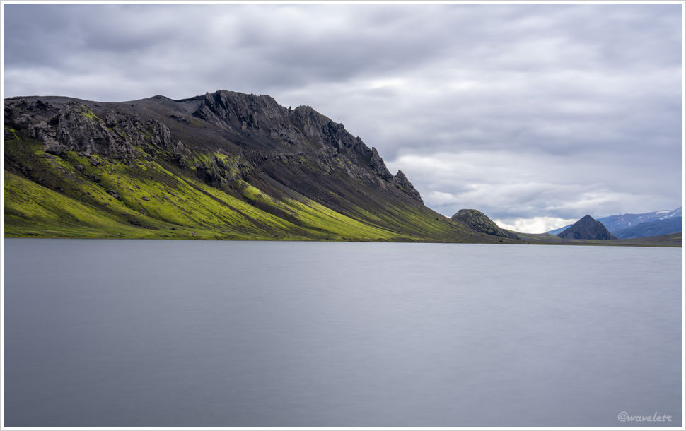
We arrived at Álftavatn at 1:30 pm, leaving plenty of afternoon to spare. I walked down to the lakeshore and took a few photos. The ground near the lake was soggy, and streams kept cutting across the path. I decided to head up to the hilltop on the left.
AllTrails lists this hill as Brattháls. It looks steep from below, but the ridge ascent is gentle. Halfway up I turned around — the huts sat small at the foot of the mountain.
The lower half of the trail is loose scree; closer to the summit, solid slabs of rock jut out. The gradual slope turns abrupt and craggy at the top, with sheer drops along the edges. I lay flat at the cliff’s edge, the whole of Álftavatn lake spread out below.
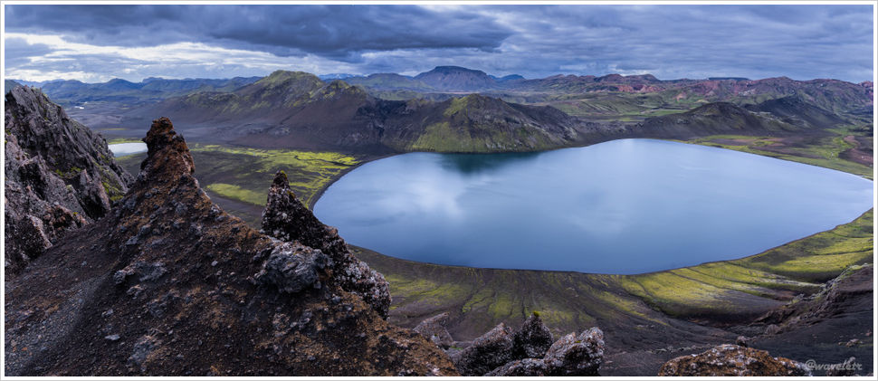
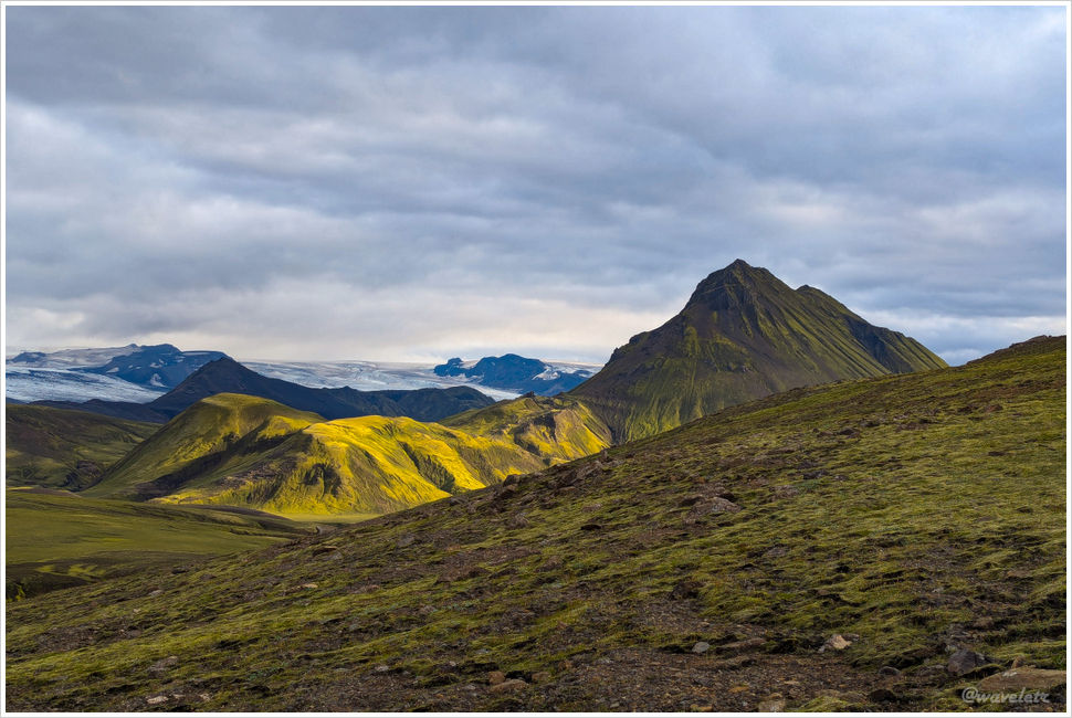
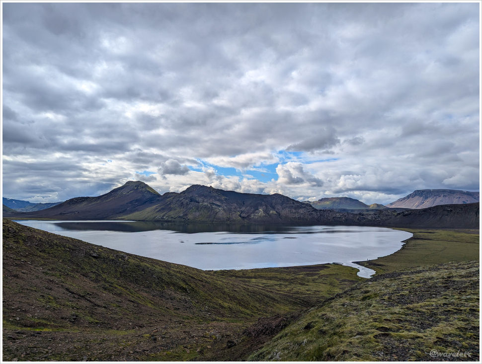
Álftavatn lake runs roughly east to west. Looking westward from the summit, a smaller lake appeared afar — worth a visit given the chance. The mountain in the distance is Stóra-Grænafjall, which translates to “Great Green Mountain.”

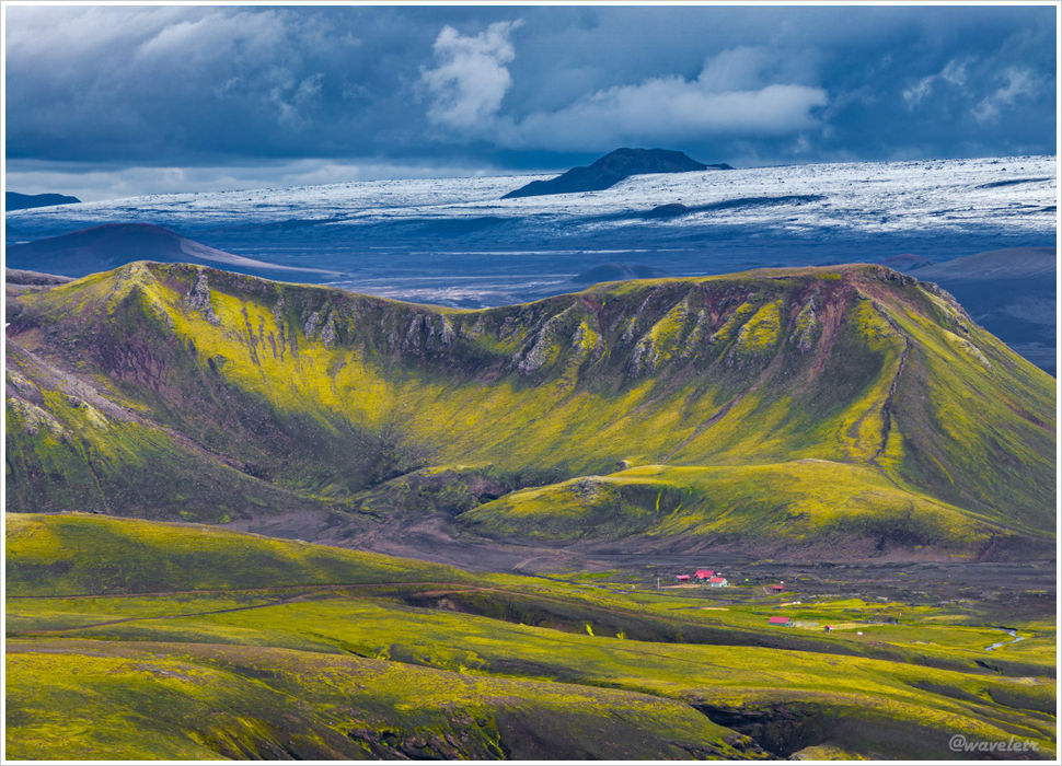
To the south lies tomorrow’s route. The ice cap in the distance is the Mýrdalsjökull glacier, sitting atop an active volcano that last erupted in 1918. The pointed peak in the foreground is Stórasúla — we’ll skirt behind it tomorrow.

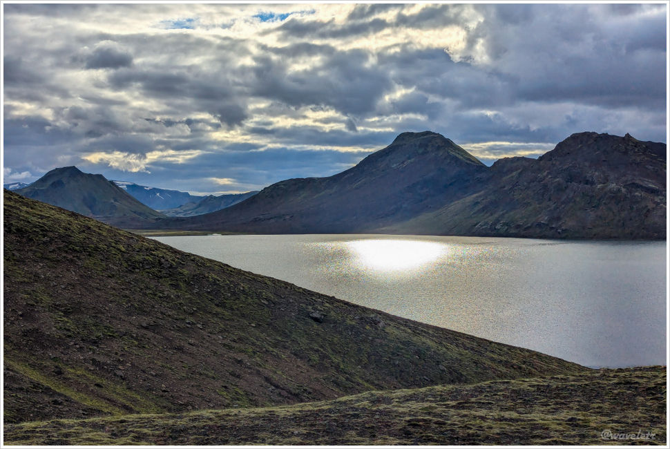
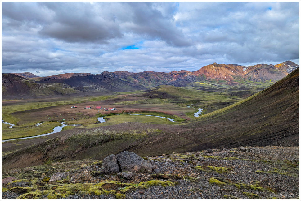
This shot is angled further west, showing the Mýrdalsjökull ice cap more clearly. The hut in the foreground is Hvanngil, we will pass by tomorrow.
One miscalculation today: I brought only one camera battery. It died shortly after reaching the summit, so I had to fall back on the drone. The telephoto shots from it left something to be desired.
I started back down around half past six and reached the hut in thirty minutes. The views from the top of Brattháls were outstanding — well worth the climb.