Eastern Canada and Maine – Ottawa and Montreal
2013.9.29Sheraton Hotel is only 3 blocks way from the Parliament. I had my usual walk in the morning, to take pictures before visitors coming and to understand what places worth visiting and how much time we’d need.
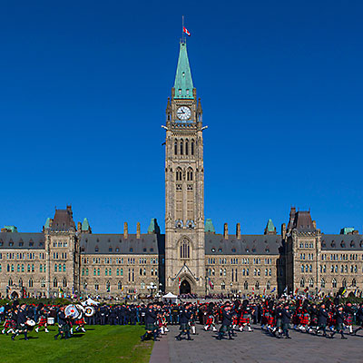
As I was walking in the square of the Parliament Buildings, I understand why it’s the most popular attractions of the city. Open settings, grand architecture, dignified buildings, but the most beautiful place was the section between the Main Block and East Block. The trees’ color has started turning. Immersed in the morning fog, it’s quite and peaceful, very different feeling compared to the rigid buildings steps away.


From the back of the Centre Block, I walked down from the Parliament Hill, By the bridge of Wellington St., steps led me down to the Rideau Canal. The Canal was built at the beginning of 19th century as a preventive measure in case of Americans invasion. It connects Ottawa River and Lake Ontario at Kingston, where we stopped for coffee the earlier night, with 200 km in length. It’s still operated today for leisure use.


Château Laurier is a grand hotel with 100 year of history. It’s located right next to the Rideau Canal. I walked along the canal underneath the bridge and climbed up from the other side. I walked over the Confederation Square and returned to the hotel.


I returned to Parliament Hill with my wife and in-laws 1 hour later. Centennial Flame was lit on. It happened to be the Canadian Police And Peace Officer’s Memorial Day, which is on the last Sunday of September of every year since 1998. We have a chance to view the memorial service in front of the Police Memorium by the Summer Gazebo and watched the parade on the front lawn of Parliament Hill.


We took the same route that I walked earlier in the morning. We had some breakfast at BridgeHead Coffee, then we had a quick tour around Ottawa‘s Lower Town without leaving our car, partly because of the safety concern but mostly because we’d have another city to visit.
Leaving Ottawa, we soon enter Quebec province. It’s well known that the official language of Quebec is French, but we were still surprised that English just disappeared from all signs. My father-in-law had done researches in France for a couple of years. He could read and speak French, which was very helpful. At one time, we stopped at a visitor center and asked for maps. The lady at the help desk helped us but just like she helped any other visitor; then my father-in-law started talking with her in French – the lady become enthusiastic almost right away. She brought more maps and brochures and told us other attractions worth visiting.
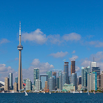
At 2pm, we arrived at Montreal, the largest city in Quebec. Montreal had been the commercial center of Canada until 70’s and remained to be a diversified and active city for commerce, technology and world affairs. However, we only planned to be here for several hour and the only area we’d visit was the Old Montreal.
Old Montreal is a historic area by the waterfront of St. Lawrence River. There are enough parking space by Rue Saint-Antoine behind the city hall. The center of the Old Montreal is the Place Jacques-Cartier square. We walked to the Old Port and Rue Saint-Amable, then we had lunch at one of many restaurants at the square. It started getting dark when we walked to Notre-Dame de Montréal Basilica. We didn’t get a chance to get in.


We drove to the Mount Royal Park. The very top of the hill was closed to vehicles, so we were not able to view Montreal’s skyline from the top. On the waist of the mountain, there is an vista point. We could overlook the northern part of the city with the Olympic Stadium in sight.


Our schedule was like group tour that could only taste the city in a very superficial way. We left Montreal at 5:30pm. It’d be a two and half hour drive to reach Quebec city. There were not a lot of car on the highway. We almost passed by Quebec City without noticing the sign. Luckily, we were able to charge the cell phone in the car and load the map.
We located Boulevard Laurier, which led us straightly into the Old Quebec. The street became tree-lined and then the buildings along the street appeared to be more elegant. After we went through a stone arch, the street suddenly became very narrow. Navigating through the European-style maze-like city grid, we checked into our hotel, Hôtel Champlain Vieux Québec. From the window, we had a view of grand Château Frontenac.

We went out to see if there was any food to eat, but it’s too late and most restaurants were closing. We returned to the hotel, had some nice tea at the lobby. With the hot water, we were able to make our reserved instant noodles as dinner.