巴黎 – 左岸

2014.10.31今天特意早起,准备去看巴黎圣母院。在楼下的餐厅吃过早饭,我们八点钟就出了门。路过圣米歇尔广场(Place Saint-Michel)的时候,还是冷冷清清。白天这里可是人来人往,车流如织,是法国人喜欢碰头的地方。在照片的右侧就是圣米歇尔喷泉,它有160年历史,名气很大。不过我觉得它颇为破落,颜色暗淡,加上白天人多,很不上像。

Place Saint-Michel, Latin Quarter, Paris

不一会儿,就走到了巴黎圣母院。巴黎圣母院位于西岱岛(Île de la Cité)的东端,始建于1163年,从唱诗堂开始,到中殿、西侧面,双塔完成时已是九十年之后。其后,教堂的南北方向的耳堂又经过改建,后殿加建了飞扶壁(buttresses ),直到1345年才完工,前后花了180年。教堂早晨八点开门,游客还不是很多。巴黎圣母院的西立面庄严肃穆、比例精美、雕梁画柱,是法式哥特风格教堂的经典之作;内部装饰却非常俭朴。

The nave looking toward the chancel, Notre-Dame, Paris
Chancel windows of Notre-Dame, Paris
A chapel of Notre-Dame, Paris

问了教堂的工作人员才知道教堂的塔楼要到十点钟才开门。时间还早,我们决定先去参观先贤祠(Panthéon)。从巴黎圣母院到先贤祠直线距离不过一公里,只要沿着圣雅克路(Rue Saint-Jacques)走就好。途中路过索邦大学的侧门,本想照张相,却发现门口排满垃圾桶和修路的路障,只好放弃。

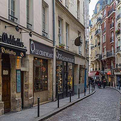
A small stree on Rue Saint-Jacques, Latin Quarter, Paris

先贤祠位于一个椭圆形广场的中央。我们先沿着左侧走到后面一个三角形的小广场,圣日内维耶广场。广场上的圣艾蒂安-迪蒙教堂(Saint-Étienne-du-Mont)面积不大,先后有几座教堂在同样的位置重建。现在的教堂完成于17世纪初,既有哥特式花窗、又融合了文艺复兴风格的钟楼,建筑特点十分独特。教堂供奉着圣日内维耶的圣骨箱,传说中她在六世纪的时候,保护了巴黎不受匈奴人的侵犯。同样葬在教堂里的还有物理学家帕斯卡(Blaise Pascal )和剧作家拉辛(Jean Racine)。教堂里螺旋形的圣坛围屏(rood screen)花纹精美,非常引人注目。可惜我们来的太早,教堂还没有开门,不能得以一观。

Saint-Étienne-du-Mont, Latin Quarter, Paris

看过《Midnight in Paris》的人应该可以认出这个场景。片中的主人公迷路后,就是坐在圣艾蒂安-迪蒙教堂侧面的台阶上,被一辆老式轿车接走,开始了一段奇妙的穿越之旅。

The side door of Saint-Étienne-du-Mont, Latin Quarter, Paris
The street next to Saint-Étienne-du-Mont, Latin Quarter, Paris
Place Emmanuel Levinas near Panthéon, Latin Quarter, Paris

我们沿着亨利四世中学(Lycée Henri-IV)后面的小路走了一圈,又回到先贤祠所在的广场。先贤祠建于十八世纪中,本来的计划是用以供奉圣日内维耶的教堂,建成时正赶上法国大革命,于是被改为纪念堂,用来安葬为法兰西做出杰出贡献的伟人:伏尔泰、卢梭、雨果、拉格朗日、以及居里夫人均葬于此。这是一座新古典主义风格的建筑,门廊的石柱和山墙与罗马的万神殿(都叫做Panthéon)十分相似。圆顶高七十米。1851年,傅科在这里做了著名的傅科摆的试验来证明地球的自转。

Panthéon, Latin Quarter, Paris
Look through Rue Soufflot from Panthéon, Latin Quarter, Paris

我们沿着圣雅克路往回走,路上开始热闹起来。我们坐下喝了些咖啡,又买了一些小纪念品。

Collège de France, Latin Quarter, Paris
Eglise St-Severin, Latin Quarter, Paris

回到巴黎圣母院的时候已是将近11点。等待登上塔楼的游客在教堂右侧排成一条长龙。我们在左岸还要再住两晚,还有时间。

Notre-Dame in autumn, the eastern side of the cathedral, Paris
Pope John Paul II statue and the South Rose Window, Notre-Dame, Paris

老婆先在旅馆休息,我打算去第六区探探路。穿过旅馆后面纵横的小路,很快我就走到圣日耳曼大道(Boulevard Saint-Germain)。大街的这一段与塞纳河平行,是贯穿巴黎左岸的主干道,明显商业气息要比拉丁区更浓。随便一走,就看见一家星巴克,我还以为对咖啡文化自视甚高的巴黎不会有星巴克的市场,后来发现居然还有不少分店。

Boulevard Saint-Germain, Paris

继续走到卢森堡花园,第一眼看到的美第奇喷泉在正午树影的掩映下让我十分惊艳。如此美景实在不忍独享,我赶快走回旅馆,叫上老婆一起上路。我们先在旅馆旁的Khao Thai吃了午饭。这是一家泰式餐馆,和左岸大多数餐馆一样,桌子紧挨着桌子,不容人侧身而过。他家的酸豆鸭肉做的很好吃。对了,在巴黎吃饭如果要白水,莫忘了说要“tap water”。只说“water”的话,肯定拿上来的是瓶装水,要收钱的。

Canard au tamarins, Khao Thai on Rue Dauphine, Paris

圣日耳曼大道两侧的小巷中,小店的数量只能用无穷无尽来形容,尤其以圣日耳曼大道和卢森堡公园之间的食品商场(Marché St-Germain)周围为最甚。其中最让人感到琳琅满目的当属甜品店。高档甜品店的店面宽敞明亮,装饰得如同首饰店一般。像Un Dimanche à Paris,Pierre Hermé这样的名店门口总是排着队。进了几个甜品店才知道,马卡龙 (Macaron)原来不是Ladurée的专利,每个店都卖。

Pastry store near Marché Saint-Germain, Paris
A butcher store near Marché Saint-Germain, Paris

卢森堡公园始建于1615年,是法国国王亨利四世的王后,玛丽亚·美第奇,在丈夫死后修建的。“美第奇”在文艺复兴时期的欧洲可是赫赫有名的大家族。起家于佛罗伦萨的银行业,美第奇家族逐步渗透到整个欧洲的皇室、宗教和政治势力中。他们不但拥有财富和权力,还特别喜欢资助和收藏艺术品,被称为是文艺复兴的教父。我们在佛罗伦萨的时候就看到过一幅标语,大概的意思是,“很遗憾很多当代收藏家的品味还不如美第奇家族”。这位玛丽亚皇后的一生也可谓跌宕起伏,从宫斗、到摄政、到被自己的儿子流放,亨利四世的被暗杀和她也不无瓜葛。

从卢森堡公园东北面走进公园,第一个看到的就是美第奇喷泉。临路的是一个狭长的池塘,池塘的尽头是喷泉的雕塑。整个建筑被绿树包围,池塘中鱼儿游泳、鸭子戏水,十分的幽静。美第奇喷泉在十九世纪中经过大规模重建,现在看到的雕像都是那时候重新替换的。斑驳的树影虽然看起来很美,但是阳光过强,对摄影反而是个困难。

La fontaine Médicis in Jardin du Luxembourg, Paris

虽然也是绿树如茵、鲜花满地,但是卢森堡公园在设计上走的不是曲径通幽的路子,而是视野开阔,树木成行,颇有正大光明的感觉,据说是仿照佛罗伦萨的碧提宮所建。卢森堡宫现在是法国参议院所在地。卢森堡宫前的圆形大池塘周边摆放着很多的绿色铁椅,几乎全部被人坐满,看起来以当地人居多。很多家长带着小孩儿在池塘里放游模型帆船。这不过是星期五的下午,巴黎人难道这么的清闲。后来才知道法国是一周35小时工作,也许周末在星期五的下午就开始了吧。

Luxembourg Palace, Jardin du Luxembourg, Paris

公园的西侧是一片树林和孩子们的娱乐场,比如小马拉车、溜旱冰等等。其间还点缀着近百座雕塑。

Statue in Jardin du Luxembourg, Paris

卢森堡公园的西北门是卢森堡博物馆,旁边有一家巴黎有名的茶点店,Angelina。位于杜乐丽花园旁边的一家应该是本店。这一家面积很小。Angelina的热巧克力和看起来像面条一样的Mont Blanc最有名。怕太甜,我们只点了一份Mont Blanc和一杯咖啡。

Le Mont-Blanc, Angelina, near Musée du Luxembourg, Paris

沿着波拿巴街(Rue Bonaparte)往回走,不一会儿就走到圣叙尔比斯教堂(Église Saint-Sulpice)。教堂于17世纪中起建,前后花了130年。最后因为资金问题没有完工,到现在南北钟楼还是不对称的。教堂的面积很大,是巴黎仅次于巴黎圣母院的第二大教堂,但是从西立面来看,要比巴黎圣母院朴素的多。小说《达芬奇密码》中的很多重要情节就在这里展开。

Église Saint-Sulpice, Paris
Fontaine Saint-Sulpice, Paris

再向北走,又回到左岸最繁华的地区,圣日耳曼德佩区(Saint-Germain-des-Prés)。这里最有名的当属临街的两家咖啡店,双偶咖啡(Les Deux Magots)和花神咖啡(Café de Flore)。这两家咖啡店可算是二十世纪初文学艺术史上的传奇,随便说说都是,这是毕加索坐过的椅子,这是萨特用餐的桌子。不过那是一百年前的事情,现在更像是游客体验生活的名胜罢了。与花神咖啡店一街之隔的圣日耳曼德佩修道院(Église Saint Germain des Prés)是巴黎最早的教堂之一,也是这一地区名称的由来,笛卡儿也安葬在这里。

Les Deux Magots, Saint-Germain-des-Prés, Paris
Saint-Germain-des-Prés at dusk, Paris

回到旅馆,离晚餐还有一会儿。我当然抓紧这段时间出去看看夜景。巴黎中心的景点离得都不太远,从旅馆走到卢浮宫实际也就是一刻钟的时间。

Institut de France and Pont des Arts with Notre-Dame at the background, Paris
Palais du Louvre at night, Paris

卢浮宫广场前方有一座“小凯旋门”(Arc de Triomphe du Carrousel)。从这里望去,可以看到协和广场上的方尖碑,和香榭丽舍大道另一端的凯旋门。这可是等了很久才等到没有人在镜头里。一辆自行车从我身边骑过,车上的人向我喊,“What a city!”。Yes, What a city!

Arc de Triomphe du Carrousel, Paris
0评论

巴黎 – 拉丁区

2014.10.30这次去巴黎的主要目的是参加OpenStack的会议。走过世界那么多地方,顶顶大名的巴黎还没有去过。加上会议的时间,我们前后在巴黎计划停留九天。本来以为很充分了,结果象凡尔赛宫等等著名景点还没来得及去。巴黎旅游的内容实在是太丰富了!

因为行程是在十月底、十一月初,本来还担心巴黎的天气会阴冷多雨,结果反而出奇的好。梧桐树叶已经开始变黄,游人相对较少,又赶上巴黎十一月难得的温暖天气。九天中只下了一次雨,也让我们领略了一下雨中的巴黎。是谁说雨中的巴黎才是最美的?

飞机到达戴高乐机场的时间是早晨九点半。打车进城的道路颇为拥堵,到达旅馆的时候已经是十一点多。我们头三天住在Citadines Saint-Germain-des-Prés Paris。酒店位于巴黎的第六区,紧邻塞纳河,就在新桥的对面。从这里前往巴黎圣母院走路不到十分钟,是游览巴黎左岸很好的落脚点。

天气晴好。象往常一样,老婆先在旅馆休息,我出去探路。沿着塞纳河向巴黎圣母院的方向走,经过圣米歇尔喷泉(Fontaine Saint-Michel),继续向前走到小桥(Petit Pont)。这里已经是巴黎的第五区。左手边小桥的另一侧就是巴黎圣母院的广场;右边就是拉丁区的中心。

向右一转,再转入左手一条叫Rue Galande的小街。小街又窄又短,却有着保存完好的中世纪建筑、古式的酒窖和餐馆,当然也有几家手工艺制品的商店。这条街在《Midnight in Paris》和《Before Sunset》里都出现过。

Rue Galande, Latin Quarter, Paris
A restaurant near Rue Galande, Latin Quarter, Paris

小街左边的一条小路上有一座很不起眼的小教堂,穷人朱里安教堂(Église Saint-Julien-le-Pauvre)。实际上它的历史可以追溯到13世纪,是巴黎最古老的教堂之一。教堂的外观残破,风格也是相当的朴素,与隔岸相望的巴黎圣母院形成鲜明的对比。

Paroisse Saint-Julien-le-Pauvre, Latin Quarter, Paris

教堂的北面小公园叫做Square René-Viviani。如果不是因为一棵有400多年树龄的刺槐,这个公园与巴黎其它的街头公园也没有什么区别。据称这是巴黎早期的居民在这个城市种下的第一棵树。小片的绿地上有人在吃着午餐,中心小广场的喷泉造型相当的奇怪,历史也很短,是1995年才建的。从公园可以遥望隔岸的巴黎圣母院。

Square René-Viviani, Latin Quarter, Paris

公园旁边就是赫赫有名的莎士比亚书店(Shakespeare & Company)了。位于巴黎文化的中心,这个书店却以出售英文书籍为主。上世纪二、三十年代,乔伊斯、海明威经常出没的书店并不在此。这间位于塞纳河边的书店建于1951年,继承了旧书店的风格和名称。我去的时候书店正在举行Jimmy Page自传的签售会,门口排起了长龙。在《Midnight in Paris》的结尾,也有这家书店的镜头。

Shakespeare & Company, Latin Quarter, Paris

回到正对小桥的大路,这里人流滚滚,旅游者和当地人穿流不息。Rue Saint-Séverin与Rue Galande相对,却完全没有对面的文化气息。一路上都是餐馆和旅游纪念品商店,韩国、地中海等各国风味的餐馆也挺多。

A cafe at the corner of Rue Dante and Rue Galande, Latin Quarter, Paris
Rue de la Huchette, Latin Quarter, Paris

回旅馆和老婆一起出来,随便在街边的小咖啡店吃完午餐,已经是下午三点。我们先是沿着我中午走过的路线转了一圈。再回到莎士比亚书店的时候,等待签名的人群已经散去,我们得以进到书店里一观。书店内狭窄阴暗,货架书籍到处都是,据说是能够淘到不少别处买不到的书刊。

Walk way by the Siene between Pont Saint-Michel and Pont Neuf, Paris

巴黎的拉丁区位于五区和六区之间。和我们后来住的协和广场附近相比,后者奢华高尚;而拉丁区则是人气旺盛,到处都是书店、咖啡店和餐馆。当地人坐在路边喝咖啡,欣赏过往的人流,完全不顾飞扬的尘土。这里物价便宜,充斥着中低档的小店、餐馆,从来就是学生和文化人喜欢出没的地方。再加上拥有世界上历史最悠久的大学之一,索邦大学(Collège de Sorbonne),孕育了拉丁区自由浪漫的文艺氛围。小资味儿相当浓厚。

西岱岛(Île de la Cité)在这里将塞纳河一分为二,过了小桥就是巴黎圣母院。下午四点,等待进入巴黎圣母院参观的队伍几乎贯穿了教堂前的广场。我们沿着河绕到巴黎圣母院的后面。这里没有拉丁区和教堂广场的喧嚣,是一处安静的公园。从这里可以看到教堂的尖塔和东面的后殿。支撑后殿的肋状骨架曲线修长,充满了动感。这里又是一处《Midnight in Paris》的主要取景点。

Square Jean XXIII at the back of Notre-Dame, Paris
Fontaine de l’Archevêché against Notre-Dame at Square Jean XXIII, Paris

巴黎圣母院后面的大主教桥是巴黎最窄的一座桥。其实塞纳河上的每一座桥上都有爱心锁,但是尤其以艺术桥和大主教桥上最多。桥的栏杆已经被爱心锁占满,无处插针。由于锁匙太多,重量太重,甚至造成桥体坍塌的危险,巴黎政府不得不一次性将所有的锁除去。但时间不久,桥上栏杆又被爱心锁挂满。

Love-locks on Pont de l\'Archevêché and Norre-Dame, Paris
A painter near Pont de l\'Archevêché, Paris
Bouquinistes by the Siene and Notre-Dame, Paris

回到酒店已经是五点多。我们的酒店有一大好处就是大厅里有免费的热水。咖啡馆虽多,也不能总是坐在里面喝咖啡。天色已经开始暗了下来。虽然是在城市,这仍然是摄影的Golden Hour。稍事休息,我就又带着相机、脚架出发了。

法兰西学院(Institut de France)的圆顶虽然算不上恢宏,但是它正对着艺术桥(Pont des Arts),周围非常适合取景。选这一张是因为它包括了很多元素,落日、埃菲尔铁塔、法兰西学院、艺术桥和西岱岛的尖端都在里面。

The western end of Île de la Cité, Institut de France and Pont des Arts, Paris
Institut de France at night, Paris

新桥(Pont Neuf)虽然名字中有个新字,却是巴黎最古老的一座桥。桥面宽阔,桥体桥柱巍然又不失轻灵。新桥实际上是两座桥,将巴黎左岸、西岱岛和右岸连接在一起。夜晚的灯光将桥体完全照亮,倒影在河水里,非常漂亮。

The Seine and Pont Neuf at nightfall, Paris

天色已经全黑。我在西岱岛的小巷里乱转,拍了几张不知名的小餐馆。

A restaurant at night, Paris
A restaurant at Rue de la Colombe, Paris

回到酒店和老婆一起出来吃晚饭。Chez Fernand就在离酒店不远的小巷内,是法式餐馆。味道服务都不错。

Escargots, snails cooked with pesto, Chez Fernand, Paris
Boeuf Bourguignon, Chez Fernand, Paris
0评论

Islands – Aruba – East and Inland

2014.4.5I got up in the dark and went to Alto Vista Chapel again. Crosses are erected along the road leading to the chapel. This time, a group of prayers gathered by the road and walking slowing towards the chapel.

It’s about 5:30am. The sky was cloudy, it’s not possible to see the sun rising on the horizon. The eastern side of Aruba is constantly attacked by trade winds from the Atlantic, waves moved in and hit the shore fiercely. Before the sun rises up, it’s quite foggy by the coast.

Sunrise at northeastern coast Alto Vista Chapel

I returned to the Alto Vista Chapel. Prayers were sitting on pews, listening to the priest. Isn’t this spiritual?

Sunrise behind Alto Vista Chapel

Our plan of the day was to explore island’s inland and eastern region. The inland of Aruba is almost featureless. The highest hill is only 617 ft (188 m). However, there are several unusual sites of rock formations scattered at the heart of the island. They are unique in that, the rocks, unlike those with volcanic or coral origins allover the island, are monolithic tonalite boulders, rising above the desert soil.

We first stopped at Casibari Rock Formations. Steps were built to allow visitors to climb to the top of the boulder, which provide a panoramic view of the island.

Casibari Rock Formations
Overlook Aruba from Casibari Rock Formations

A little to its east, it’s Ayo Rock Formations. The area is bigger than Casibari, with more strange-shaped rocks.

Casibari Rock Formations
A lizard at Ayo Rock Formations

We kept on driving to one of Aruba’s most popular attractions, Natural Bridge. The last part of the road is unpaved, but it’s very easy to drive. The bridge was a formation of coral limestone, spanned more than 100 feet. It actually collapsed 10 years ago, but the view is still impeccable. Facing the open sea at Aruba’s very north shore, with lashing waves crashed over stark rocks violently, against the backdrop of dreamy sky in deep blue color. There were some good photo opportunities.

Natural Bridge
Natural Bridge

There is a bar on site overlook the collapsed bridge. A group of tourists came and the guide asked them to line up on top of the bridge. They were singing and dancing and really making a lot of fun of it.

Natural Bridge
Natural Bridge
Natural Bridge
Natural Bridge

1.5 miles northwest to the Natural Bridge, it’s Bushiribana Ruins, an abandoned gold mill that was once used to process ore from mines in the nearby hills. It’s built in 1825, less two hundred years ago, but probably because of the stark contrast to its surroundings, the ruins invokes feelings of much older history.

Bushiribana Ruins
Bushiribana Ruins
Bushiribana Ruins
Bushiribana Ruins

Near Bushiribana Ruins on the beach, there is a site where people stacked rocks up, and over time became the Wish Rock Garden. The similar scenes can be found in many places at Aruba’s northeastern coast.

The Wish Rock Garden near Bushiribana Ruins

We had the late lunch at La Trattoria el Faro Blanco by the California Lighthouse, then retired to our hotel. At the evening, we had the farewell party on the beach again. My wife’s company was quite generous to reward top performers, but someone has to write a big check for it.

Ritz-Carlton Hotel, Aruba

We left Aruba in the second day morning. Most tourists in Aruba are Americans, so Aruba has an agreement with the United States government to have US Customs at the airport. This time, we had the connection flight at JFK airport, and we returned to our home in the afternoon.

Flying over New Jersey coast line
0评论

Islands – Aruba – North and Middle

2014.4.4In the morning, I got up at 6:30 and went to Alto Vista Chapel to shot sunrise. Someone said watching sunrise at Alto Vista Chapel is a spiritual experience, but it took me much longer time to get there than I though. The sun already rose up.

I drove about a mile north off road. Aruba’s northeastern beach is rocky. I didn’t want to get the tires damaged so I stopped and took some pictures of the rocky landscape. On the surface of the beach, there are a lot of igneous rocks, broken and rugged. The other type looked like coral reef, mostly beneath the surface. They seemed to be composed by narrow and parallel pipes in rock formation.

Northeast coast near Alto Vista Chapel, Aruba
Sand formation at Northeast coast near Alto Vista Chapel, Aruba

Returned to the hotel, after having the breakfast, we set off to see some landmarks of the island. Driving to the north, the road runs along the coast. Beaches become quite narrow and sand are coarse. There are no grand hotel anymore. Between Hadicurari Beach and Malmok Beach, not far from the coastline, there is a small shipwreck. A more famous shipwreck is Antilla Shipwreck, located between Malmok Beach and Boca Catalina Beach, further in the sea and cannot be seen from the coast. It’s a popular place for scuba diving.

A shipwreck near Malmok Beach, Aruba

At the very north tip of the island, it’s California Lighthouse. It’s named after another ship wrecked nearby. Adjacent to the lighthouse is an Italian restaurant called La Trattoria el Faro Blanco. Both the lighthouse and the restaurant sit on a hill. The balcony of the restaurant offers a beautiful view of the western beaches and coastline and golf course Tierra del Sol.

Overlook the northern tip of Aruba from Restaurant La Trattoria el Faro Blanco
A colorful lizard, Aruba
California Lighthouse, Aruba

We then visited Alto Vista Chapel, the place I just went to in the morning. The chapel itself itself was undergoing some construction. The surrounding area is semi-arid, almost fully covered by tree-like cactus.

Alto Vista Chapel, Aruba

The closest town to Alto Vista Chapel is called Noord, which has only a couple streets. We drove through the town back to the Palm Beach. We saw several Chinese restaurants by the road, but mostly empty. There were even a Chinese supermarket but also seemed closed. It’s said most of grocery stores and supermarkets are actually owned by Chinese in the island.

Village store by the road, Aruba

Near Palm Beach, along J.E. Irausquin Blvd. are the shopping area. We enter a store at Paseo Herencia Mall selling Mopa Mopa Artworks. These are woodcraft, masks, animal figures, boxes, with vivid colors. However, the colors are not painted on. The procedure to make these pieces are quite unique. The buds of the mopa mopa tree are boiled until they become a resin, like a gum. After adding vegetable dyes for the color, the artisans stretch the resin with hands and mouth, yes mouth, to make it into a thin sheet; then, it’s cut and applied to the wood. The tradition comes from Columbia. We bought a small fish from the store.

Fish, Mopa Mopa Artwork

We went to a beach bar recommended by several locals to have the late lunch. To get to the beach, we have to cross Holiday Inn hotel. I have to say, Holiday Inn as well as Marriott are much more vibrant than Ritz-Carlton.

Holiday Inn resort, Aruba

At the corner of Bubali road crossing island’s main road, L.G. Smith Blvd, there is a supermarket called Super Food Plaze. This is a huge place. It’s the Safeway of Aruba.

Fruits in super market, Aruba
0评论

Islands – Aruba – Southwestern Coast

2014.4.2~3Less than two weeks after we came back from Polynesia, we were on our way to Aruba again. It was to attend my wife’s company event. We flew a red eye to get to Atlanta in the early morning, then from there, it took only 4 hours to reach this Southern Caribbean island.

This our first time flying over the Caribbean. The color of the sea was mesmerizing.

Flying over the Caribbean

The bus took us to Ritz-Carlton Hotel, one of the newest and best hotels in Aruba. The organizer explained to us the schedule and all activities and dinner options. We checked into our room at 3pm. There were no activities on the arriving day. We waited in the room for the dinner party.

Our room in Ritz-Carlton Hotel, Aruba

Aruba is located at the southern rim of Caribbean Sea. Only 18 mile orth of the coast of Venezuela, it is out of the hurricane zone across most of Caribbean region. Days in Aruba are always dry, warm and clear throughout all seasons. It’s sometimes windy because of trade winds from the Atlantic, but the Southwestern coastlines are mostly sheltered by the island. The party started at 6:30pm. There was nice view of the sunset from the Palm Beach.

Sunset, Aruba
Sunset, Aruba

In the morning, I had a walk along the beach. Ritz-Carlton Hotel is located at the north end of Palm Beach, the 4-mile-long beach and high-rise hotel district of the island. There were several boat floating on the shallow water, some good object for photography, but the wave and direction of the light were not perfect.

Boats near Palm Beach, Aruba

I spotted a small stingray swimming at the shallow water.

Returning to the hotel, our room had a view of the northern side of the beach. Sea water near the coast are in different shades of blue. There are many water sport related small shops along the beach.

Ritz-Carlton Hotel, Aruba
Palm Beach, Aruba
Palm Beach, Aruba

At the time when my wife had the company meeting in the morning, I went to the Hertz office at the first floor to rent a car. The agent tried to persuade me to rent a SUV. According to her, normal cars are not allowed to enter the Arikok National Park and some off-road places. My research before the trip told me that Aruba’s landscape is not that exciting, so I still decided to rent a normal car.

It’s free time after the lunch. We drove to the down, Oranjestad, the capital of Aruba, to do some shopping. Oranjestad is a busy town, tourists are everywhere and traffic is jammed. Aruba’s port is also right next to the town.

Flee market, Oranjestad, Aruba
Oranjestad, Aruba
Oranjestad, Aruba

After shopping, we thought that we should go to see that other end of the island. We kept on driving to the south. On our way near the south end, we passed a town called San Nicolas, There were some deserted industrial facilities around the town. San Nicolas use to be a bustling town but now is running down.

The very south end of the island is semi-arid, covered by low bushes and dotted with tall cactus. The winding road led to a nice lagoon called Baby Beach. The water is calm and it’s good place for snorkeling.

Baby Beach, Aruba
Baby Beach, Aruba
0评论

Islands – Valparaíso

2014.3.22It’s midnight when our plane landed at Santiago airport. Hilton Garden Inn is only 15-minute-drive away from the airport. Its free shuttle took us to the hotel. Both the facility and the room of the hotel were pretty new. We had a good sleep.

While planning the trip, we were quite struggled if we’d go to Valparaíso. Some reports say that, because Valparaíso is a port city and the city has been run down for many years, the safety issue seemed to be worse than those big cities in South America.

We figured we had to have a guide if we went there. Several tripadvisor recommended a local guide named Michael Arnold. We got in touch with him through his website and we connected in Skype. He reckoned our concern but assured us that it’s a manageable risk and touring the city with a local made it much safer than wandering around on our own. It turns out that Michael’s guide made our visit safe, fun, and at the same time, we learned a lot about the city. We can’t recommend his service enough.

We also thought back and forth about how to get to Valparaiso from Santiago. Private transportation is expensive. It would cost more than $300 round trip for two of us. In the end, we followed Michael’s suggestion to take the bus. Taxi took us to Pajaritos bus station the next day morning at 9am. The staff at the bus station didn’t speak English, but bus routes and their schedule were clearly marked. There are two major bus companies, Turbus and Pullman Bus, operating between Santiago and Viña del Mar through Valparaiso. We purchased the round-trip (ida y vuelta) tickets for 8500 Peso ($15) per person from Turbus.

Pajaritos bus station, Santiago

The bus ride was comfortable and we felt very safe as well. It took one hour and twenty minutes to get to Valparaiso and only made a couple of stops. The bus entered the city through its main avenue, Av. Argentina. A large flea market held in the median strip of the street. Later Michael told us, it’s a good place to loss your wallet.

Parroquia los Doce Apóstoles and flee market, Valparaiso

We met our guide Michael at the bus station. He immediately took us to the ticket office and confirmed our seats on the returning bus. Walking out of the station, Micheal told us that several days ago when he took a group of visitors for a walk during a tour, their stuff left on the bus were stolen. He’s not sure if the bus driver he had hired had anything in it, but he felt his own reputation was hurt. He checked our carrying bags to make sure they were secured. I could see he was always alert when we were out of the car and walking. He said he has been keeping a pepper spray in his pocket since the incident.

In fact, we had a very good experience throughout the tour. Michael is a German who has been living in Valparaiso for many years. He talked about the city’s tradition with great pride. The first stop he took us to is a hat shop, as Michael put it, one of many shops that try hard to retain their identities of the prosperous past. My wife bought a lovely owl necklace in the store and immediately got cheered up.

A hat shop at Valparaiso

We walked along Av. Argentina towards the port. Port of Valparaiso is surrounded by hills from the south. On our right, behind a supermarket, there is a cable car, funicular or ascensore called by locals. Because of the steep hills, many areas of Valparaíso has no public transportations. The funicular railways connects the downtown and the lower slopes of the surrounding hills. There are 26 funicular railways in Valparaiso, but only a few still operate now.

Funicular railways, Valparaiso
Port of Valparaíso
Port of Valparaíso

We walked to the parking lot on the roof of the supermarket. While overlooking downtown and port of Valparaíso from the roof, Micheal showed us some paintings and photographs of Valparaíso’s past. The history of Valparaíso shares the similar trajectory of another city we had visited by the Magellan channel, Punta Arenas. Valparaíso used to be an important port for ships traveling between Atlantic and Pacific oceans by crossing the Straits of Magellan. It’s economical, geopolitical and cultural center of Chile at its golden age, from 1848 to 1914. However, the opening of the Panama Canal in 1914 greatly reduced the number of ships taking that route. City’s economy had been running down since then until the turn of the 21st century.

Valparaiso
Valparaiso

Michael drove us through the city center. Francia is one of the major avenues of the city. It led us to the other side of the valley. The narrow streets winds around the waist of the hill. We parked our car near Iglesia Las Carmelitas (Las Carmelitas church).

Valparaiso
Valparaiso

Walking on the hilly streets of Valparaíso, you will soon be amazed by abundant street art on the wall, some are just graffiti, some are quite creative and some are really arty. At the foothills of Cerro Bellavista around Rudolph area is especially popular, thanks for “Museo a Cielo Abierto” (Open Air Museum) project. The idea was formed in 1969 by a group of art students led by Professor Francisco Méndez Labbé. Many paints were created but the project was put on hold because of the political situation in Chile. In 1991, this open museum finally came into reality. Twenty murals were painted on the wall between Ricardo de Ferrari and Héctor Calvo. Many artists who had painted these murals had become world famous at the time.

By Guillermo Núñez, Museo a Cielo Abierto, Valparaiso
Abandoned rusty house, Valparaiso
Valparaiso
Valparaiso

Unfortunately, all murals have been damaged, in various degree, not only by weather but by vandals. Now they are under strict protection.

By Mario Toral, Museo a Cielo Abierto, Valparaiso
By Ricardo Yrarrázaval, Museo a Cielo Abierto, Valparaiso
Guimerà street, Valparaiso
Colorful houses at Cerro Bellavista, Valparaiso

We walked back to Guimerà and stopped at a restaurant and a small gift shop on our way.

Decors of a restaurant, Valparaiso
An old house turning into a hotel with design, Valparaiso
Iglesia de los Carmelitas, Valparaiso
Valparaiso
Valparaiso

We got on the car and drove to Cerro Concepción area. We had our lunch, an empanada and a chicken soap, at a local restaurant. We found that we like South American food much better than North American ones.

A local restaurant where we had the lunch, Valparaiso

This section of the neighborhood is booming. Many streets are under construction, old houses are turning into fancy hotels, tens of restaurants and art galleries are opened to attract people from Santiago to spend a day or tourists just get off the cruise ship. Paseo Gervasoni, a broad pedestrian walkway, stands out of other narrow and colorful streets of the area. It is surrounded by old mansions. Local artists come here to display their paintings and crafts everyday. It’s a nice place to overlook the city, the port and the sea.

Backyard of a fance restaurant, Valparaiso
A art gallery at Cerro Concepción area, Valparaiso
The colorful street at Cerro Concepción area, Valparaiso
Overlook Anibal Pinto Square, Valparaiso
Paseo Gervasoni, Valparaiso

Valparaíso is a famous place for bike racing. The Valparaiso Cerro Abajo Race is legendary. Bikers bike down from top of the hill to the sea in just matter of minutes. A perfect sport for GoPro comercials. (I actually saw one on our flight.)

Cerro Abajo, Valparaiso
http://vimeo.com/87417235

The clear sky in the morning became cloudy in the afternoon. We walked all the way down to Plaza Sotomayor. The plaza is a landfill. The coastline was at Sotomayor Avenue in front of the Chilean Navy building. In the center of the plaza, it’s the monument that honors soldiers at navy battles during the War of the Pacific between Chile and allied Peru and Bolivia. According to Michael, Chilean guides could spend hours there.

The Chilean Navy (Armada de Chile), Plaza Sotomayor, Valparaiso

We took Ascensor Concepción back up to the hill. This is the first funicular railway of the city, starting operation in 1883.

Ascensor Concepción, Valparaiso
Hilly landscape and colorful houses of Valparaiso

Murals are everywhere, on almost every house of every street of Cerro Concepción neighborhood. I’ve never seen a city this colorful. Valparaíso would be a paradise for photographers and walkers if it could become safer.

Valparaiso
Valparaiso
Valparaiso
Valparaiso
Valparaiso
Valparaiso
Valparaiso
Valparaiso

We caught our returning bus at 3:40pm at the very last minute. Michael told the bus driver to let us off the bus at a earlier station closer to the hotel, instead of going back to Pajaritos. Back to the hotel, we learned that we actually had an extra hour because daylight savings time has ended during our 10-days journey. We wish we could spend this extra hour in Valparaíso. We are so grateful to our guide Michael who made our last day of the trip a wonderful experience.

Vineyard between Valparaiso and Santiago
0评论

群岛 – 复活节岛 – 再见

2014.3.21This was our last day at the Easter Island. We’ve already been to places that we had planed to go. You are supposed to be casual, trip plan as well, in this remote island. In the morning, we went to Ahu Tongariki again. Again, the sunrise wasn’t so perfect.

Ahu Tongariki at sunrise, Easter Island
Overlook Rano Raraku from Ahu Tongariki, Easter Island

Coming back from Ahu Tongariki, we went to Ahu Akivi again and took more pictures with the statues.

Ahu Akivi, Easter Island

Returned to our lodge, Nicole, our hostess, told us that our flight to Santiago was going to be delayed. Well, it gave us more time on the island. We went to LAN’s office at Av. Atamu Tekena and confirmed our ticket. Looked like the flight would delay for at least 2 hours.

We didn’t have to return our car until early afternoon, so we followed Nicole’s recommendation and looked for restaurant called Tataku Vave. It’s at the south part of the town passing port Hanga Piko. We had to drive a section of unpaved very bumpy road. When we got there, the restaurant was still not open for business, but their location is super.

Tataku Vave Restaurant, Easter Island

We drove back to port O’tai and had our last meal on the island at La Taverne du Pecheur. The restaurant has two floors. We sat on the open patio of the second floor, had a nice meal and the last view of the harbor.

North harbor, Easter Island
The harbor, Hanga Roa O\'tai, and the town, Easter Island
La Taverne du Pecheur Restaurant, Easter Island

I want to dedicate this section of the blog to dogs and cats on the island. As in other South America countries, Easter Island has many street dogs. Nicole, our hostess, told us, the locals don’t necessarily consider dogs as human’s friend. Sometimes, they don’t treat dogs well. But the dogs we encountered were all mild and a lot of them were very cute.

The dog of Hotel Cabanas Koro Nui, Easter Island
The larger dog of Hotel Cabanas Koro Nui, Easter Island
The cat of Hotel Cabanas Koro Nui, Easter Island
The dog who loves rocks, Easter Island
A dog at Orongo, Easter Island
A dog at Restaurant Haka Honu, Easter Island
A street dog, Easter Island
A dog at Rano Raraku, Easter Island
A dog at Ahu Tahai, Easter Island

Our flight eventually delayed for 3 hours. The plane took off at 4:20pm. We left this beautiful island and headed to Santiago, Chile.

Overlook Poike from the airplane, Easter Island
0评论

群岛 – 复活节岛 – 采石场

2014.3.20Hadn’t got the best picture of sunrise at Ahu Tongariki, I planed to go there again. My wife wanted to go with me this time. Knowing the route already, we left the lodge at 7:30am, later than the previous day. It took us a little more than a half hour to get there. Unfortunately, the sunrise was not as good as yesterday. Cloud at the horizon turned to bright and red for a short period of time then got pale again. We didn’t even see the sun, but we did play around and took many pictures after most other visitors left.

Ahu Tongariki at sunrise, Easter Island

Our plan was to see Rano Raraku in the morning. We already have the ticket. The ticket is only valid to enter Orongo and Rano Raraku once each. At the entrance, the ranger stamped the ticket. The trail splits after a short walk. Most original moais are on the right; to the left was to the crater. We decided to go to the crater first.

The trail runs up gradually and gently. For 5 minutes, the trail makes a right turn. A steeper slope leads to a gap in the western end of the crater wall. Right at the bottom of the slope, it’s a huge prone moai. Climbing up to the slope to enter the crater, the crater center is occupied by a lake, another one of three natural source of fresh water on the island. Unlike the crater lake of Rano Kau, the lake is not covered by the plants. The inner slope is mild and verdant.

Panorama of Rano Raraku\'s crater lake, Easter Island

The cloud has been thick. It’s drizzling as we left the crater. I felt the rain was coming so we walked back to the entrance, then the drizzle became a pour. Good we didn’t go to the other side. Sheltering from the rain that the entrance for a while, we decided to go back to town to have the breakfast. We’d not rush on this casual island. The ranger was not in the kiosk at the entrance, only a young man there reading a book. We asked him to put a note on our tickets.

It’s already 1:30pm as we returned to Rano Raraku. It’s still partly cloudy but with a lot of blue sky. The weather on the island varies all the time. The rains often come and go, last no more than 15 minutes.

Rano Raraku is the birthplace of almost all 887 moais that have ever been built by the Rapa Nui. Only half of them were transported to the ahu and ceremonial sites, the rest were either unfinished or abandoned. After centuries of erosion, those who were left behind are now buried by ashes and dirt at the south slope of Rano Raraku. The quarry becomes such a unique place where these deserted giants evokes more ancient feelings than those who stand.

Moais are scattered at both sides of the trail. Some of them stand but are buried to their busts and necks, others are lying or tilting around.

Rano Raraku, the main moai quarry, Easter Island

Right after passing a lookout point, we reached maybe the most photographed moais, Hinariru, on the island. They are sometimes called “the moai with the twisted neck”. I’d also call them the moai with contempt face.

Rano Raraku, the main moai quarry, Easter Island

Along the base of the volcano, there are many moais half-buried or failed over. It’s really like a scene of prehistory.

Rano Raraku, the main moai quarry, Easter Island

Walking uphill on the trail, we saw several uncompleted moai still in the process of being carved out from the volcanic rocks. Among them, there is one moai that is twice the size of the largest standing moai. It was never finished, probably because its size and weight make transportation impossible with diminished resources. The following are two large moais. By studying them, people learned how these moais were made.

Two large moais carved from the rock, Rano Raraku, Easter Island

Walking down the slope, we saw a moai unlike any other classic one. It is called Tukuturi, in a kneeling position with its hands on the legs. It also has a small beard and buttocks can be clearly seen. More distinctively, it is made by the reddish stone at Puna Pua, the origin of moai’s topknot, and moved here. It’s unusual and more realistic posture indicates that it might be the one of the last moais ever made.

Tukuturi, a moai with beard and  in unusal kneeling posture, Rano Raraku, Easter Island
Tukuturi, a moai with beard and in unusal kneeling posture, Rano Raraku, Easter Island

Going further passing Tukuturi, there is a view point. The easternmost volcano of the island, Poike, and Ahu Tongariki are clearly visible.

Overlook Ahu Tongariki from Rano Raraku, Easter Island

We turned back and returned to our car at 2:30pm. We made a brief stop at Ahu Tongariki. There were only a few visitors at day time. Right next to the entrance stands a moai. It’s often called “Traveling Moai”, maybe because it has been toured around the world.

Ahu Tongariki, Easter Island
Ahu Tongariki, with their hats in the foreground, Easter Island

We kept on driving along island’s northeastern coast. After passing Poike, just like the southern coast line, there are many deserted ceremonial sites and villages dispersed by the ocean.

Pu O Hiro, used to attract fish by blowing through the holes, eastern coast, Easter Island
Papa Vaka, a premiere site of  ancient rock artrock art, Easter Island
Papa Vaka, a premiere site of ancient rock artrock art, Easter Island
Papa Mangai, petroglyphs of a heke (octopus), Papa Vaka, Easter Island
Near Te Pito Kura, the north coast of Easter Island

It’s definitely more than 80°F as we driving toward Anakena beach. As we reached the beach, we felt some rest was much needed. Anakena beach is the only beach that swimming is allowed. Unexpectedly, there is a palm grove by the sea. Under the trees, several temporary huts provide lunches for visitors. Sandwich, fruits and drinks were served, but grilled chicken and fish were the most delicious.

Lunch near Anakena beach, Easter Island

Anakena has two Ahus, a single moai named Ahu-Ature at the right, and Ahu Nao-Nao, several moais, four of them with topknot (pukao), in the central of the ceremonial site. There are several moais lying on the ground. With the white beach stretching all the way to the back of the ahu and surrounding coconut palms as the background, this is a Polynesian-looking paradise.

Ahu Nao-Nao at Anakena beach, Easter Island

Going directly back from Anakena to Hanga Roa only took us 20 minutes. The road runs through mild hills right across the middle of the island.

Inner island landscape, Easter Island

After having some rest, we went out again to another major site that we had not visited, Puna Pau, where all of pukao came from. Just take the only road leaving the town, drive 2 more minutes after passing the right turnoff that leads to Rano Raraku, and make a left turn at “Puna Pau” sign. It only take a couple of more minutes to get a small parking lot at the bottom of the hill.

Pukao were made by red scoria rock. You can see some of these giant column scattered on the slope of the hill. On the top of the hill, there is a small crater. This is where the quarry is. Every scoria rock is marked by a number. There are about 100 of them found on the island. The hilltop also offers a nice view of Hanga Roa and the surrounding area.

Red scoria, used to carve the pukao (topknots), at Puna Pau, Easter Island
Puna Pau, Easter Island

Returned to Hanga Roa, we stopped at southern side of the down by the sea, near the port Hanga Piko. It’s about 8pm. The sun was low at the horizon and waves moved in. It’s a good surfing place.

Overlook Rano Kau from the west coast of Easter Island
Sea and waves of island\'s west coastline, Easter Island

We went to Tahai again to watch the sunset. I thought the previous day’s sunset already couldn’t be better, but I was wrong. It’s glorious.

Ahu Tahai at sunset, Easter Island

We had dinner at La Kaleta restaurant. It’s located at the far end of the harbor of the central of the town. The dinning area is open to the sea. Great view and nice food.

0评论

群岛 – 复活节岛 – 日出日落

2014.3.19Easter Island’s time zone must be set weirdly. The sun rises at 8:30am and sets at 8:30pm. Even consider it’s daylight saving time, I’ve never seen a sunrise in this late hours.

Get up at 6:30am, I was on my way to Ahu Tongariki to see the sunrise. The road winds along the island the southern coast line. I was all by myself on the road. It’s dark with a little fog. I did at one moment feel lonely and a bit of scary. I didn’t driver very fast. For almost an hour, we first saw a sign of Rano Raraku. Drove another 5 minutes, I saw a score of cars parked at the left of the road. This must be it.

Ahu Tongariki is across the road by the ocean. It’s still dark and I had to use the flashlight to see the ground. There were already 20 to 30 people on the site but they were quiet. Watching these moais closely, their face were still yet to be seen, but their size made a grand presence. I couldn’t help feeling amazed standing in front of these huge statues.

As more people were moving in, the horizon started turning red. The sun rose behind Ahu Tongariki over the sea. Ahu Tongariki contains 15 moais. Each one of them has different size and unique facial expression.

Ahu Tongariki at sunrise, Easter Island

The sky was painted in pink color as the sun rose. Where we stood is the ceremonial site of Ahu Tongariki. It’s a largely flat plain between here and Rano Raraku, the original birth place of all moais. The unique shape of the crater provides a nice backdrop of the surrounding landscape.

Overlook Rano Raraku (quarry) from Ahu Tongariki, Easter Island
360 degree panorama of Ahu Tongariki and Rano Raraku

Unfortunately, the sun didn’t disperse the cloud at the horizon. I was not able to get the signature picture that the sunlight piercing through between statues. As people started leaving after 8:30am, horses moved in. They might be raised by a middle-aged man nearby and later I heard him speaking fluent Japanese with two young girls. The restoration of Ahu Tongariki was originally initiated by a Japan team in 1992.

Ahu Tongariki, Easter Island

I returned to my car at 9am. The jeep was surrounded by several horses. One of them seemed to have developed fantasies to the jeep and kept rubbing and pushing against the door.

Near Ahu Tongariki, Easter Island

On my way back, I took a detour to Rano Raraku to check if I could purchase the National Park ticket over there. National Park ticket is required to enter Rano Raraku and Orongo, but is only sold at the airport and Rano Kau. Rano Kau opens at 9am, so you can just come here after watching sunrise at Ahu Tongariki. However, it seems that it’s often cloudy in the morning in this area.

Rano Raraku (quarry), Easter Island

I met my wife at the hotel. We went to have a breakfast at a small cafe next to the hotel by Av. Atamu Tekena. A very friendly dog usually hangs out in the cafe. The cafe serves fresh tea and sandwiches.

A cafe next to the lodge Cabañas Koro Nui by Av. Atamu Tekena, Easter Island

We had a short walk around Hanga Roa’s only main street, Av. Atamu Tekena. There is a market along the street every morning. The street used to be called Av. Policapro Toro, which is after a Chilean Naval officer who took Easter Island under Chile’s territory. Now that name was given to the street by the ocean. The main street was renamed to Av. Atamu Tekena in 1998, after a 19th-century Rapa Nui hero. The indigenous Rapa Nui, 1500 people out of total population of 5000, are seeking island’s independence from Chile in recent years. We saw one slogan painted on the wall advocating “decolonization” near the town.

Hanga Roa\'s market, Easter Island

We went to Rano Kau again at about noon. We purchased the National Park ticket at the ranger station. It’s $60 per person for foreigners.

The crater lake is about 1 mile wide on top of Rano Kau. It’s one of only three natural source of fresh water in the island. Standing by its rim, the view is incredible. The lake is 600 feet below the rim and only 10 feet deep. Its surface is covered by cattail plants, similar to the species in the floating islands of Lake Titicaca, which we unfortunately didn’t get chance to go in our Peru trip. I feel the patchy pattern of the plants, especially viewed from the top, is surreal. The outer cliff of the crater is steep. The sea have already started eroding into the wall. There is a gap or “bite” called Kari Kari on the southern rim. One can overlook the deep blue sea through the gap. The nearest inhabited land is more than 1000 miles away.

Crater lake of Rano Kau, Easter Island

On the narrow part of the western edge of the crater, the Rapa Nui built the ceremonial village, Orongo, comprised by 54 stone houses and many rock arts sites. Orongo is important in that it marks the turning point of the Rapa Nui’s civilization where the old culture and religion of building huge statues was abandoned, maybe because of the degradation of natural resources in the island, and the emerge of the new birdman cult that worships Make-Make god. This transition took place at the end of the 16th century.

Southwest to Orongo out in the sea, there are three islets, called respectively Motu Nui, Motu Iti and the sea stack Motu Kau Kau in the front. Being the largest of three, Motu Nui is an essential location for the birdman cult. Every spring, people from different tribes gathered at Orongo. The summit of the event is the bird man competition. Representatives from each tribe went down the cliffs, swam to Motu Nui and waited there for days to get the first eggs of Sooty tern, then they swam back and climbed up the cliffs and presented the egg to the judges at Orongo. The last competition took place around 1867.

View from Orongo, Motu Nui, with the smaller Motu Iti and the sea stack of Motu Kau Kau, Easter Island

The trail loop around the village. We spent about an hour at Orongo.

Orongo, Easter Island
Houses in Orongo, Easter Island

Back to the town, it took us sometime to locate the post office. It’s a small, unnoticeable house by the fire station. We got our passport stamped.

The Post Office of Hanga Roa, Easter Island

We went to the museum at the north end of the town. I had this impression since my childhood, Easter Island is a remote island with a lot of statues built by aliens. The first part is correct, the second part is certainly fantasization. It’s known that all these hundreds of statues were built by the indigenous Rapa Nui between 1200 and 1500. According to the record of first western visitors to the island in 1722, moais were not religious objects, so most scholars believe today they represent the Rapa Nui’s ancestors. What is unknown are exactly why they were built and how they were transported and erected.

What is more interesting to me is that, as an isolated island with human settlement, Easter Island provides a meaningful model to study human society evolution. I can’t help extending the model to the entire human race and its development on the earth. Unfortunately, the outcome is quite pessimistic. Easter Island experienced rapid growth after the initial settlement between 700 to 1100 A.D. (some study indicates that the settlement happened in an even later date.) The population reached 15,000. However, uncontrolled exploitation of the natural resource, partly because of the construction of the huge moai, greatly degraded the environment. Extreme deforestation killed almost every species of trees and land birds, destabilized the already fragile ecosystems. The civil war broke out. Tribes started fighting for the diminishing resources. At the time when the first European came to the island, the population has decreased to 2000 to 3000 within a hundred years.

As the Rapa Nui adapted the new cultures, bird man cult, to deal with their living conditions, the confrontation between old and new civilizations further devastated the island. Disease and slavery brought the native population down to only 100. No one was able to understand the rongorongo script, and oral tradition transferred from one generation to another was disrupted, the island’s cultural knowledge has been lost.

The story is sad, but our trip has to go on. We returned to Restaurant Haka Honu to have our lunch at 3:30pm.

Restaurant Haka Honu, Easter Island

We had some rest at the lodge, then went out bought some bottled water, Agua sin gas, at the grocery store. The price is 700 peso, about $1.2 per bottle.

A grocery store in Hanga Roa, Easter Island
Shops in Hanga Roa, Easter Island

It’s about 7pm. One hour and half to the sunset, the golden hour for photographing. We drove to the same road to Ahu Tongariki and made several stops at island’s southern coast. There are several ruins of Ahu or small sites of individual moai along the coast. Scholars believes moais were toppled down during the internal war between tribes, but some researches show that this only happened after the encounter of Europeans.

Overlook Rano Kau from the south coast of Easter Island
The south coast of Easter Island
A small Ahu at the south coast of Easter Island

We headed back to Tahai at 8:15pm. Many people sitting on the grass waiting for the sunset. There were good amount of clouds on the horizon to allow the setting sun burned the clouds.

Ko Te Riku (with restored eyes) and Tahai at sunset, Easter Island
Ahu Tahai at sunset, Easter Island

We had the dinner at Au bout du Monde. We found the food to be mediocre.

0评论