Mt. Rainier – Sunrise
2013.8.1I still clearly remember the view when last time we drove from Seattle city to Sea-Tac Airport 8 years ago – a huge mountain, standing by itself, dominated the horizon, bold and respectful. That’s Mt. Rainier, whose prominence (4,027 m) ranks #21 in the world. Mt. Rainier is also renowned for blooming wildflowers during the summer months. This year, we finally got a chance to visit Mt. Rainier in the peak blooming season at the end of July.
Our flight arrived at Seattle at 9am. We took WA-410 to go to the park. It’s as cloudy as Seattle’s sky normally is, but after 2 hours, when we entered the park, it’s getting clear. At one point as we passed Sunrise Park Rd. fork, we could see Mt. Rainier.

We turned right at WA-410 and WA-123 fork to Tipsoo Lake before going to the lodge. We stopped at one vista point to overlook the valley. Clouds were moving fast up against the valley toward us. We were not aware that the clouds would stay in the park for the rest of two days.
Tipsoo Lake is a lovely lake with tranquil water. The whole area was covered by wildflowers. A lot of Lupine, dotted with Pasque Flower seed head in white and Arnica in yellow. A hiking trail surrounds the lake. From the far side of the lake, one can photograph Mt. Rainier’s reflections, but as I was taking pictures on this side, clouds started moving into the lake and soon swallowed everything within. I didn’t have a chance to see the reflection, but the cloud also made this flower-surrounded small lake like a fairy place.


As we left the Tipsoo lake, we couldn’t even see the road at some section because the cloud was too thick. We literally walking in the cloud, until we reached lower elevation, the cloud really became the cloud. We booked the lodge of our first-day stay at Parkwood area. Along Hwy. 12, Parkwood is not even a town. It only has a couple of stores, restaurants, and hotels, but the lodge we booked, Timberline Village, is 4 miles outside the area towards the park. We totally missed it at first. A local man asked us to follow his car and helped us find the lodge.
Although the facility is basic, the room is spacious with a very good shower. We had lunch at Cruiser’s Pizza because of the coupon that the lodge left on our room table. It’s maybe the only normal dining place in the area. The food is fresh. My wife said the burger was the best she had in years.

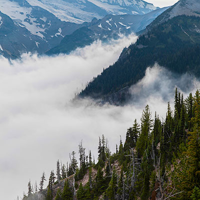
We returned to the park after some rest. The whole park was still in the cloud. We wanted to try our luck at Sunrise area.


Two miles from Sunrise Visitor Center at Sunrise Lake Point, the cloud was so thick and we could barely see anything 30 feet away. We had little hope to see the mountain at all. There were only a handful cars in Sunrise Visitor Center parking lot. The rangers were about to leave and the only thing they could tell us about the weather was that it’s unpredictable. As we were walking toward Frozen Lake, I felt the cloud lifted up a little bit. We decided to change the route to go to Emmons Vista. Gradually, the sun dispersed the clouds and the majestic Mt. Rainier revealed itself in front of us. For 20 minutes, we were walking above clouds.


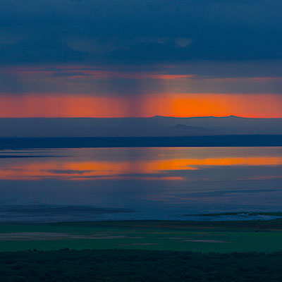
Clouds soon reclaimed the Sunrise area. We were hoping the next day would be a better day.


")